
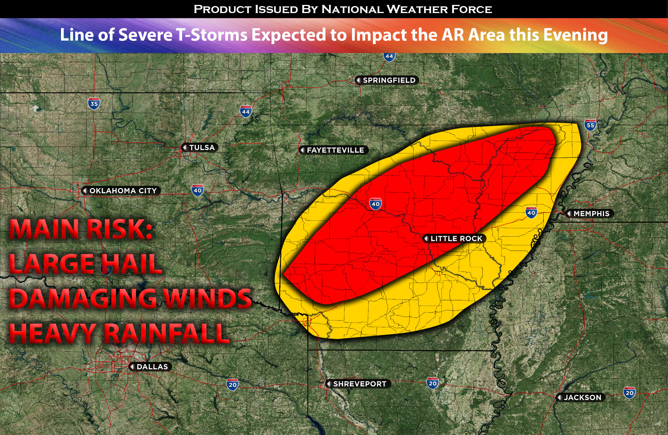
 A current cluster of thunderstorms this late morning is projected to move eastward, entering a rapidly destabilizing and highly volatile air mass across northern and central Arkansas. The region will experience significant heating due to predominantly clear skies. This, combined with abundant deep low-level moisture, an incoming disturbance, and robust instability, sets the stage for severe storms in central Arkansas, extending to the eastern part by evening. These storms primarily pose risks of large hail, destructive winds, and localized heavy downpours.
Main risk: large hail, damaging straight-line winds and local heavy rainfall.
Timing: Storms are expected to continue forming around 3-5pm CDT and move across the region before losing strength into eastern AR.
Locations Impacted: central, northeast, east, and southeast AR.
Stay tuned for more updates.
Sina⚡⚡
With over a decade of experience in forecasting severe thunderstorms, this individual is a seasoned forecaster and developer. Their expertise in severe weather forecasting and computer science is entirely self-taught, complemented by a foundation in Atmospheric Science from UNCO. They have dedicated their efforts to developing innovative tools that enhance the accuracy of analyzing large hail and tornadoes. As a significant contributor to the National Weather Force, they have played a crucial role in providing accurate and timely information, as well as developing tools to keep those affected well-informed.
NOTE: The alerts and outlooks posted here are customary made to inform. At times, which is often, you will see an alert forecast posted on here that you do not see elsewhere. That is fine, the track record of the main office is very high so maintain to follow an event when posted. These are custom concentrated alerts and outlooks that are created by National Weather Force team of experts.