
Persistent low-level warm advection will remain over West Virginia, Virginia, and Maryland. This will initially lead to cloudy conditions in the morning. However, these clouds are likely to dissipate later on, causing the atmosphere to destabilize quickly. Concurrently, a shortwave trough, which promotes upward moisture movement, will instigate the development of scattered thunderstorms. When paired with extremely high shear levels throughout the atmosphere, the conditions will become ripe for severe thunderstorms that can yield large hail, damaging winds, and even tornadoes. The heightened low-level shear further underscores the need to monitor for tornado risks in the area.
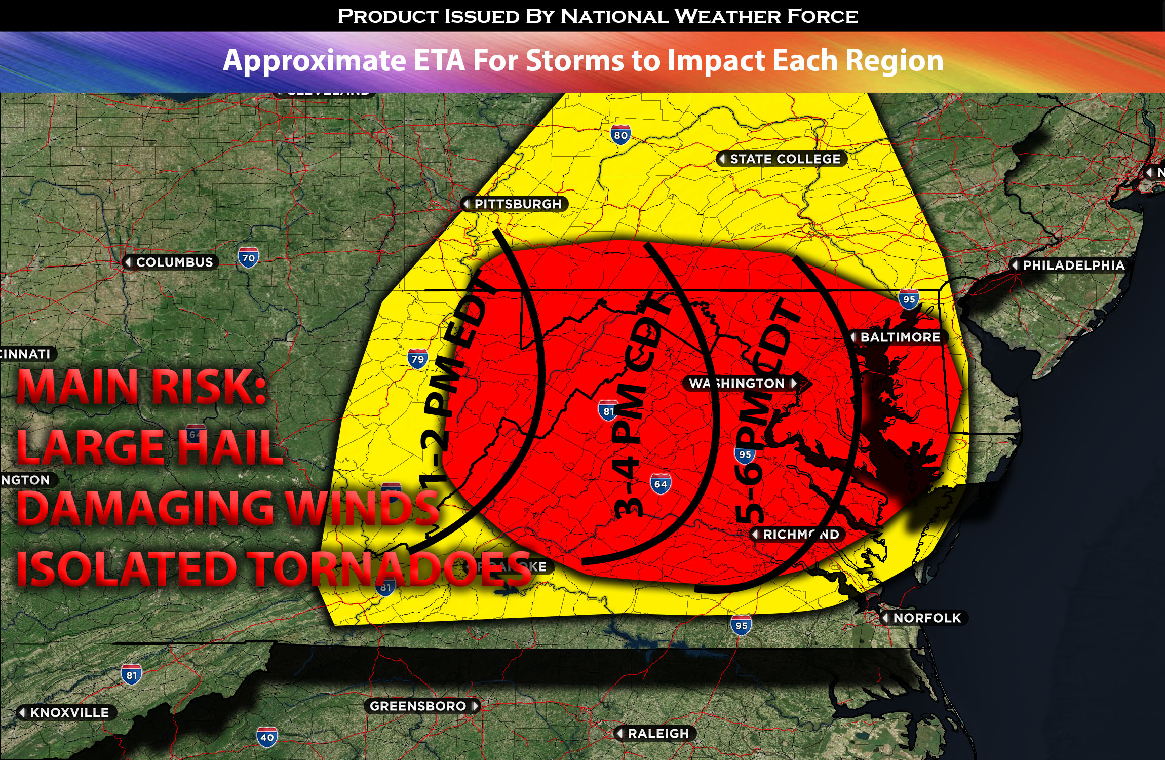
It’s anticipated that these storms will emerge around noon or early afternoon, starting in central West Virginia and intensifying as they reach the West Virginia panhandle. As they progress, these storms are likely to cluster and move eastward, eventually forming a squall line affecting the wider region of VA/MD with various hazards. By evening, the primary threat from these storms will transition to damaging winds before they move off the coast.
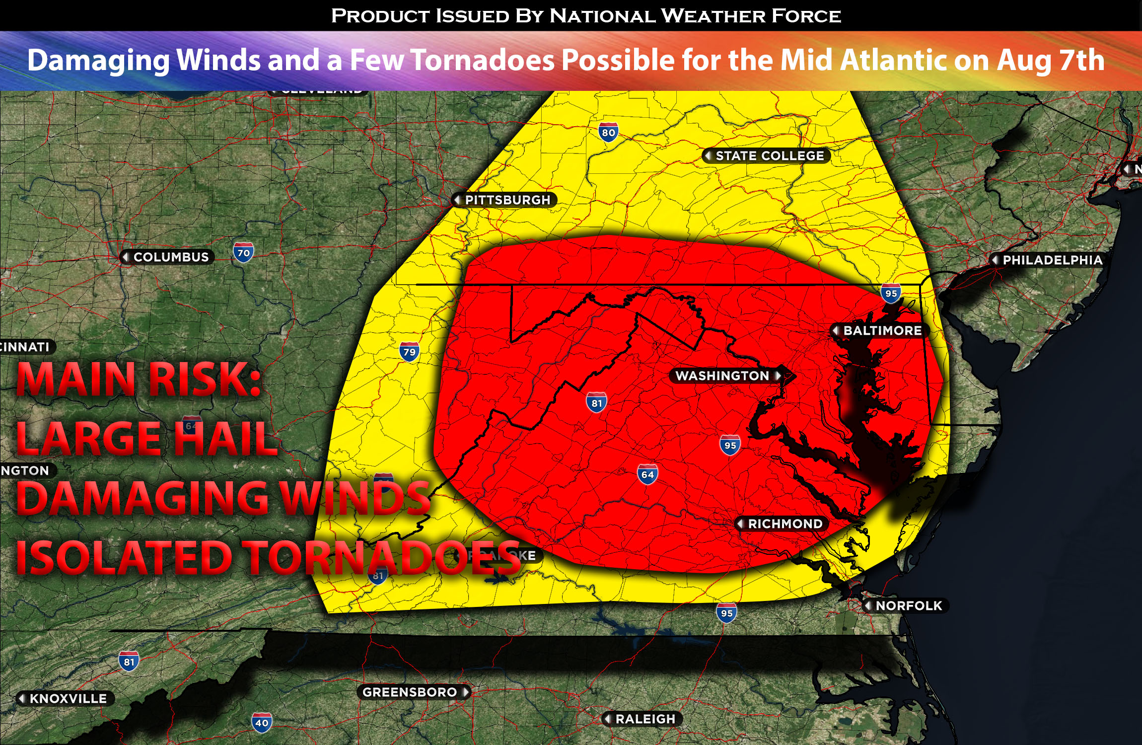
Main risk: large hail, damaging straight-line winds 70mph+ and a few tornadoes are possible.
Timing: Storms are expected to form in WV east into WV panhandle and continue to rapidly strengthen becoming a squall line into Virginia and impacting the rest of the area. For more detailed ETA check the graphic below.
Locations Impacted: WV central, southeast, panhandle, MD most portions and VA north central, northeast, and southeast.
Stay tuned for more updates.
Sina⚡⚡
With over a decade of experience in forecasting severe thunderstorms, this individual is a seasoned forecaster and developer. Their expertise in severe weather forecasting and computer science is entirely self-taught, complemented by a foundation in Atmospheric Science from UNCO. They have dedicated their efforts to developing innovative tools that enhance the accuracy of analyzing large hail and tornadoes. As a significant contributor to the National Weather Force, they have played a crucial role in providing accurate and timely information, as well as developing tools to keep those affected well-informed.
NOTE: The alerts and outlooks posted here are customary made to inform. At times, which is often, you will see an alert forecast posted on here that you do not see elsewhere. That is fine, the track record of the main office is very high so maintain to follow an event when posted. These are custom concentrated alerts and outlooks that are created by National Weather Force team of experts.