
Persistent showers and thunderstorm activity are evident across the state, influenced by a low-pressure system gradually moving eastward. Due to this, the potential for early daylight heating in the Iowa and Illinois regions might be initially subdued. However, with westerly winds forecasted to intensify due to a trough in the vicinity by around 5pm CDT, significant heating is expected to return. This, when combined with heightened instability and mid-level shear, will foster the formation of severe storms, initiating in Missouri and moving northeastward. These will also cover parts of Iowa and Illinois, gaining strength as they traverse the area.
Considering the atmospheric conditions, these storms could produce large hail, with some locations possibly seeing hailstones exceeding 2 inches, alongside damaging wind gusts. This storm line is then projected to shift southeastward into Indiana, gradually waning in intensity as it progresses into the Kentucky region during the night.
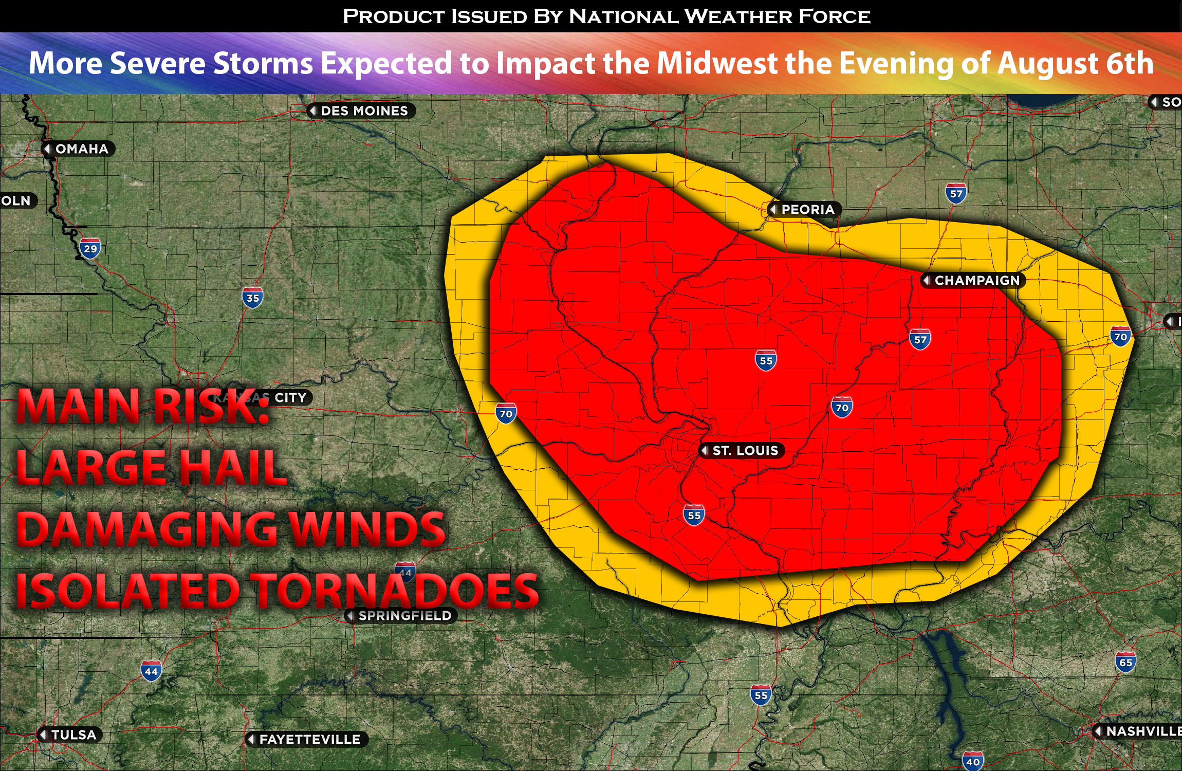
Main risk: large hail, damaging straight-line winds, and isolated tornadoes possible.
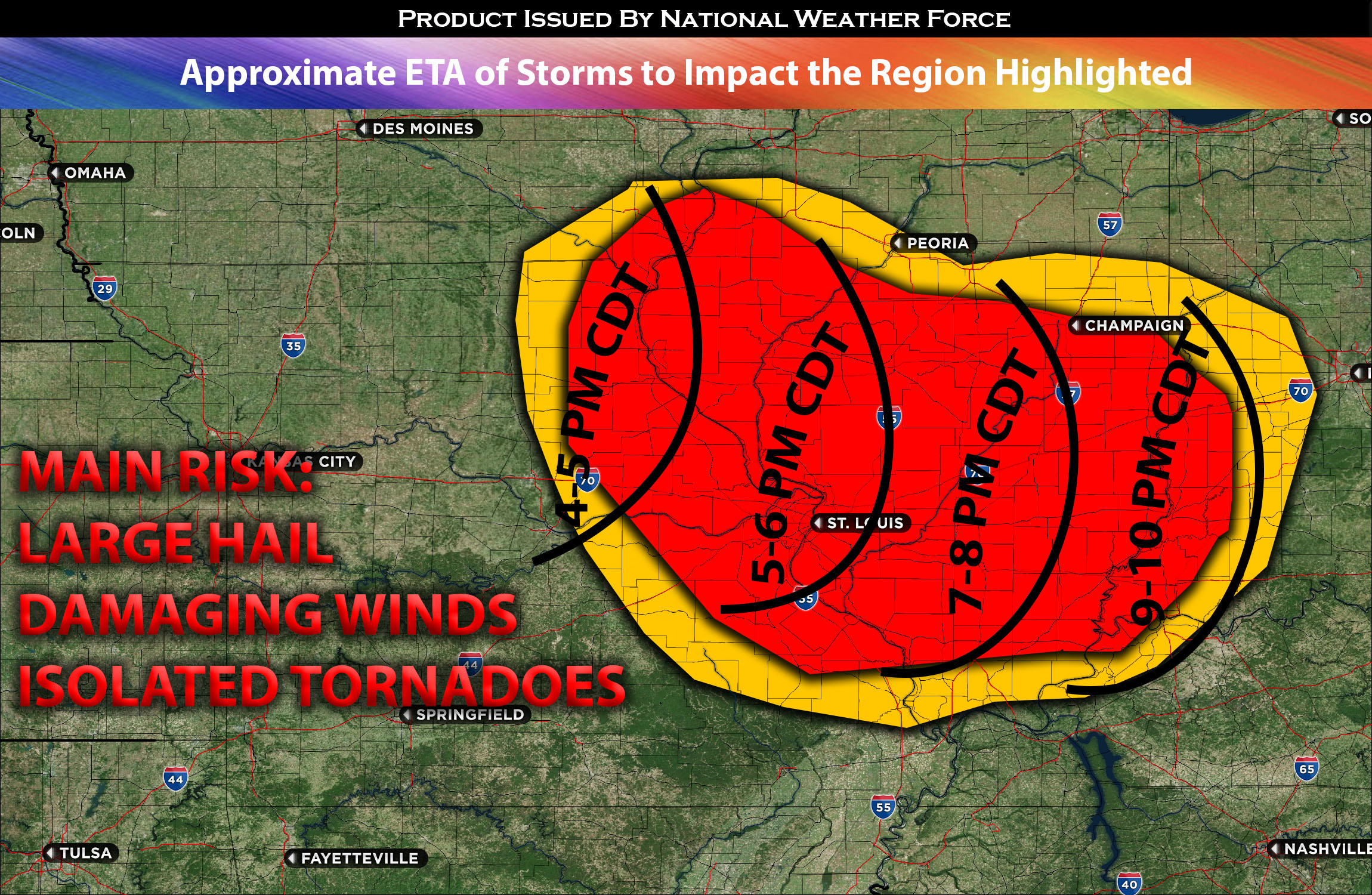
Timing: These storms are expected to form around IA/MO east and continue to strengthen with more activity forming in IL especially south of Peoria IL. Then continuing through the rest of the region and into KY and Indiana overnight. For more detailed ETA check the graphic below.
Locations Impacted: IA eastward, MO northeast, IL west, central, east, IN, west and central more south into KY north.
Stay tuned for more updates.
Sina⚡⚡
With over a decade of experience in forecasting severe thunderstorms, this individual is a seasoned forecaster and developer. Their expertise in severe weather forecasting and computer science is entirely self-taught, complemented by a foundation in Atmospheric Science from UNCO. They have dedicated their efforts to developing innovative tools that enhance the accuracy of analyzing large hail and tornadoes. As a significant contributor to the National Weather Force, they have played a crucial role in providing accurate and timely information, as well as developing tools to keep those affected well-informed.
NOTE: The alerts and outlooks posted here are customary made to inform. At times, which is often, you will see an alert forecast posted on here that you do not see elsewhere. That is fine, the track record of the main office is very high so maintain to follow an event when posted. These are custom concentrated alerts and outlooks that are created by National Weather Force team of experts.