
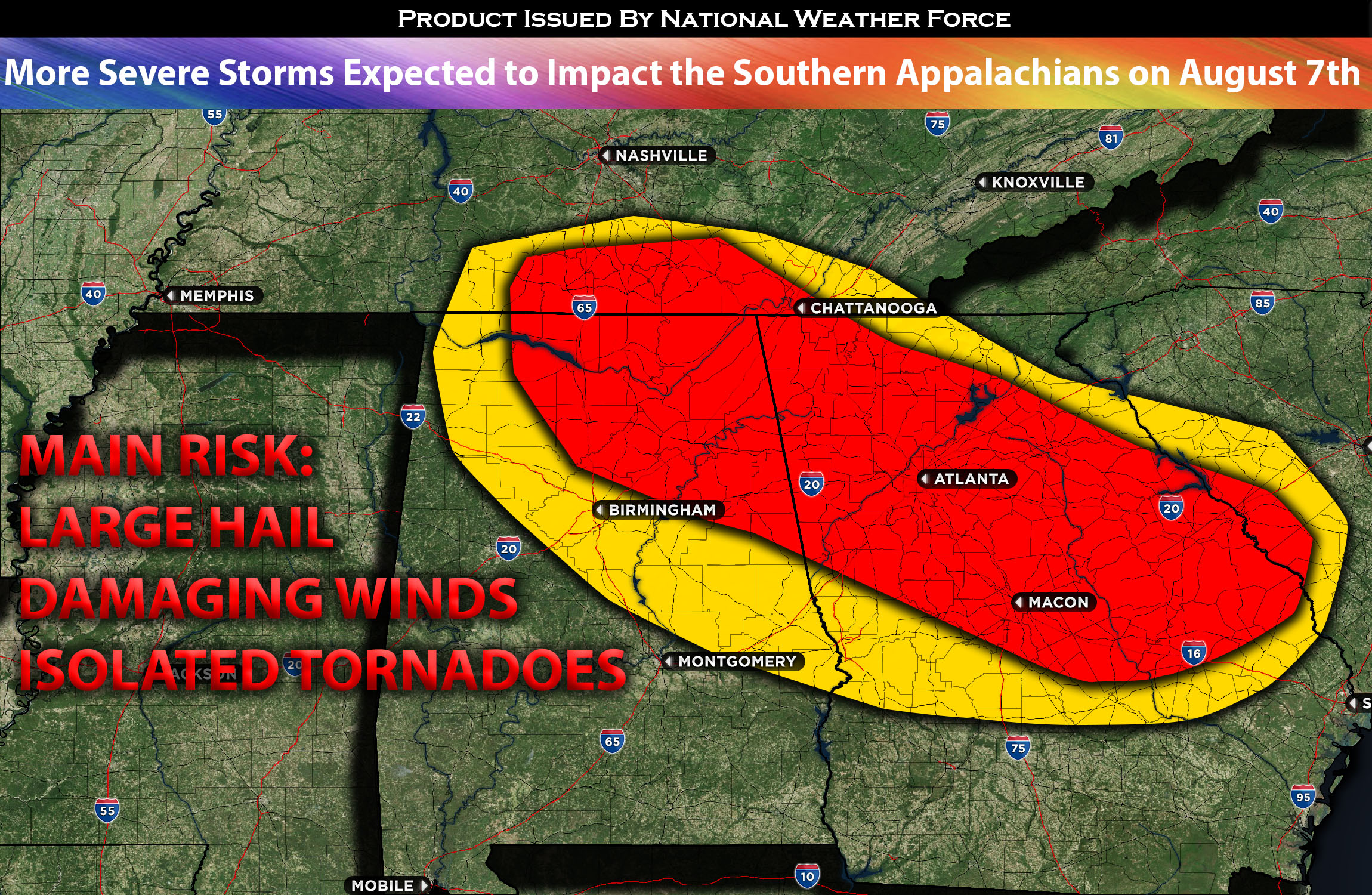
Another day brings continued warm advection to the Alabama/Georgia area, with an approaching boundary facilitating the formation of scattered storm clusters in the southern and southeastern parts of Tennessee. Coupled with high mid-level shear and notable low-level shear, the conditions are ripe for a wide array of severe weather hazards. These storm clusters will then move southeastward across Alabama and Georgia, eventually coalescing into a substantial squall line that’s expected to sweep through Georgia and parts of Alabama on Monday afternoon. The most concentrated area for severe weather is expected to be in northern and central GA. This line will extend southeastward throughout the evening, though it will gradually diminish in size and intensity.
The primary threats associated with this storm line include damaging winds and localized heavy rainfall, which could result in potential flooding.
Main risk: large hail, damaging straight-line winds, and isolated tornadoes possible.
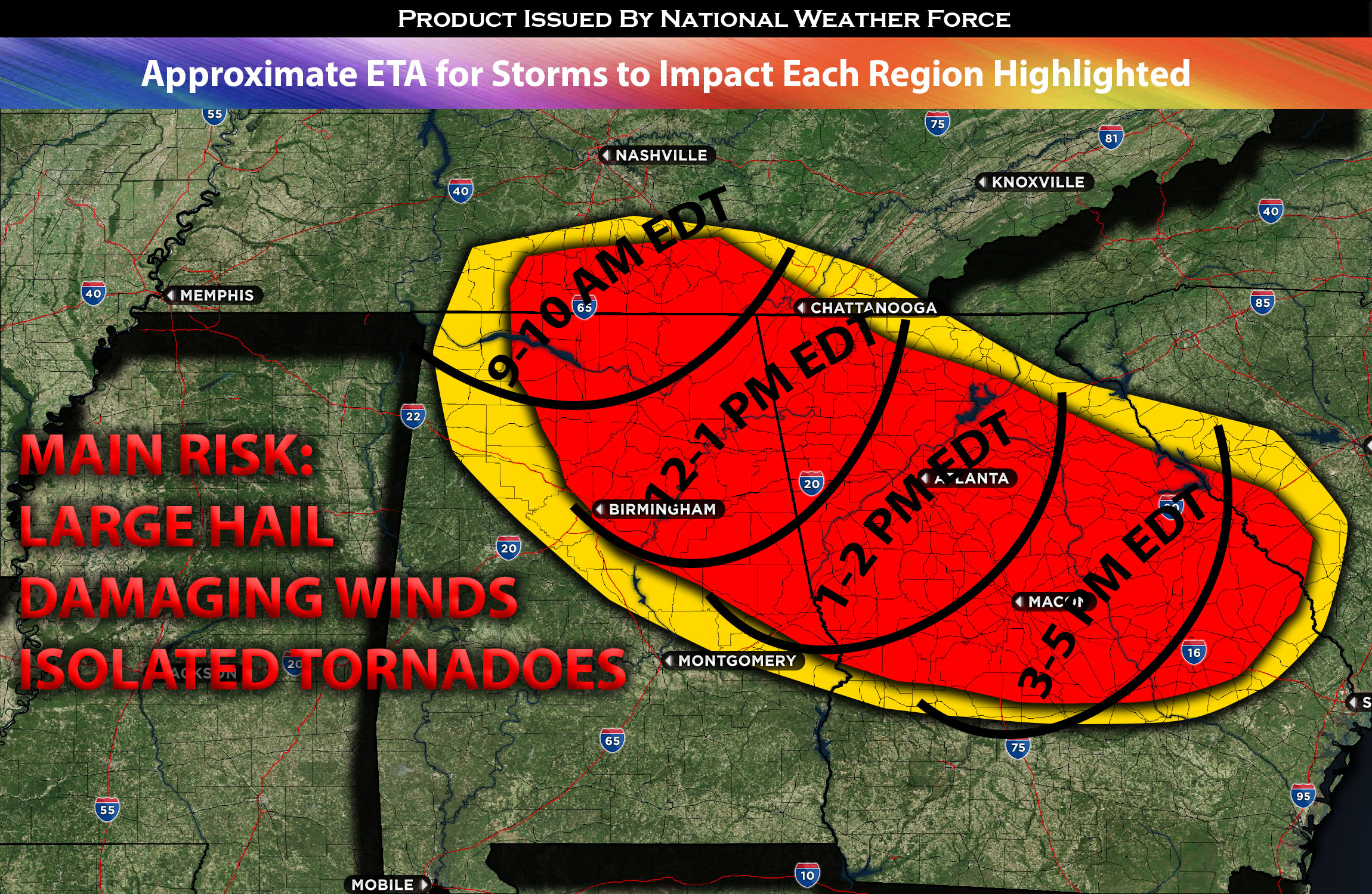
Timing: Storms are expected to form in TN south/southeast and into portions of AL and most of GA north and central by the afternoon/evening. For more detailed ETA check the graphic below.
Locations Impacted: TN south, southeast, AL, northeast, north, central, east, GA northwest, north, northeast, central, and south.
Stay tuned for more updates.
Sina⚡⚡
With over a decade of experience in forecasting severe thunderstorms, this individual is a seasoned forecaster and developer. Their expertise in severe weather forecasting and computer science is entirely self-taught, complemented by a foundation in Atmospheric Science from UNCO. They have dedicated their efforts to developing innovative tools that enhance the accuracy of analyzing large hail and tornadoes. As a significant contributor to the National Weather Force, they have played a crucial role in providing accurate and timely information, as well as developing tools to keep those affected well-informed.
NOTE: The alerts and outlooks posted here are customary made to inform. At times, which is often, you will see an alert forecast posted on here that you do not see elsewhere. That is fine, the track record of the main office is very high so maintain to follow an event when posted. These are custom concentrated alerts and outlooks that are created by National Weather Force team of experts.