
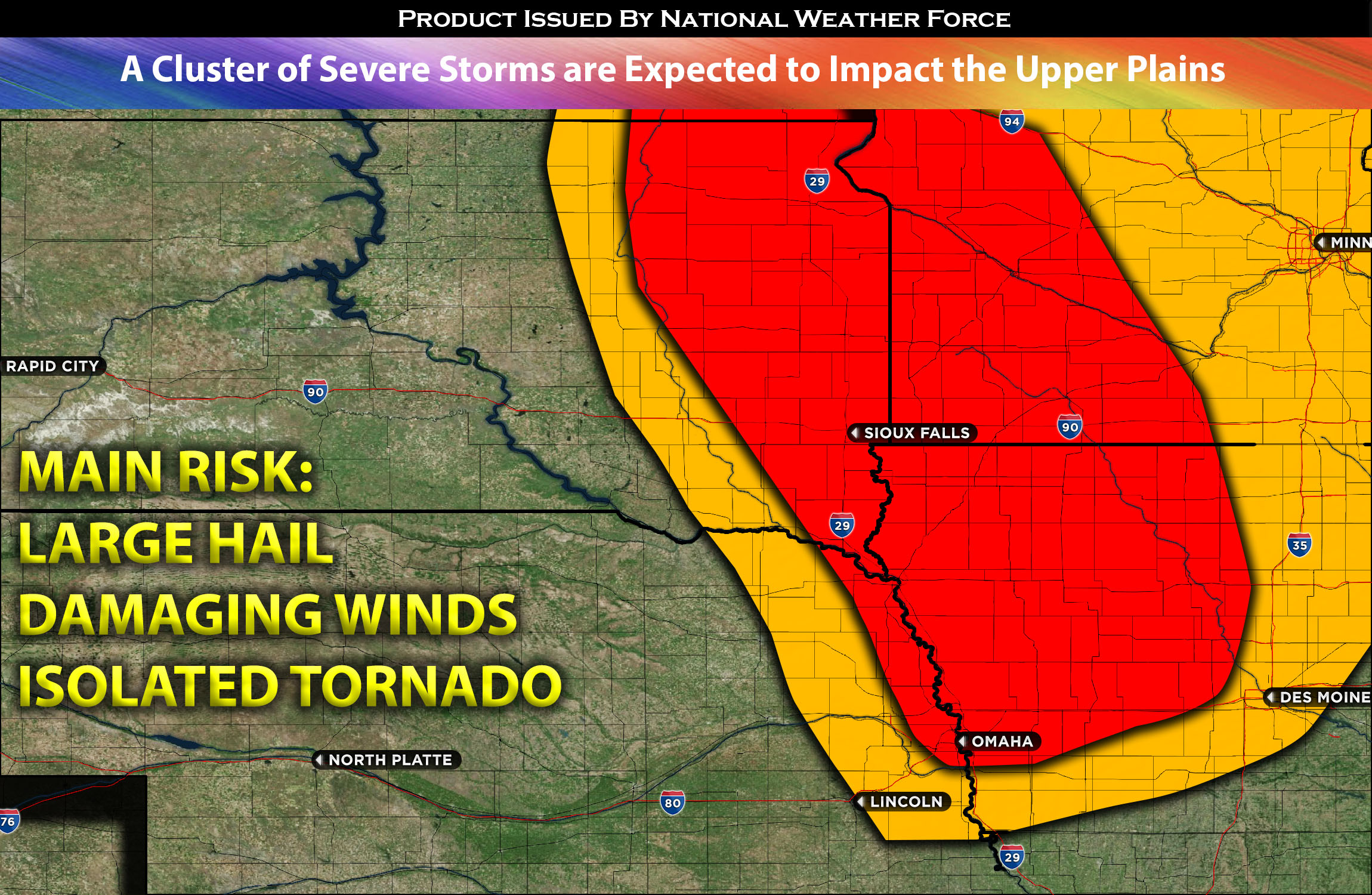
Daytime warming ahead of a mild cool front will lead to moderate afternoon destabilization across the central and northern Plains region. As this boundary progresses through the area, it will lift warm, moist air, potentially triggering thunderstorms around Eastern SD by late afternoon or evening. Coupled with mid-level shear and moderate instability, conditions will be ripe for the formation of severe thunderstorms. These storms may produce large hail, damaging winds, and possibly even a tornado, given the lack of low-level shear. A cluster of storms is anticipated to develop around Northeastern/Eastern SD, and a few possible further south. Some storms also extending to extreme southwestern parts of ND. As they take shape, they will move southeastward, transitioning into a line of storms that will cover the MN/IA region. This line is expected to persist through the evening and into the overnight hours in IA, eventually moving out of the primary affected area to the east. A few lingering storms might reach the IL area by early Friday morning, posing risks of localized strong winds and heavy rain, before they dissipate entirely.
Main risk: large hail, damaging straight-line winds, and perhaps a tornado (possible but not a main threat due to lack of low-level shear).
Timing: Storms are expected to form in SD east around 3-4pm CDT before pushing southeast into MN and into IA by the late evening. A few lingering storms might also push into IL by early morning. For more detailed ETA check the graphic below.
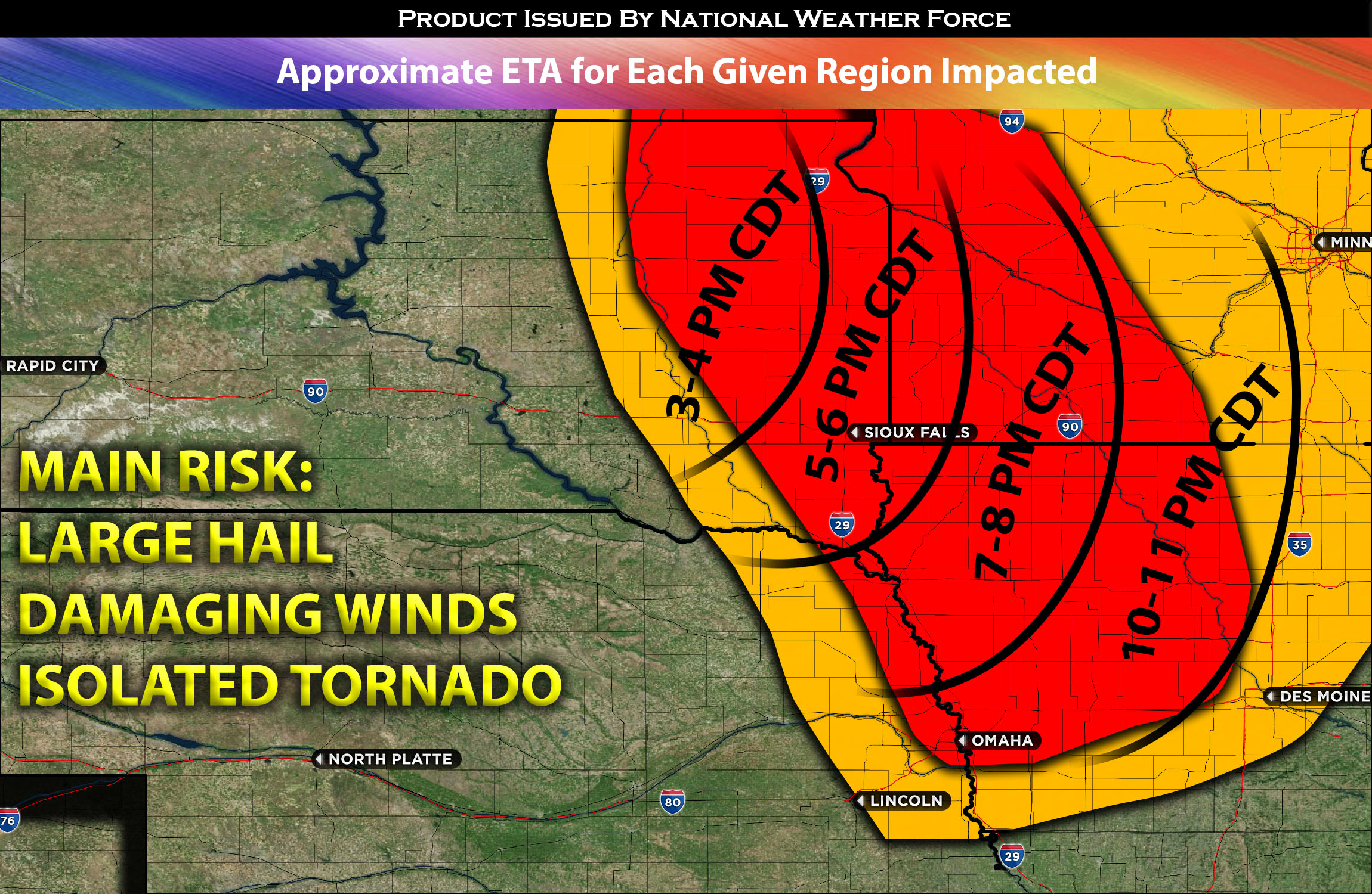
Locations Impacted: SD east, ND southeast, MN southwest and south, IA most portions, and IL northwest.
Stay tuned for more updates.
Sina⚡⚡
With over a decade of experience in forecasting severe thunderstorms, this individual is a seasoned forecaster and developer. Their expertise in severe weather forecasting and computer science is entirely self-taught, complemented by a foundation in Atmospheric Science from UNCO. They have dedicated their efforts to developing innovative tools that enhance the accuracy of analyzing large hail and tornadoes. As a significant contributor to the National Weather Force, they have played a crucial role in providing accurate and timely information, as well as developing tools to keep those affected well-informed.
NOTE: The alerts and outlooks posted here are customary made to inform. At times, which is often, you will see an alert forecast posted on here that you do not see elsewhere. That is fine, the track record of the main office is very high so maintain to follow an event when posted. These are custom concentrated alerts and outlooks that are created by National Weather Force team of experts.