
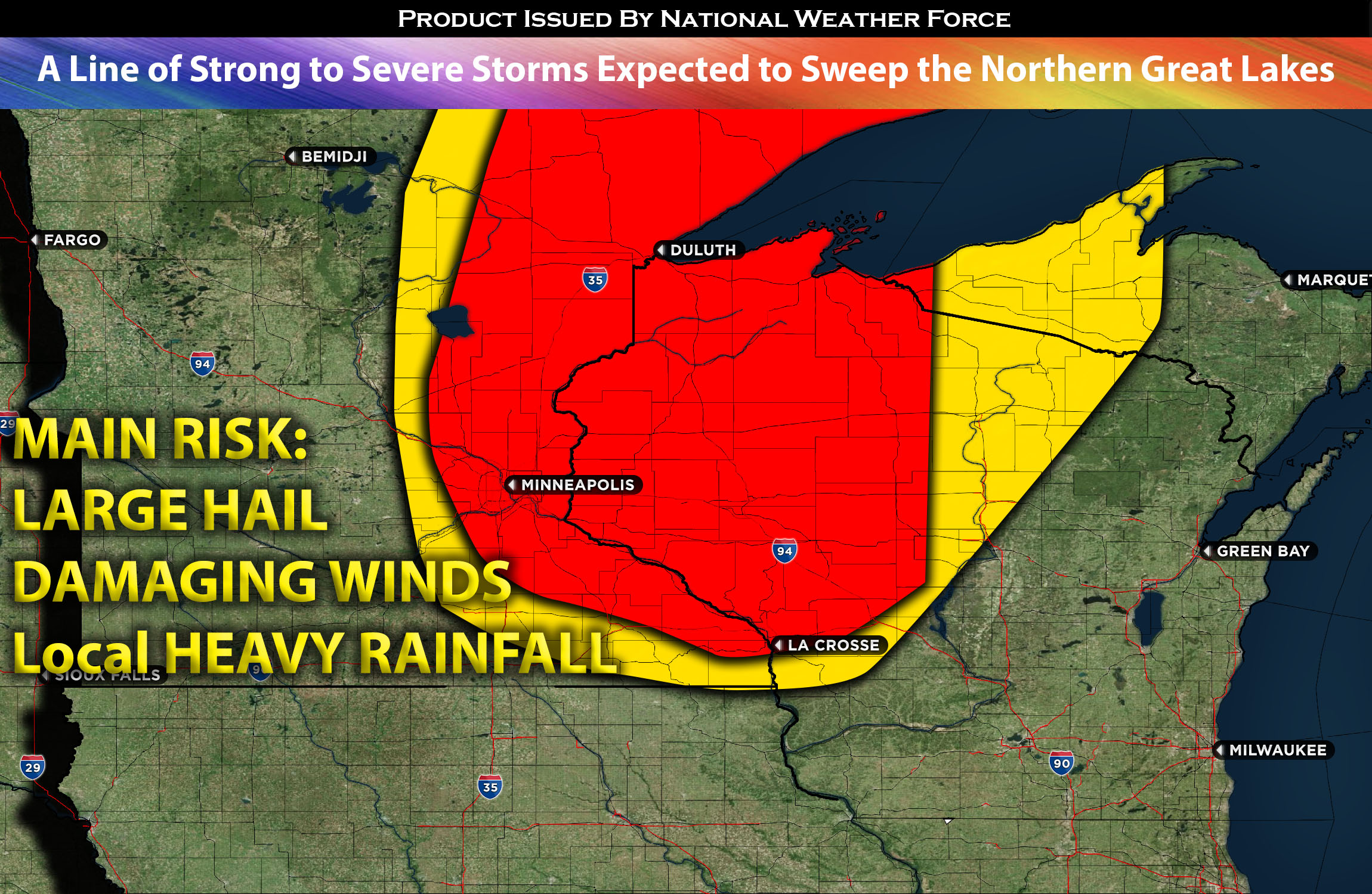
For MN and WI:
An upper trough is expected to push southeast into the Great Lakes on Wednesday. This will introduce a strong southwesterly deep-layer flow ahead of it. A surface low will continue its eastward movement across Canada, dragging a cold front into the MN/WI area and then in the evening/overnight across the neighboring states. The presence of warm, moist air at the surface, characterized by dew points in the 60s ahead of the front, combined with daylight heating (resulting in elevated instability), will facilitate the formation of scattered thunderstorms across northeastern MN. These storms are anticipated to form around noon/afternoon and progress eastward, taking a southeastward turn upon reaching the central MN/WI region. Expected to be linear in nature ahead of the front, these storms, when encountering deep layer shear, will likely produce strong, locally damaging winds and large hail.
Main risk: large hail, damaging straight-line winds, and very low risk for a tornado due minimal low-level shear.
Timing: These severe storms are expected to form in MN around 11-2pm CDT and continue eastward then southeastward across central MN and into WI around the evening/overnight ahead of the cold front.
Locations Impacted: MN northeast, east, central, WI northwest, north, northeast possibly central.
Stay tuned for more updates.
Sina⚡⚡
With over a decade of experience in forecasting severe thunderstorms, this individual is a seasoned forecaster and developer. Their expertise in severe weather forecasting and computer science is entirely self-taught, complemented by a foundation in Atmospheric Science from UNCO. They have dedicated their efforts to developing innovative tools that enhance the accuracy of analyzing large hail and tornadoes. As a significant contributor to the National Weather Force, they have played a crucial role in providing accurate and timely information, as well as developing tools to keep those affected well-informed.
NOTE: The alerts and outlooks posted here are customary made to inform. At times, which is often, you will see an alert forecast posted on here that you do not see elsewhere. That is fine, the track record of the main office is very high so maintain to follow an event when posted. These are custom concentrated alerts and outlooks that are created by National Weather Force team of experts.