
Ahead of a cold front, the southeast areas will experience warm, moist air at low levels, with dew points reaching the low 70s. The rapid destabilization will result in elevated instability, setting the stage for thunderstorm development later today, just in front of the cold front. While the skies will be initially cloudy to mostly cloudy, the significant moisture combined with some clearing will erode the morning’s more stable atmospheric cap. This, paired with sufficient deep layer shear, will lead to the formation of scattered strong to severe storms across the affected region, with wind patterns aligning with these systems. Consequently, these storms will quickly intensify, posing primary threats of large hail and damaging winds. The highest risk of severe storms looks to be in NC and VA given being closer to the triple point boundaries and shear being more sufficient. The formation of these storms is anticipated for this afternoon, and they’ll progress eastward ahead of the front.
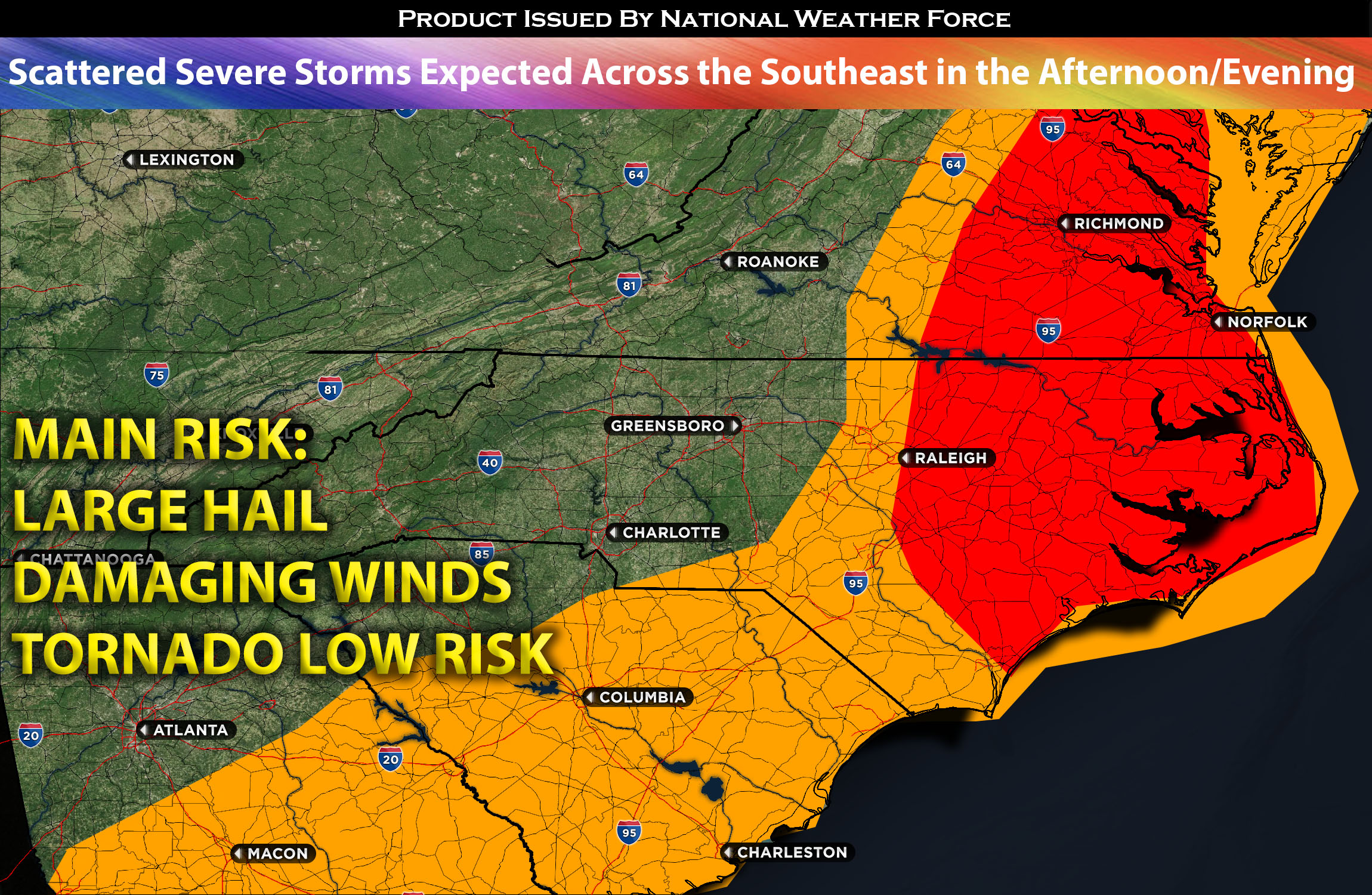
Main risk: large hail, damaging straight-line winds, and low risk for a tornado due to little low-level shear.
Timing: These severe storms are expected to form in NC an WV around 1-3pm EDT and continue eastward through the rest of the southeast.
Locations Impacted: NC most portions eastward, VA southeastward, into SC and GA area northeastward.
Stay tuned for more updates.
With over a decade of experience in forecasting severe thunderstorms, this individual is a seasoned forecaster and developer. Their expertise in severe weather forecasting and computer science is entirely self-taught, complemented by a foundation in Atmospheric Science from UNCO. They have dedicated their efforts to developing innovative tools that enhance the accuracy of analyzing large hail and tornadoes. As a significant contributor to the National Weather Force, they have played a crucial role in providing accurate and timely information, as well as developing tools to keep those affected well-informed.
NOTE: The alerts and outlooks posted here are customary made to inform. At times, which is often, you will see an alert forecast posted on here that you do not see elsewhere. That is fine, the track record of the main office is very high so maintain to follow an event when posted. These are custom concentrated alerts and outlooks that are created by National Weather Force team of experts.