
For Northeastern Areas:
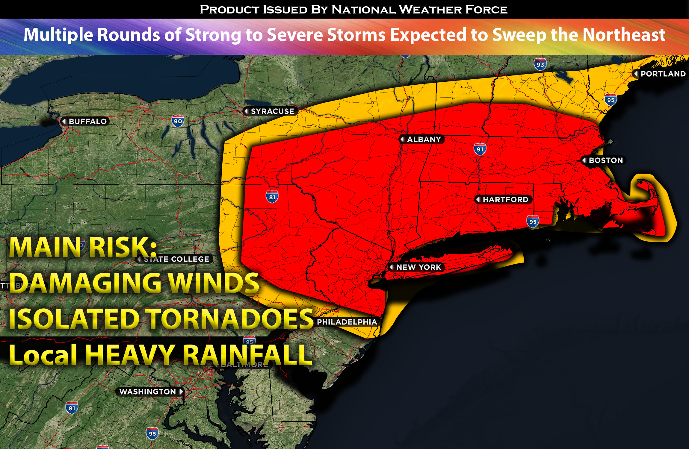
Multiple rounds of cluster storms are expected to impact the northeast on Friday morning. This is as the upper-level trough continues its northeastward movement across Canada. At the surface, a low in Quebec is progressing eastward, bringing with it a cold front that will transition from the Ohio Valley into the northeast. Ahead of this front, warm moist air, with dew points in the mid-60s to low-70s and combined with elevated mixed layer instability and mid to low-level shear, will allow for the formation of thunderstorm clusters that have the potential to become severe. These storms are capable of producing localized damaging winds and perhaps even an isolated tornado or two. The highest risk for such events appears to be near a northward-advancing warm front across New England. These storms will swiftly depart the area as the cold front moves east. A few of these cluster of storms are expected to move through populated areas such as Boston and New York City during the early hours of Friday.
Main risk: local damaging winds, isolated tornadoes possible and local heavy rainfall.
Timing: These severe storms are expected to be ahead of the cold front and move through the impacted regions of NY, PA and northward around 7am-10am with the first band being the strongest followed by multiple bands until the cold front pushes through.
Locations Impacted: NY, PA northeastward, and portions of CT and MA.
Stay tuned for more updates.
Sina⚡⚡
With over a decade of experience in forecasting severe thunderstorms, this individual is a seasoned forecaster and developer. Their expertise in severe weather forecasting and computer science is entirely self-taught, complemented by a foundation in Atmospheric Science from UNCO. They have dedicated their efforts to developing innovative tools that enhance the accuracy of analyzing large hail and tornadoes. As a significant contributor to the National Weather Force, they have played a crucial role in providing accurate and timely information, as well as developing tools to keep those affected well-informed.
NOTE: The alerts and outlooks posted here are customary made to inform. At times, which is often, you will see an alert forecast posted on here that you do not see elsewhere. That is fine, the track record of the main office is very high so maintain to follow an event when posted. These are custom concentrated alerts and outlooks that are created by National Weather Force team of experts.