
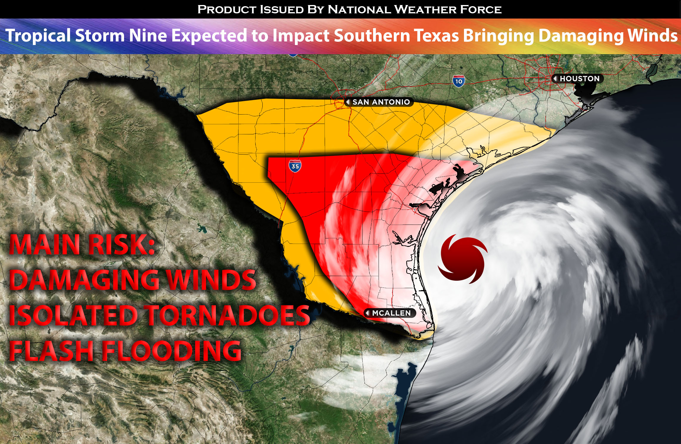
For Southern Texas Area:
As the tropical depression nine undergoes an intensification process it is expected to become a tropical storm by early Tuesday morning. As this system gains momentum, its center is forecasted to approach the south Texas coast, possibly having a notable impact at the onset of the period.
Attributed to this system is an influx of tropical moisture combined with a notable surge in low-level flow and shear. This atmospheric activity is projected to permeate through the regions of south-central, stretching further into Deep South Texas. Such conditions are conducive to the genesis of transient, low-topped supercells. These storms have the capacity to spawn potentially dangerous outcomes, such as a tornado or two. Moreover, there could be episodes of isolated damaging wind gusts, ranging from strong to possibly severe intensities.
Within the cyclonic system, the northeast quadrant is often deemed the most susceptible to such atmospheric disturbances. Another threat of course will be very heavy rain bringing the risks for flooding. Moreover, anywhere within the vicinity of the tropical storm will have tropical storm conditions capable of strong to damaging winds.
Main risk: local damaging winds, isolated tornadoes and heavy rainfall.
Timing: Impacts from the TS will be felt as soon as Tuesday early morning through Tuesday night with many lingering showers and strong thunderstorms through the night.
Locations Impacted: Southern TX.
Stay tuned for more updates.
Sina⚡⚡
With over a decade of experience in forecasting severe thunderstorms, this individual is a seasoned forecaster and developer. Their expertise in severe weather forecasting and computer science is entirely self-taught, complemented by a foundation in Atmospheric Science from UNCO. They have dedicated their efforts to developing innovative tools that enhance the accuracy of analyzing large hail and tornadoes. As a significant contributor to the National Weather Force, they have played a crucial role in providing accurate and timely information, as well as developing tools to keep those affected well-informed.
NOTE: The alerts and outlooks posted here are customary made to inform. At times, which is often, you will see an alert forecast posted on here that you do not see elsewhere. That is fine, the track record of the main office is very high so maintain to follow an event when posted. These are custom concentrated alerts and outlooks that are created by National Weather Force team of experts.