
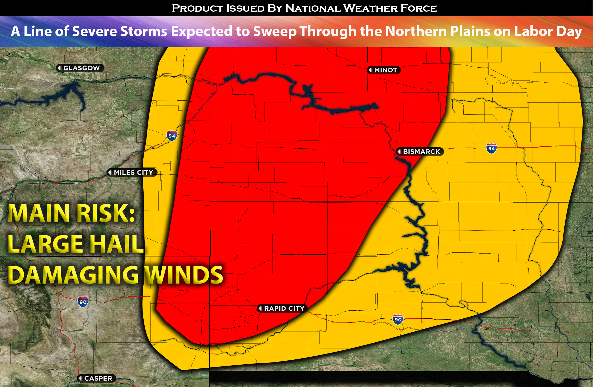
For ND and SD:
A strong upper-level trough is expected to move northeast across the central Rockies, advancing towards the northern Great Plains by later today. At the surface, a weaker, sagging cold front is anticipated to sweep through the area from ND to SD as the day progresses. The elevated instability and low-level moisture ahead of this front will foster the development of a cluster of storms along it. A southwesterly flow, with most winds being perpendicular to the front, will cause these storms to form a line and traverse the affected region. Given the mid-layer shear of 40-50 kts, these storms could become severe, mainly producing large hail and damaging winds. However, due to a lack of low-level shear (indicating minimal wind shift at the surface), the tornado risk remains very low. These storms are predicted to form as a cluster from western SD through western ND and intensify as they move northeastward across the area.
Main risk: large hail, damaging straight-line winds mainly. Very low risk for a tornado given the lack of low-level shear.
Timing: Storms are expected to form around western SD/ND area bordering WY and continue to strengthen with time through the rest of the impacted region as a line (moving northeastward).
Locations Impacted: northeastern WY, SD west, northwest, central, north; ND southwest, south, central southeast.
Stay tuned for more updates.
Sina⚡⚡
With over a decade of experience in forecasting severe thunderstorms, this individual is a seasoned forecaster and developer. Their expertise in severe weather forecasting and computer science is entirely self-taught, complemented by a foundation in Atmospheric Science from UNCO. They have dedicated their efforts to developing innovative tools that enhance the accuracy of analyzing large hail and tornadoes. As a significant contributor to the National Weather Force, they have played a crucial role in providing accurate and timely information, as well as developing tools to keep those affected well-informed.
NOTE: The alerts and outlooks posted here are customary made to inform. At times, which is often, you will see an alert forecast posted on here that you do not see elsewhere. That is fine, the track record of the main office is very high so maintain to follow an event when posted. These are custom concentrated alerts and outlooks that are created by National Weather Force team of experts.