
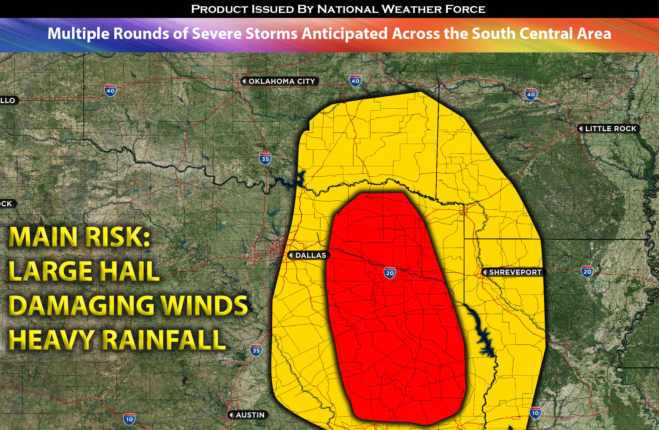
Outlook for OK, TX Southwest AR, Western LA: Scattered thunderstorms, a few of which may be strong and severe, are expected to form in the eastern portions of Oklahoma, moving southeastward across southeastern Oklahoma in the evening. Eventually, an MCS (Mesoscale Convective System) is expected to develop and move southward across northeast/eastern Texas. Multiple clusters of severe storms are anticipated to impact areas east of Dallas, Texas, and then move southward across eastern Texas and into portions of LA. These storms are expected to diminish overnight and into Saturday morning north of Houston. The remaining threats will be heavy rain and local strong winds.
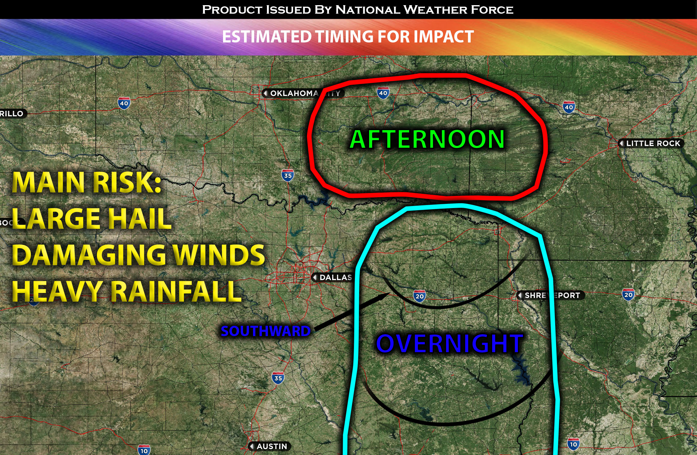
Timing & Impact Details: Storms are expected to form in the afternoon, scattered across eastern and southern Oklahoma. Another round of stronger to severe storms is likely overnight, passing through the Dallas, TX area. The stronger embedded cells are expected to be east of Dallas, with the main risk being damaging winds. As midnight approaches, this line of storms will likely organize into an MCS (Mesoscale Convective System) and impact eastern Texas, moving southward. They are expected to diminish before reaching Houston.
Approximate Impact Outline:
Forecast Details:
A high-pressure system continues to dominate the area. A boundary of warm air advection, with dew points in the 60s and locally low 70s to the east of it, will allow storms to form across Oklahoma and spread south and eastward. As these storms dissipate, additional storms are expected to form, driven by the cold pool left over from downdraft winds. Given the circulation of mid-level north-northwesterly flow due to the high pressure, the effective shear value in this area remains in the 30-40 kts range. Given the unstable environment, these storms can organize into a severe line of storms and continue this cycle once more as they push towards the eastern portions of TX, especially east of Dallas.
Visualization of Storms and Mesoanalysis: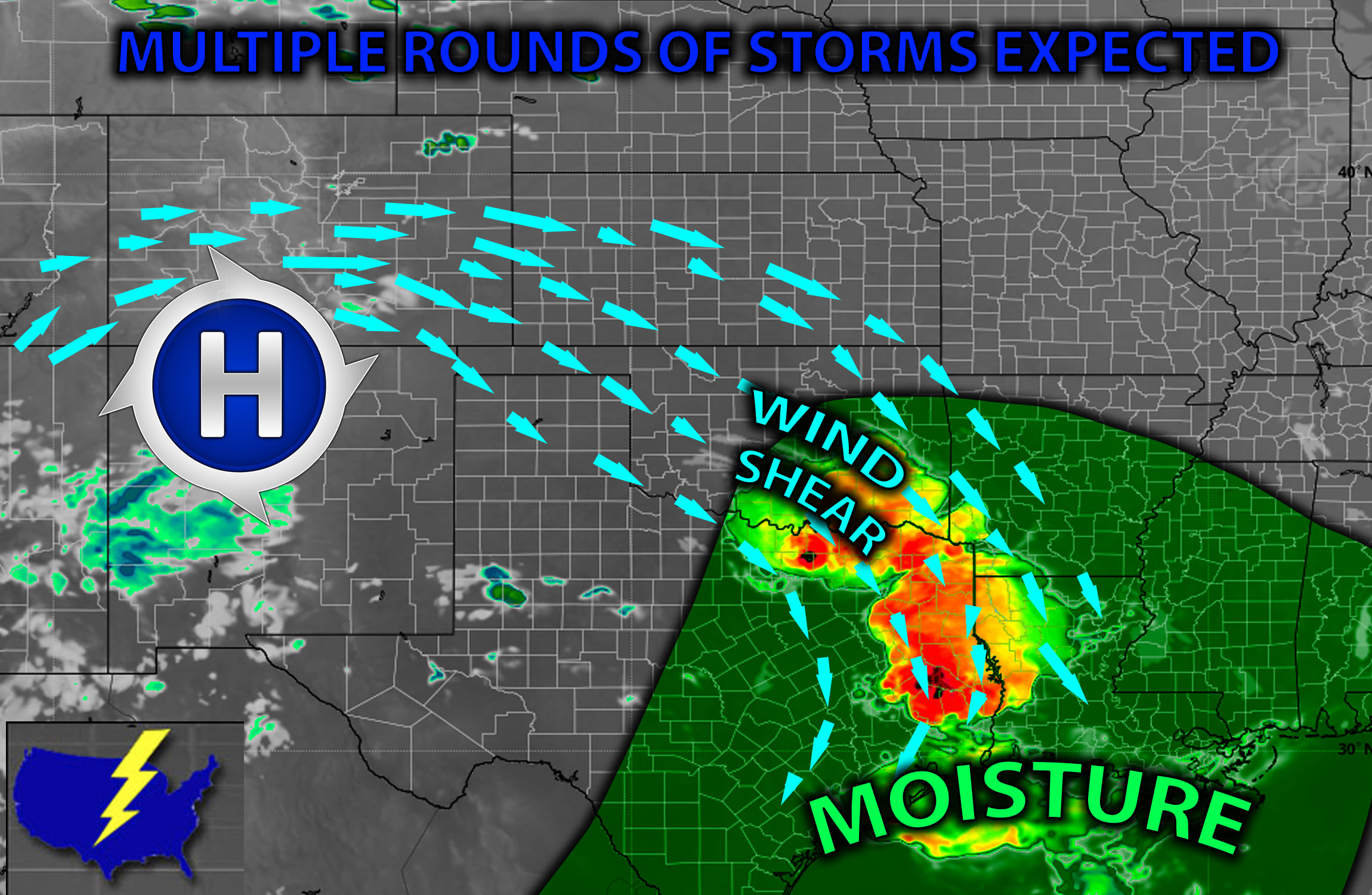
Main risk: large hail, damaging straight-line winds mainly. Very low risk for a tornado given the limited low-level shear.
Sina⚡⚡
With over a decade of experience in forecasting severe thunderstorms, this individual is a seasoned forecaster and developer. Their expertise in severe weather forecasting and computer science is entirely self-taught, complemented by a foundation in Atmospheric Science from UNCO. They have dedicated their efforts to developing innovative tools that enhance the accuracy of analyzing large hail and tornadoes. As a significant contributor to the National Weather Force, they have played a crucial role in providing accurate and timely information, as well as developing tools to keep those affected well-informed.
NOTE: The alerts and outlooks posted here are customary made to inform. At times, which is often, you will see an alert forecast posted on here that you do not see elsewhere. That is fine, the track record of the main office is very high so maintain to follow an event when posted. These are custom concentrated alerts and outlooks that are created by National Weather Force team of experts.