
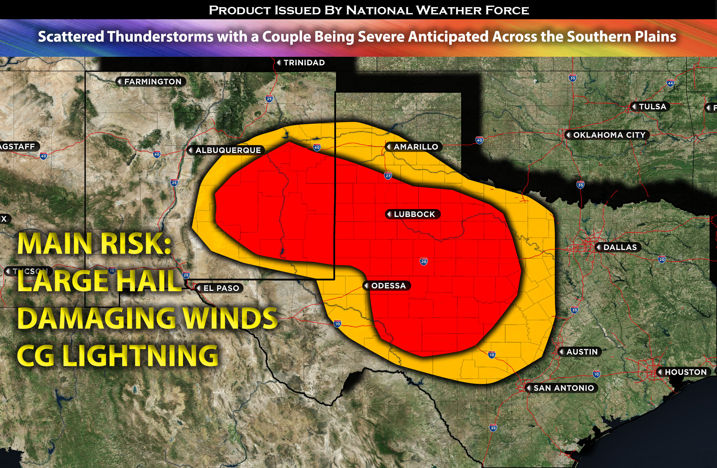
Outlook for southeastern NM and portions of western & central TX: Scattered thunderstorms with a few storms capable of becoming severe is possible across southeastern NM, western TX and portions of central TX. The main risk with these storms will be large hail and damaging winds to the impacted regions. Given the modest unstable airmass, a widespread outbreak is not anticipated.
Timing & Impact Details: These storms are most likely to form in the evening, around 3-4pm CDT, and could persist through the rest of the evening, depending on how quickly the air mass destabilizes from daylight heating. Storms that do form are expected to originate in southeastern NM, around areas such as Roswell, Dexter, and Artesia, and will span across western and parts of central TX, including places like Abilene. They will then move east to southeast before diminishing as they transition into a more stable air mass.
Approximate Impact Outline: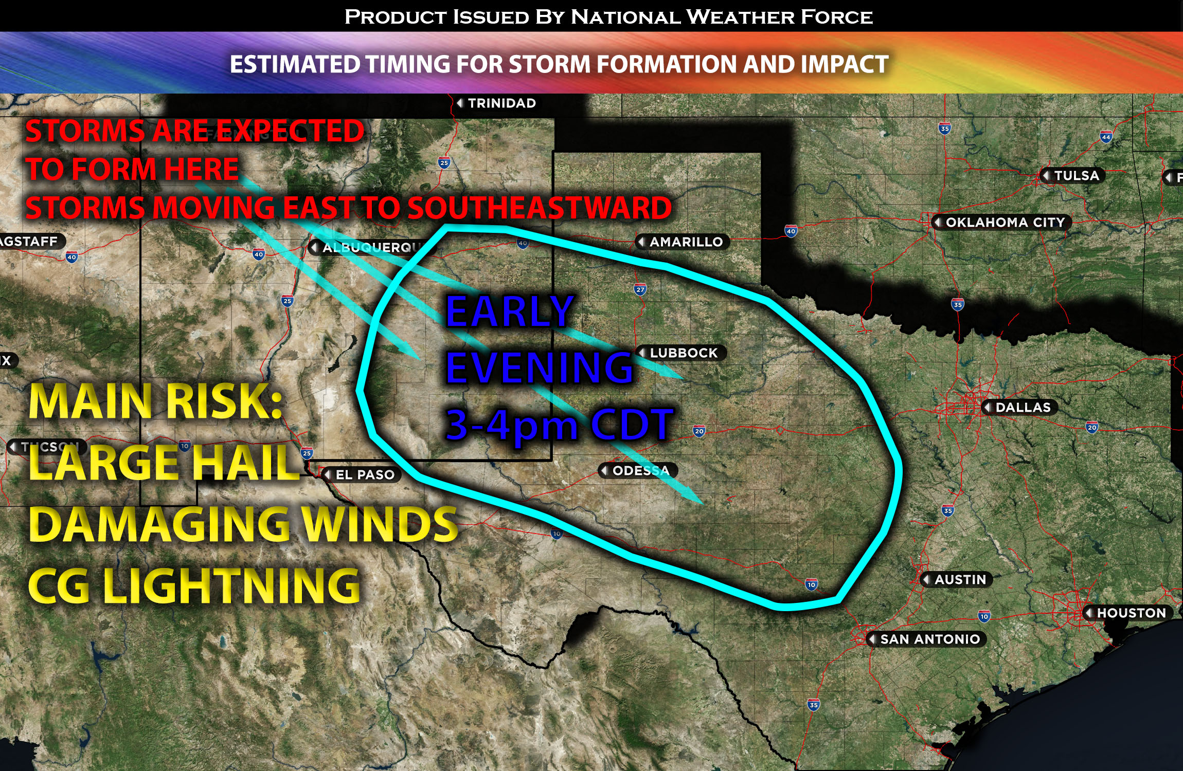
Forecast Details:
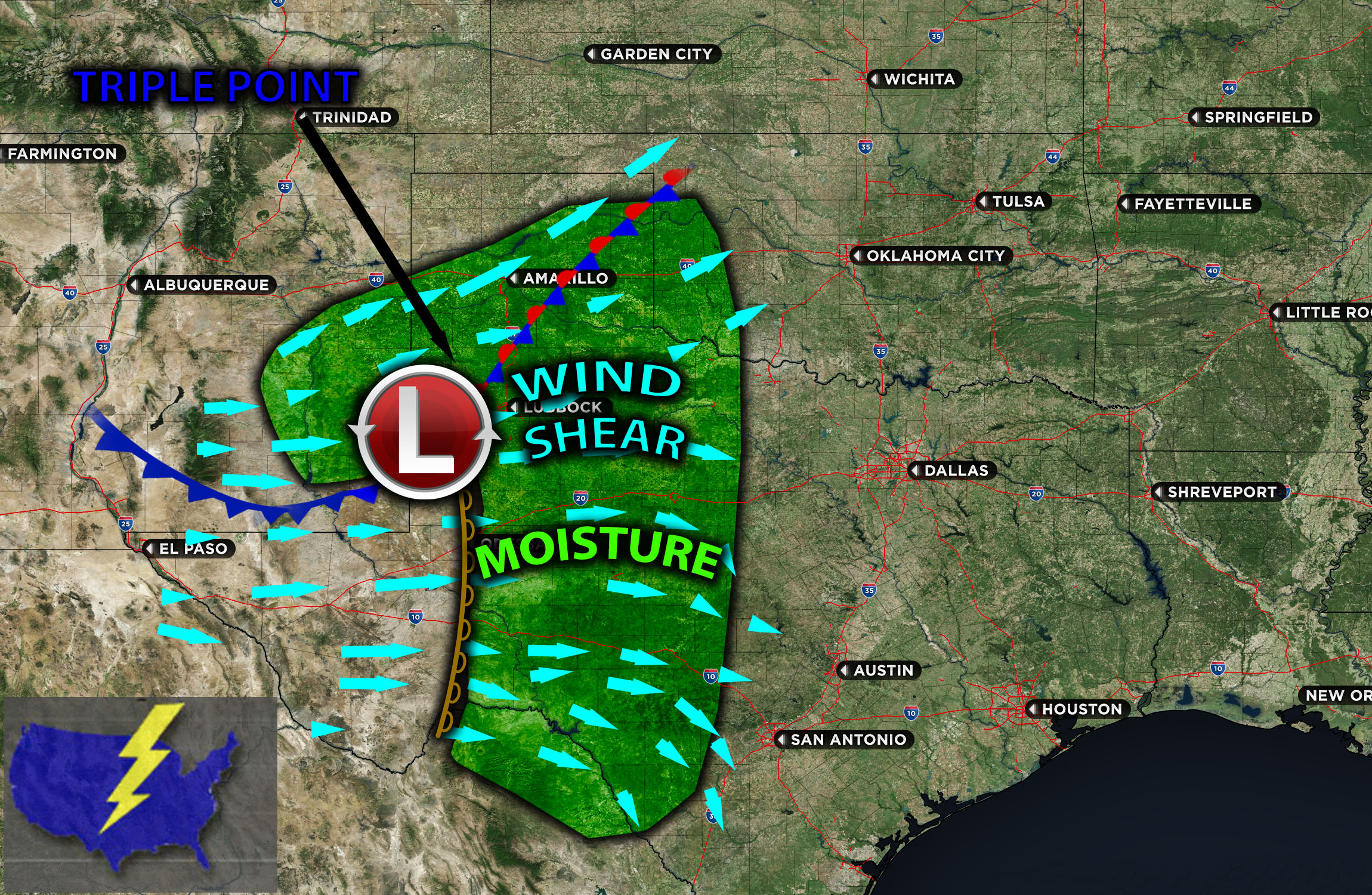
In the mid-to-upper levels of the atmosphere, a shortwave trough is digging into the southern Plains area. At the surface, a triple point, defined as multiple boundaries converging at a certain location, will form right along western TX, generating lift. This triple point will comprise a dryline and a developing cold front. To the east of the dryline, low-level moisture with dew points in the 60s will be present, along with modest instability due to cloud cover obscuring daytime heating. Nevertheless, just south of the cold front, MLCAPE values will range from 1500-200 J/kg, driven by the more intensely heated environment. This will facilitate storm formation across western and parts of central TX. The presence of westerly to northwesterly winds (indicating that winds come from those directions), which veer with height, coupled with effective shear around 30-35 kts, means these storms pose an isolated risk for large hail and damaging winds. The impacted regions will include portions of southeastern NM, and parts of western and central TX by Monday evening. However, due to the limited unstable air mass, these storms will be short-lived and primarily scattered in nature (hit or miss).
Visualization of Storms and Mesoanalysis:
Main risk: large hail, damaging winds mainly. Tornado risk extremely low due to lack of vertical and low-level shear.
Stay tuned for more updates.
Sina⚡⚡
With over a decade of experience in forecasting severe thunderstorms, this individual is a seasoned forecaster and developer. Their expertise in severe weather forecasting and computer science is entirely self-taught, complemented by a foundation in Atmospheric Science from UNCO. They have dedicated their efforts to developing innovative tools that enhance the accuracy of analyzing large hail and tornadoes. As a significant contributor to the National Weather Force, they have played a crucial role in providing accurate and timely information, as well as developing tools to keep those affected well-informed.
NOTE: The alerts and outlooks posted here are customary made to inform. At times, which is often, you will see an alert forecast posted on here that you do not see elsewhere. That is fine, the track record of the main office is very high so maintain to follow an event when posted. These are custom concentrated alerts and outlooks that are created by National Weather Force team of experts.