
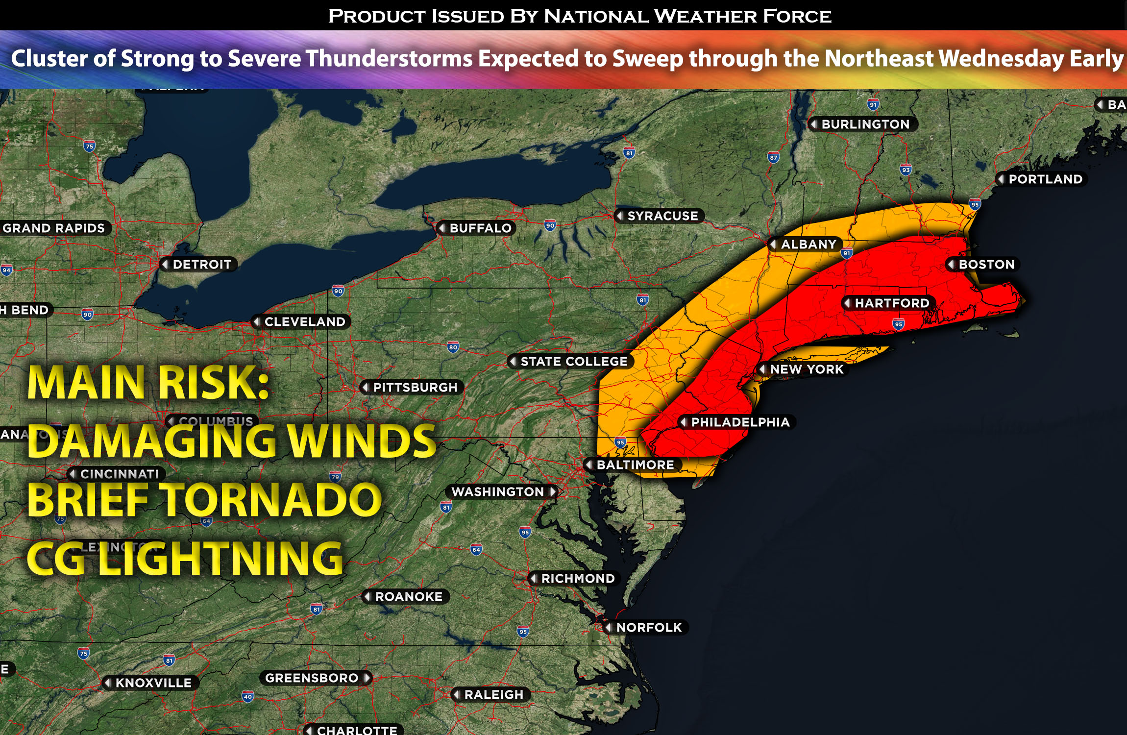
 From southern MA through CT, NY eastward (including NYC), and PA eastward:
A line of strong thunderstorms is expected to sweep through the area early Wednesday morning. Some of these storms may be severe, capable of producing a brief tornado and damaging gusty winds in the impacted regions before the cold front pushes through.
Timing & Impact Details: These storms are expected to form ahead of the cold front, stretching from PA to CT, as a few clusters. A stronger cluster is anticipated just south of NY, set to sweep through during the early morning commute between 5-7am EDT, impacting the region. These clusters of storms are expected to diminish in coverage from south to north as the front moves out by mid-morning Wednesday.
Forecast Details:
In the upper levels of the atmosphere, an upper-level trough is expected to move toward New England on Wednesday. At the mid-levels, multiple vorticity maxima will be embedded, creating a southwesterly flow that allows for an increased amount of mid-level shear over the region. At the surface, a low pressure with a cold front attached will sweep through the area. Ahead of it, there will be low-level warm air advection with a significant amount of moisture. Due to the lack of daylight heating from early hours, the instability will remain limited over the area. Nevertheless, enhanced vertical shear will allow for some storms to become severe, capable of producing a brief isolated tornado and gusty damaging winds in the impacted regions. The primary area of concern appears to be south of New York City where a cluster of cells is expected to form and move through the area. But NYC will most likely also get hit by a few cells.
Visualization of Mesoanalysis: 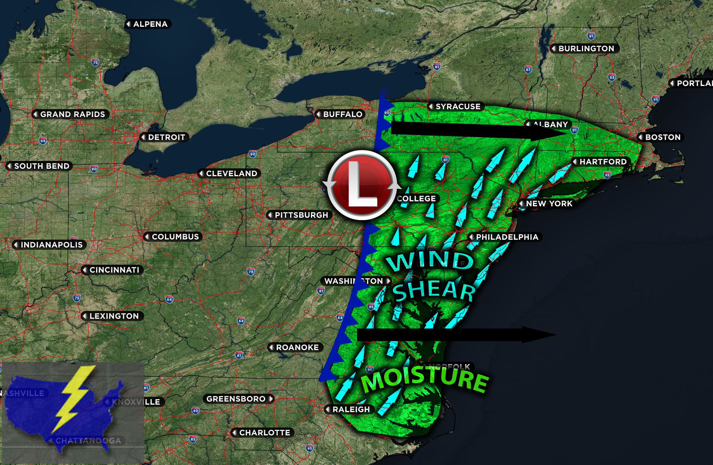
Main risk: gusty damaging winds, brief tornado possible
Stay tuned for more updates.
Sina⚡⚡
With over a decade of experience in forecasting severe thunderstorms, this individual is a seasoned forecaster and developer. Their expertise in severe weather forecasting and computer science is entirely self-taught, complemented by a foundation in Atmospheric Science from UNCO. They have dedicated their efforts to developing innovative tools that enhance the accuracy of analyzing large hail and tornadoes. As a significant contributor to the National Weather Force, they have played a crucial role in providing accurate and timely information, as well as developing tools to keep those affected well-informed.
NOTE: The alerts and outlooks posted here are customary made to inform. At times, which is often, you will see an alert forecast posted on here that you do not see elsewhere. That is fine, the track record of the main office is very high so maintain to follow an event when posted. These are custom concentrated alerts and outlooks that are created by National Weather Force team of experts.