
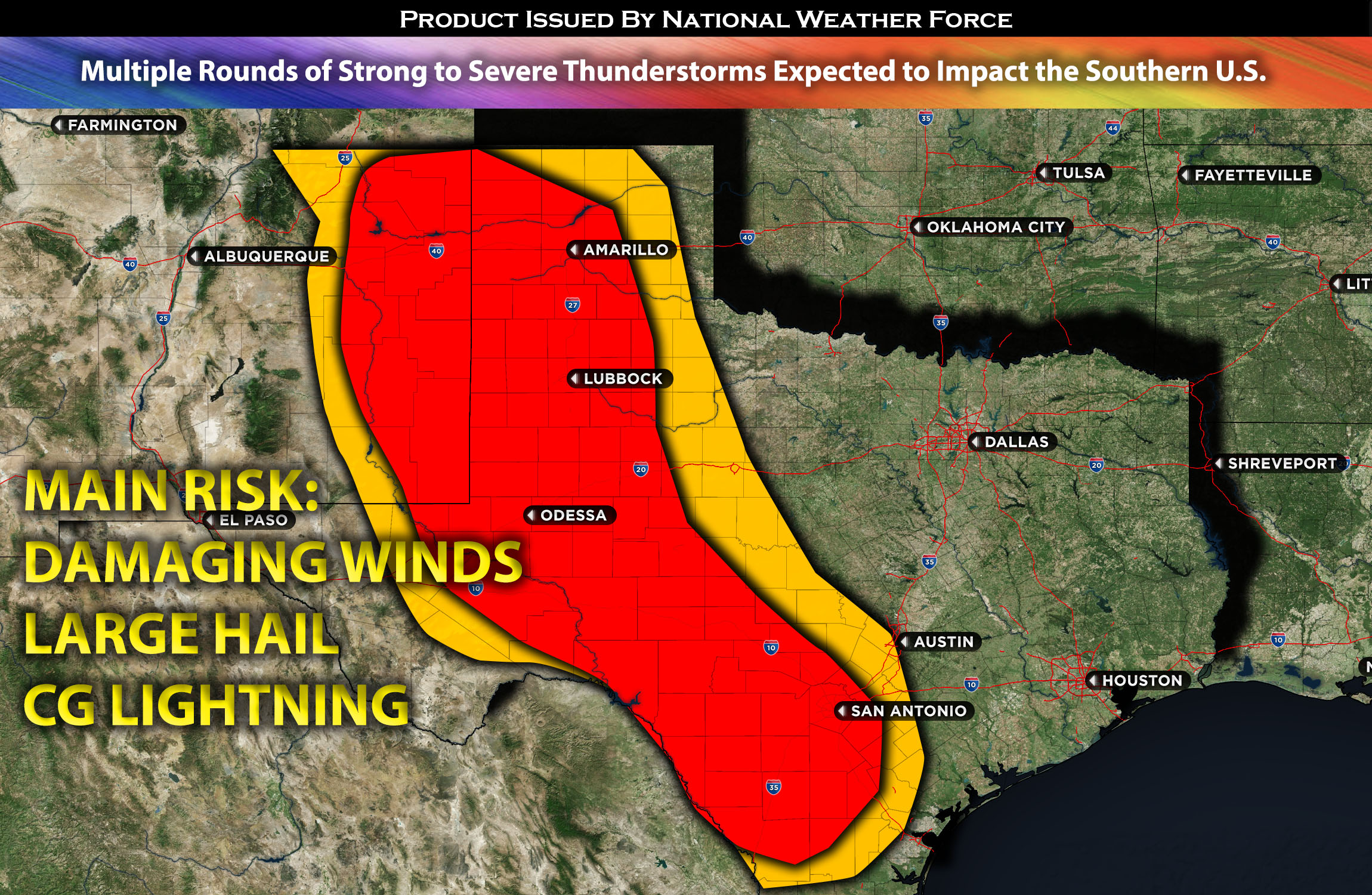
From extreme eastern NM to western and southern TX:
A cluster of storms that are capable of being severe is expected to impact the region given the unstable airmass. Then multiple rounds of thunderstorms are expected throughout the day in a hit or miss fashion (some get hit while others only feel muggy conditions). The strongest storms may produce large hail, damaging winds and CG lightning.
Timing & Impact Details: Widespread storms are expected to form in western TX later tonight. These are anticipated to cluster and become an MCS, moving southeastward across the impact regions. Multiple rounds of storm formation throughout this region, from eastern NM into western and southern TX, are possible all day on Friday due to the unstable airmass.
Forecast Details:
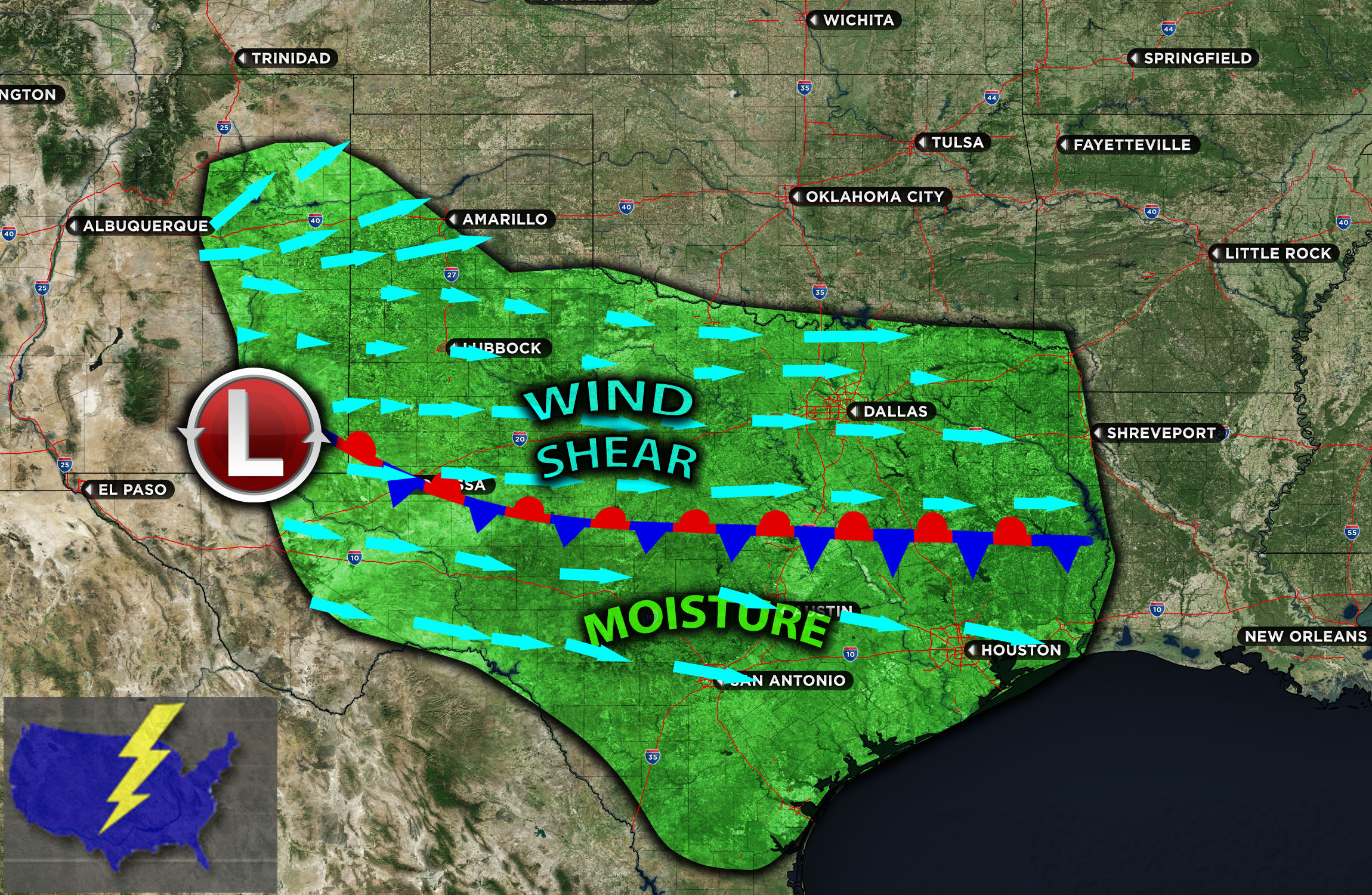
In the mid-to-upper-level atmosphere, zonal flow will continue across the southern U.S., with a low-amplitude trough moving eastward from west of the central plains. This scenario, combined with elevated instability and an abundance of low-level moisture that brings dew points in the mid-60s (and locally even into the upper 60s across TX), will set the stage. The elevated instability and steep lapse rates will facilitate updrafts. This, when combined with effective shear from the westerly flow influenced by a surface boundary, will enable storms to escalate into severe ones, capable of producing large hail and damaging winds. Due to the anticipated clustering of storms later tonight, they are likely to coalesce into an MCS in western TX and progress southeastward throughout Friday towards southern TX. Moreover, more rounds of storms are expected across TX, with the ongoing unstable airmass making them hit or miss, implying that while some areas will be impacted, others might only experience muggy conditions.
Visualization of Mesoanalysis:
Main risk: Large hail, damaging winds, tornado risk too low due to lack of low-level shear.
Stay tuned for more updates.
Sina⚡⚡
With over a decade of experience in forecasting severe thunderstorms, this individual is a seasoned forecaster and developer. Their expertise in severe weather forecasting and computer science is entirely self-taught, complemented by a foundation in Atmospheric Science from UNCO. They have dedicated their efforts to developing innovative tools that enhance the accuracy of analyzing large hail and tornadoes. As a significant contributor to the National Weather Force, they have played a crucial role in providing accurate and timely information, as well as developing tools to keep those affected well-informed.
NOTE: The alerts and outlooks posted here are customary made to inform. At times, which is often, you will see an alert forecast posted on here that you do not see elsewhere. That is fine, the track record of the main office is very high so maintain to follow an event when posted. These are custom concentrated alerts and outlooks that are created by National Weather Force team of experts.