
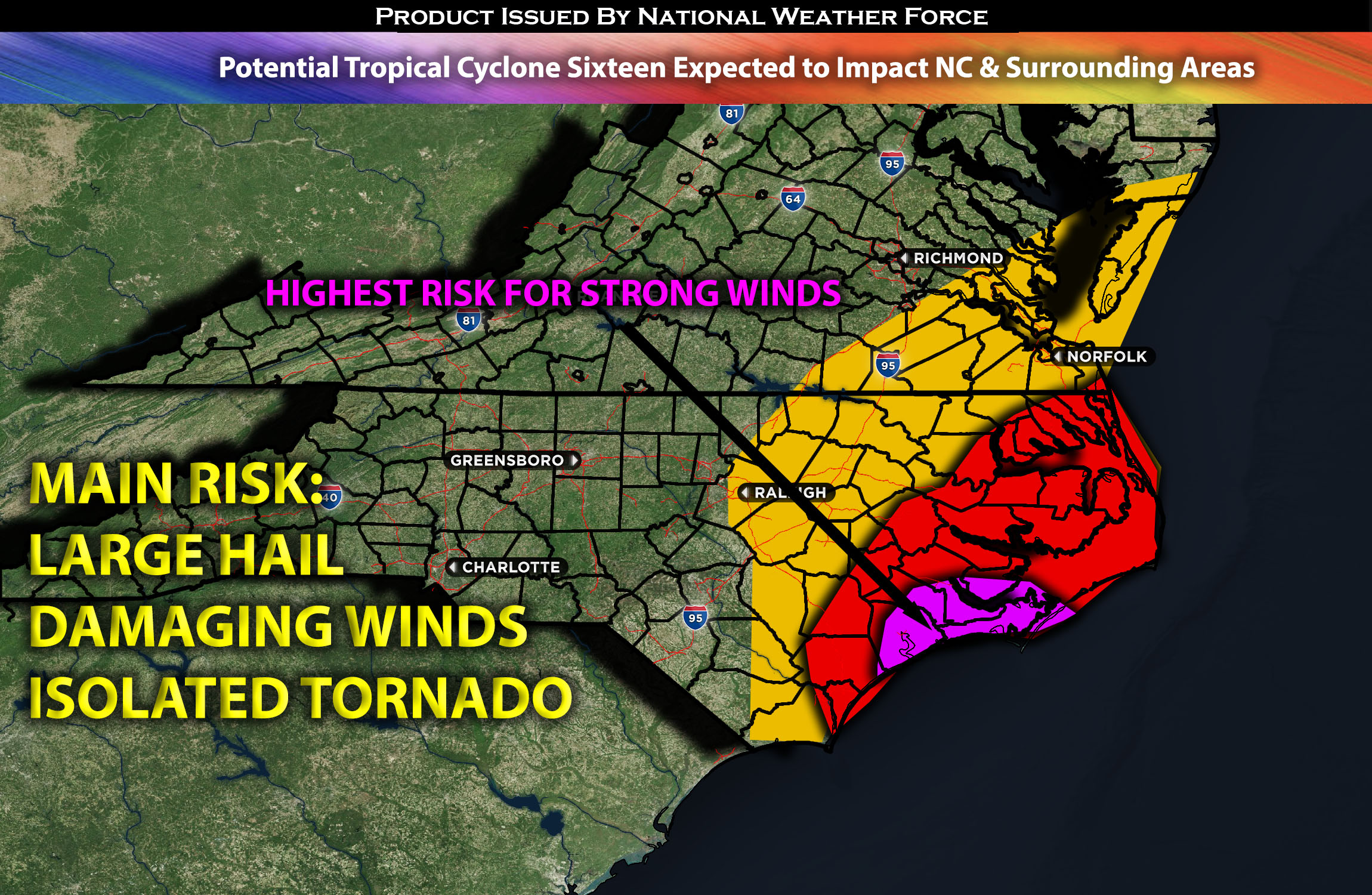
 Southeastern NC stretching up to Southeastern VA including the surrounding areas:
PTC #16 (Potential Tropical Cyclone 16) is expected to continue its trajectory up the coast. Accompanying it will be tropical storm conditions with heavy rain leading to flash flooding, strong to locally damaging winds, and a moderate storm surge of 2-5ft, especially impacting the coasts of NC.
Timing & Impact Details: PTC #16 is expected to continue to spin towards NC and with most impacts being around 3-5pm with more heavy bands 7-11pm EDT. The core is expected to make it on to land by around early morning Saturday with the strongest winds around the northeast of the circulation in southeastern NC.
Forecast Details:
As PTC 16 approaches the coast, it will usher in heavy rain, strong winds, and potential flooding throughout the area. During the daylight hours, the overland boundary layer is expected to remain north of the cyclone’s baroclinic zone, rendering conditions too stable for surface-based convection; it might seem calm before the storm intensifies later. However, as the evening sets in and continues into the night, the frontal zone is likely to migrate inland. This shift will be accompanied by an intensifying low-level flow, which will boost moisture levels and sharpen low-level lapse rates, extending from the southeast to the northwest across the region.
This dynamic will heighten buoyancy, especially in the mainland coastal areas close to eastern NC. While midlevel lapse rates may only slightly exceed moist adiabatic values, MLCAPE is projected to fall within the 500-1700 J/kg range. Furthermore, vertical shear given the spin with height with typical effective SRH values between 300-500 J/kg. Given these conditions, the primary risks associated with these storms include strong to locally damaging winds, flash flooding, and a sporadic tornado threat, underscored by the storm relative helicity.”
Main risk: flash flooding, storm surge, local damaging winds, isolated tornadoes possible due to the circulation and elevated low level shear.
Stay tuned for more updates.