
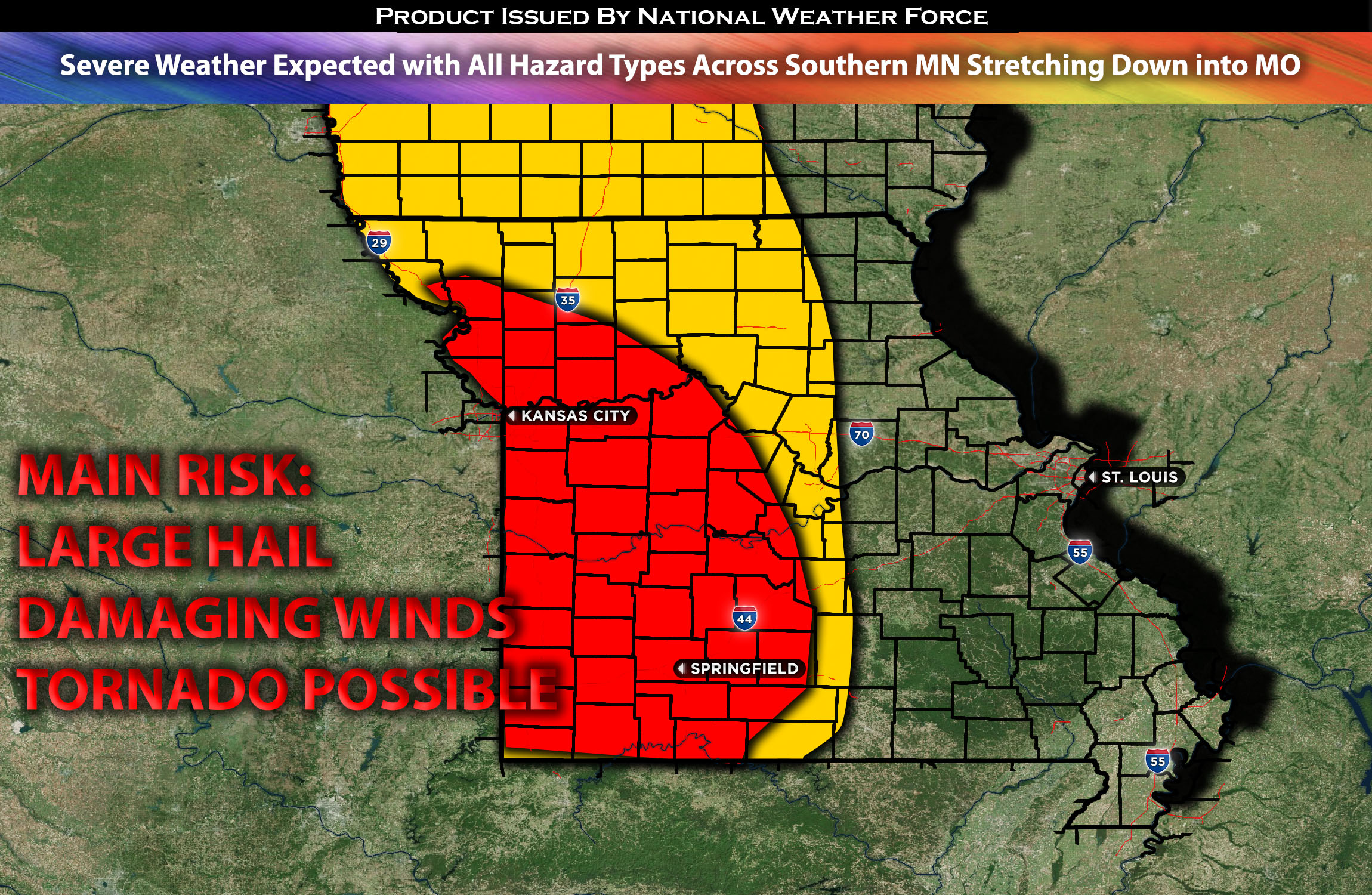
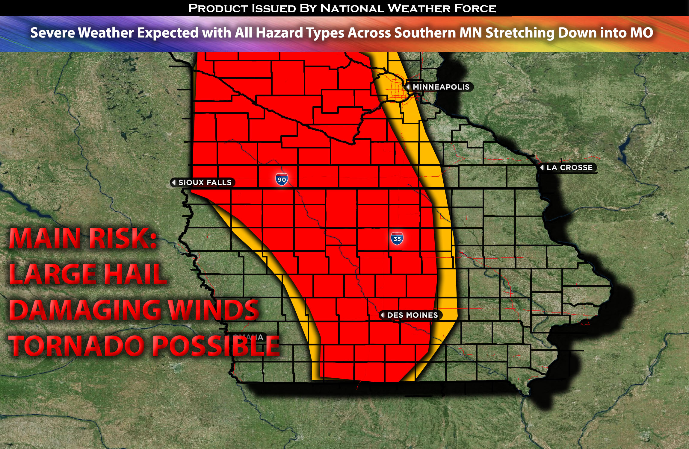
Southern MN stretching down to IA and into MO:
As the atmosphere destabilizes in the evening, severe storms capable of producing all types of hazards are expected to impact regions from southern MN through IA and into MO. These storms will be capable of generating large to very large hail, damaging winds, and possibly a few tornadoes, particularly considering the shear vectors with height.
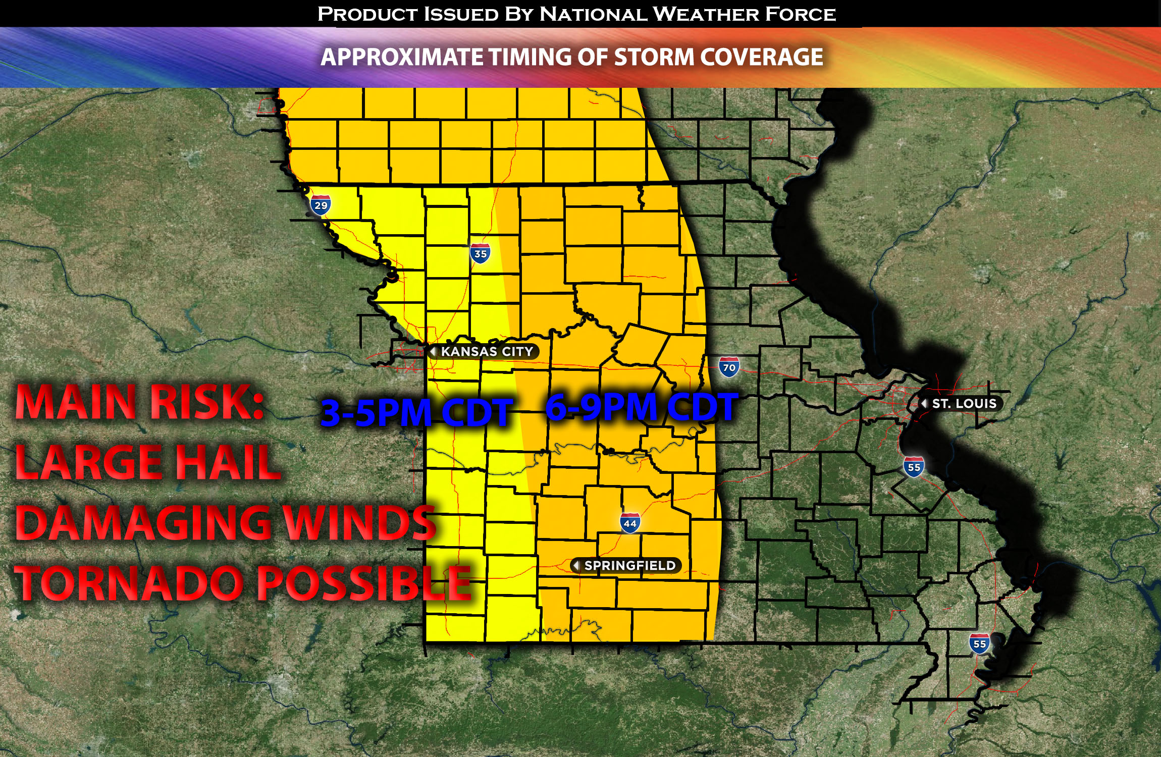
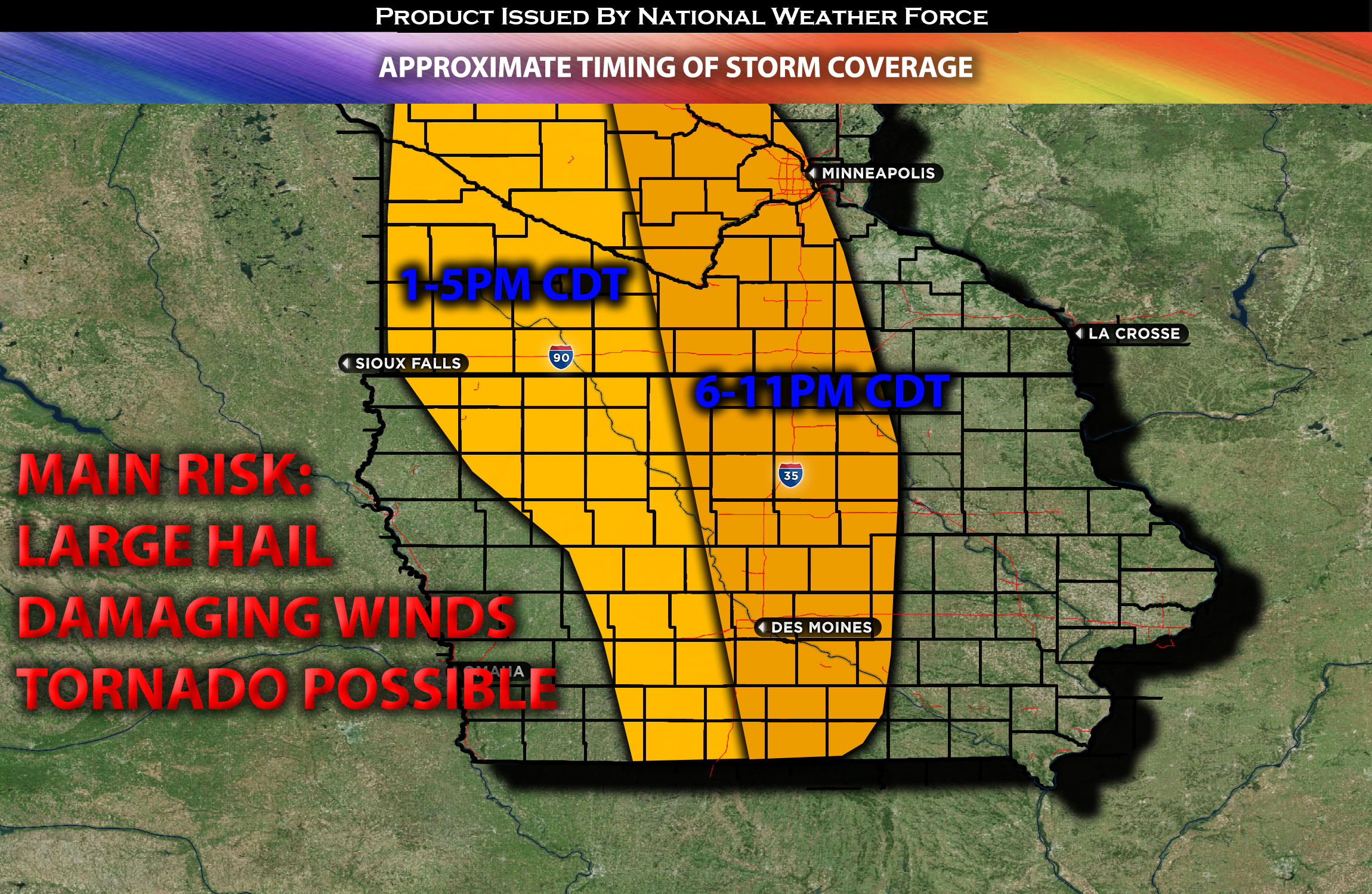
Timing & Impact Details: Determining the exact timing will be somewhat challenging, depending on when destabilization occurs. Storms are expected to form in southern MN and IA around 1-2pm CDT. Later, around 3-5pm CDT, more storm clusters—with a few discrete ones—are anticipated to develop through MO, moving eastward across the affected areas. A storm line is also projected to pass through Sioux City and Des Moines by evening, with additional clusters emerging around that region. The tentative timing for storm formation over MO is around 5-6pm CDT, possibly earlier if destabilization happens more quickly. These storms are expected to initiate around northwestern MO and just west of southern MO, then move southeastward across the impacted regions—mainly northwestern, western, and parts of central MO—throughout the night.
Approximate Timing of Storm Coverage:
Forecast Details:
In the upper levels of the atmosphere, an upper-level low is moving eastward and is expected to reach the north-central plains by the afternoon, specifically around the NE/SD area, accompanied by a strong southwesterly flow. At the surface, a low-pressure system is projected to progress across the KS/NE region, with a boundary and warm front preceding it. The presence of very warm mid-level moisture, along with elevated instability and vertical shear—with effective shear from 0-6km estimated at 40-50kts across the MN south into the IA/MO region—will be significant. The strengthening and focusing of the low-level jet, combined with the associated low-level shear, sets the stage for a variety of severe weather hazards, including large to very large hail, damaging winds, and tornadoes, especially given the shear vectors with height.
As the atmosphere destabilizes, there’s an expectation for robust storm activity across multiple regions, spanning from southern MN through IA and extending to the MO area along this boundary. Discrete storm cells are likely in these areas, and any of them could pose a risk for all mentioned hazards during the evening. As nighttime approaches, these storms are predicted to coalesce, with the primary threat shifting to damaging winds.
Main risk: Large to very large hail, damaging winds, a few tornadoes possible due to the circulation and somewhat concentrated low-level shear.
Stay tuned for more updates.
Sina⚡⚡
With over a decade of experience in forecasting severe thunderstorms, this individual is a seasoned forecaster and developer. Their expertise in severe weather forecasting and computer science is entirely self-taught, complemented by a foundation in Atmospheric Science from UNCO. They have dedicated their efforts to developing innovative tools that enhance the accuracy of analyzing large hail and tornadoes. As a significant contributor to the National Weather Force, they have played a crucial role in providing accurate and timely information, as well as developing tools to keep those affected well-informed.
NOTE: The alerts and outlooks posted here are customary made to inform. At times, which is often, you will see an alert forecast posted on here that you do not see elsewhere. That is fine, the track record of the main office is very high so maintain to follow an event when posted. These are custom concentrated alerts and outlooks that are created by National Weather Force team of experts.