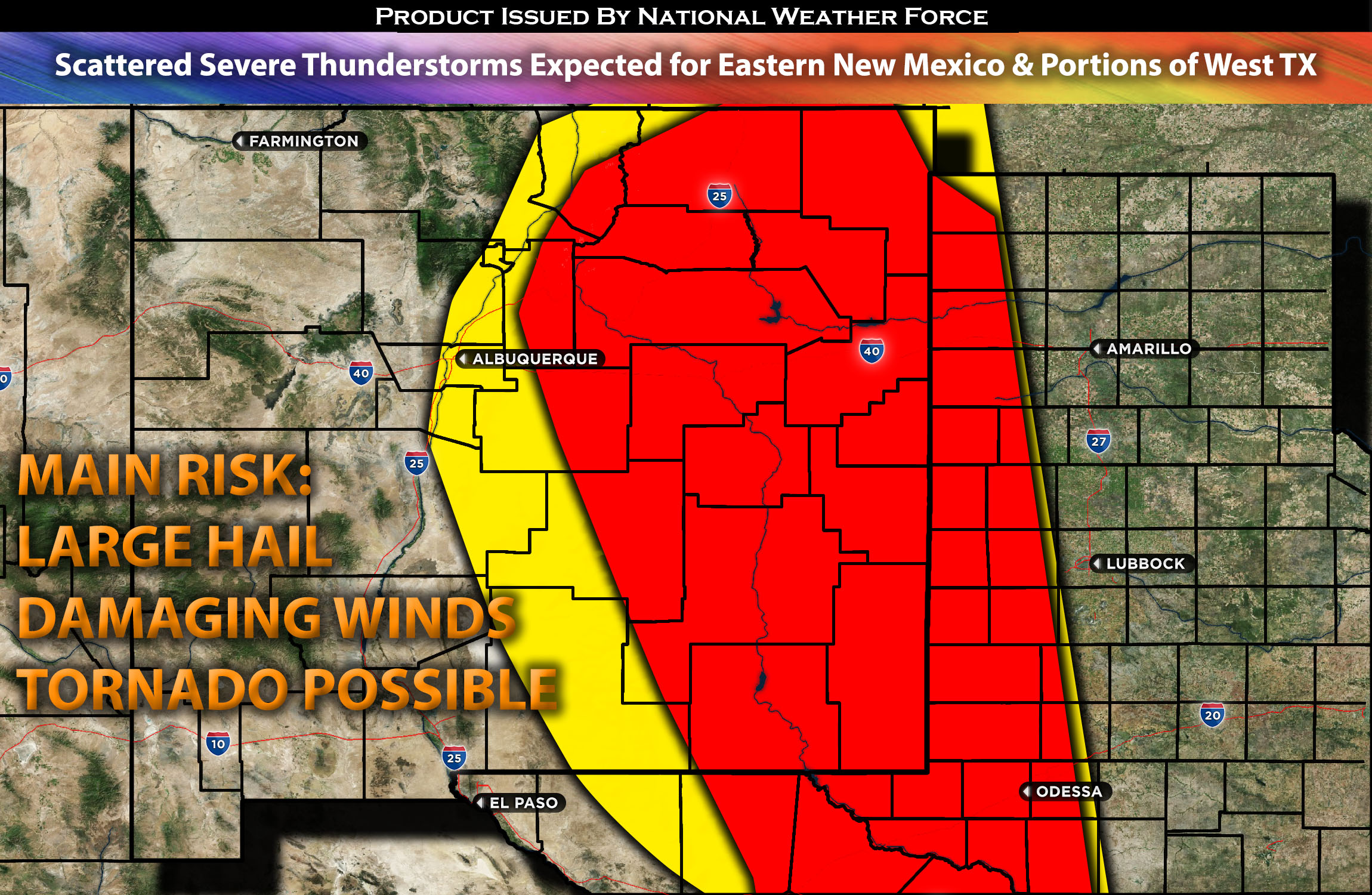
Eastern New Mexico Stretching to Western Texas:
Showers and thunderstorms expected early afternoon with a few strong ones before noon. Then more scattered strong to severe thunderstorms are expected across Eastern NM on Monday in the late afternoon. These storms may produce large hail, damaging winds, and potentially a tornado or two. Some of these storms most likely will also spill over later in the evening/overnight into western TX with main risk being damaging winds, CG lightning and hail. See below for detailed timing and forecast information.
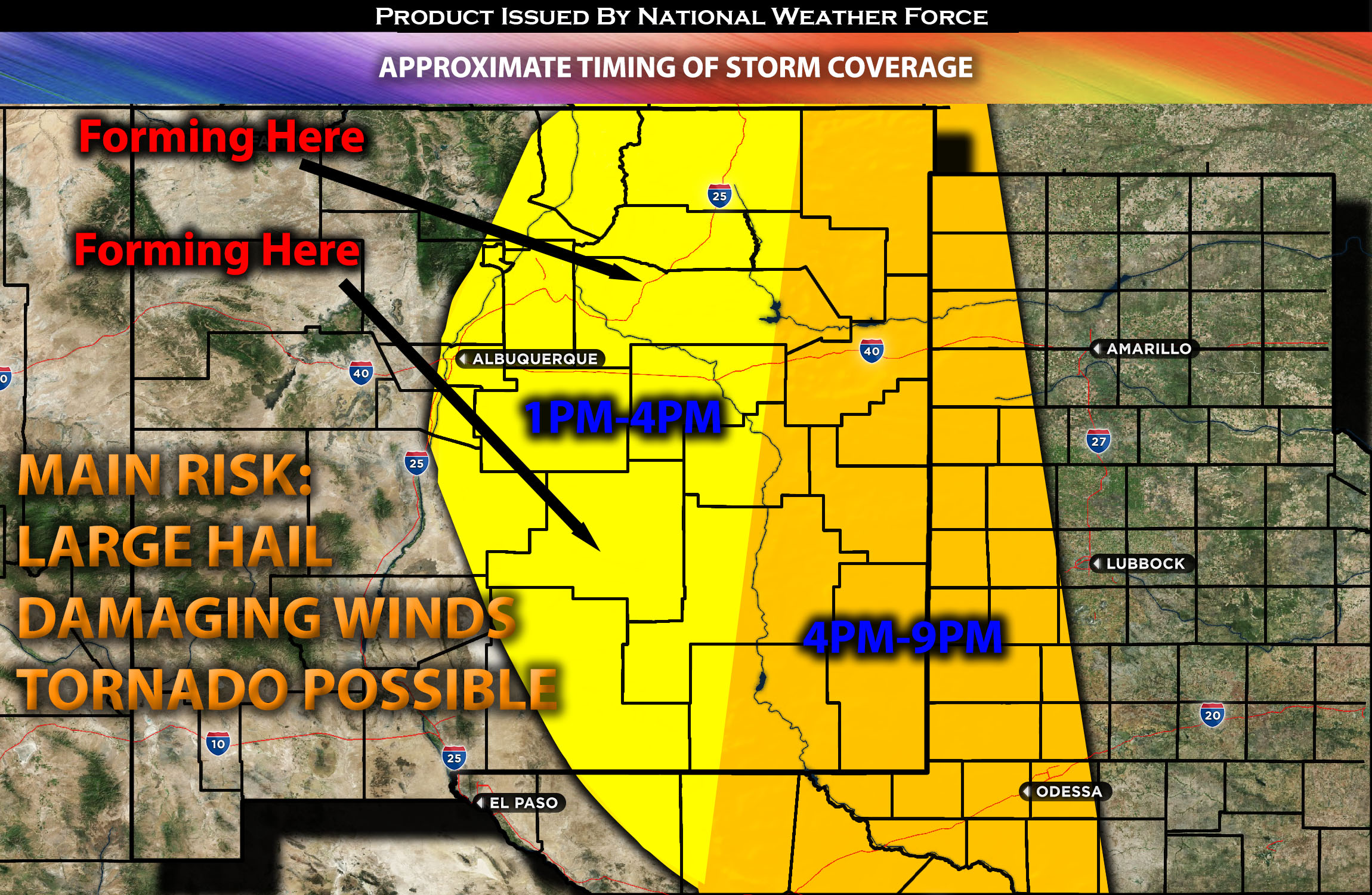
Timing & Impact Details: Timing of storm formation will be when destabilization occurs around later in the afternoon/evening especially scattered in nature across eastern NM. Strongest storms are anticipated to form around 3-5pm CDT although more storms anticipated to continue forming in clusters through the evening across eastern NM and overnight into far eastern NM and portions of western TX (see graphics for details).
Approximate Timing of Storm Coverage:

Forecast Details:
In the upper levels of the atmosphere, an upper-level trough is expected to continue moving eastward from the West Coast towards the Rockies. Concurrently, shortwave troughs are anticipated to move through the plains, with one impacting the NM/west TX area. Simultaneously, a continuous southeasterly flow will introduce more moisture to the NM/western TX regions. This influx of moisture, combined with surface heating, elevated instability, and deep layer shear in the range of 35-40 kts, will facilitate the formation of severe storms across NM and eastward as destabilization takes place. The primary risks include large hail and damaging winds. Additionally, a tornado or two might form if sufficient low-level shear coincides with the low-level jet stream, especially during the evening.
Main risk: Large hail, damaging winds, a few tornadoes might be possible but not main threat.
Stay tuned for more updates.
Sina⚡⚡
With over a decade of experience in forecasting severe thunderstorms, this individual is a seasoned forecaster and developer. Their expertise in severe weather forecasting and computer science is entirely self-taught, complemented by a foundation in Atmospheric Science from UNCO. They have dedicated their efforts to developing innovative tools that enhance the accuracy of analyzing large hail and tornadoes. As a significant contributor to the National Weather Force, they have played a crucial role in providing accurate and timely information, as well as developing tools to keep those affected well-informed.
NOTE: The alerts and outlooks posted here are customary made to inform. At times, which is often, you will see an alert forecast posted on here that you do not see elsewhere. That is fine, the track record of the main office is very high so maintain to follow an event when posted. These are custom concentrated alerts and outlooks that are created by National Weather Force team of experts.
