
 Central Plains from NE East towards portions of IA,MO and western IL:
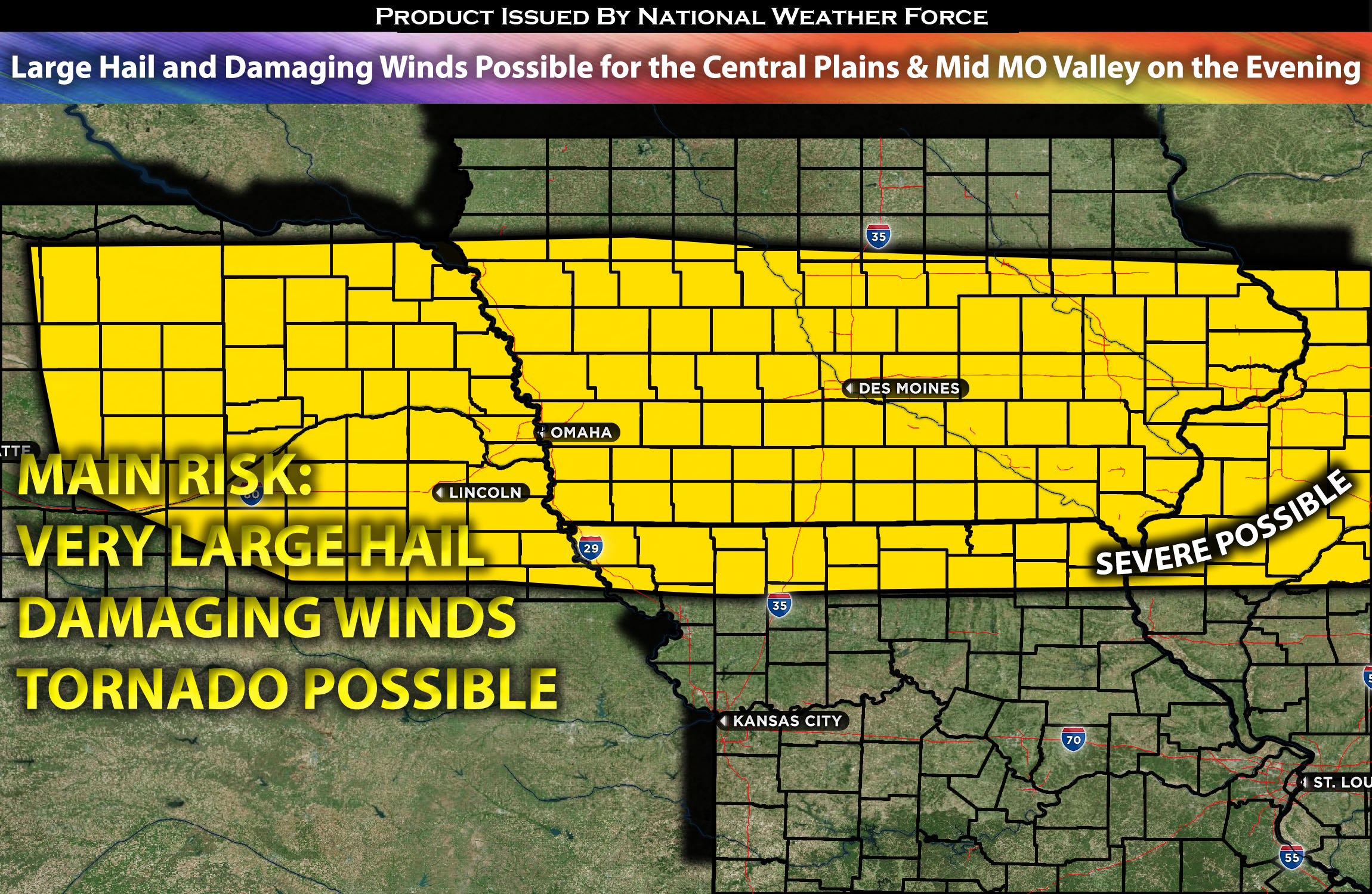
Storms are expected to develop along this boundary, depending on the timing of destabilization. These storms will likely be sporadic, or “hit or miss,” across the area, initiating around the evening between 5-7pm CDT and persisting into the overnight hours. The potential impacts of these storms include large hail, localized damaging winds, cloud-to-ground (CG) lightning, and sustained heavy rainfall throughout the night.
Regions At Risk: Eastern NE, southern IA, western IL, and extreme northern MO.
Forecast Details:
A trough in the upper atmosphere will originate from the Pacific Northwest/Great Basin and move southeast towards the central Rockies and adjacent High Plains by Wednesday into Wednesday night. As this transpires, a strengthened belt of southwesterly flow will encompass the central Plains, extending to the Mid-MO/Mid-MS Valley. At the same time, a surface-level low-pressure zone will take shape over eastern CO and shift east into western KS throughout the night. A warm front will be situated across southeast NE, extending eastward along the MO/IA border and reaching northwest IL. While capping will inhibit thunderstorm formation within the warm sector below the warm front, the combined effects of strong warm advection above the warm front and increasing large-scale ascent are likely to trigger intermittent thunderstorm occurrences by evening from central/eastern NE to northwest IL. Given the presence of a somewhat elevated instability zone, there’s potential for some of these storms, primarily in the evening and overnight, to produce large hail across these regions.
Main risk: Large hail and local damaging winds
Stay tuned for more updates.
Sina⚡⚡
With over a decade of experience in forecasting severe thunderstorms, this individual is a seasoned forecaster and developer. Their expertise in severe weather forecasting and computer science is entirely self-taught, complemented by a foundation in Atmospheric Science from UNCO and an IT background from WGU. They have dedicated their efforts to developing innovative tools that enhance the accuracy of analyzing large hail and tornadoes. As a significant contributor to the National Weather Force, they have played a crucial role in providing accurate and timely information, as well as developing tools to keep those affected well-informed.
NOTE: The alerts and outlooks posted here are customary made to inform. At times, which is often, you will see an alert forecast posted on here that you do not see elsewhere. That is fine, the track record of the main office is very high so maintain to follow an event when posted. These are custom concentrated alerts and outlooks that are created by National Weather Force team of experts.