
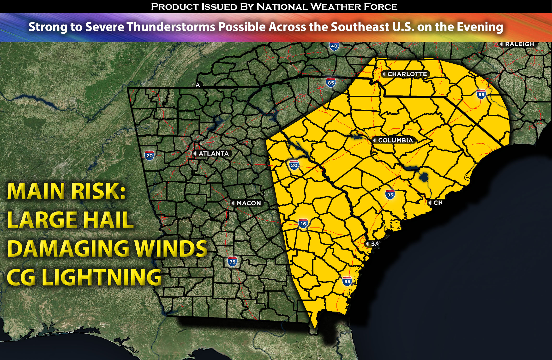
Extending from SC to GA:
Strong to severe thunderstorms are possible across the area by mid noon with a line of storms anticipated to form ahead and along the cold front moving eastward across the area with time. These storms are capable of producing local damaging winds and large hail in a hit or miss fashion. The highest chance for any severe weather looks to be in SC eastward across portions of northeastern GA.
Regions At Risk: NC central, east, SC central and east stretching down into fast eastern GA.
Forecast Details:
In the upper levels of the atmosphere, a mid-level trough is expected to gradually move eastward toward the Lower Great Lakes area. This will introduce mid-level cold air advection and enhanced forcing, destabilizing the airmass across the southeast. At the surface, a cold front will advance rapidly eastward across the southeast during the day, reaching Northern Carolina by evening. This front will drive moisture into these regions, raising dew points to the lower 60s. The conditions will foster the development of scattered thunderstorms, some of which may be severe. A veering westerly flow, induced by a strengthening jet stream of 50kts or more, will make storms capable of producing localized damaging winds. Additionally, some storms may produce large hail throughout the evening before dissipating as they move east.
Main risk: local large hail, damaging winds, CG lightning, and heavy rainfall
Stay tuned for more updates.
Sina⚡⚡
With over a decade of experience in forecasting severe thunderstorms, this individual is a seasoned forecaster and developer. Their expertise in severe weather forecasting and computer science is entirely self-taught, complemented by a foundation in Atmospheric Science from UNCO and an IT background from WGU. They have dedicated their efforts to developing innovative tools that enhance the accuracy of analyzing large hail and tornadoes. As a significant contributor to the National Weather Force, they have played a crucial role in providing accurate and timely information, as well as developing tools to keep those affected well-informed.
NOTE: The alerts and outlooks posted here are customary made to inform. At times, which is often, you will see an alert forecast posted on here that you do not see elsewhere. That is fine, the track record of the main office is very high so maintain to follow an event when posted. These are custom concentrated alerts and outlooks that are created by National Weather Force team of experts.