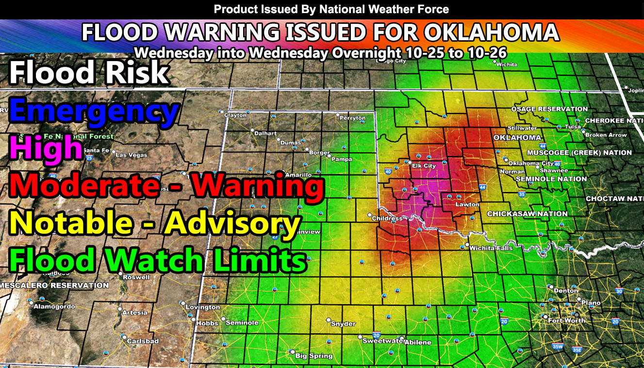
National Weather Force has issued a Flood Warning in high-risk form from Northwest Texas into the Western half of Oklahoma, effective Wednesday and going through Wednesday night into early Thursday morning.
An upper-level system that will be responsible for storms in Arizona today and tomorrow (Tuesday) will eject eastward through New Mexico. This system will have strong upper divergence (lift) out ahead of it for your Wednesday. This system will merge with deep tropical moisture from what was Hurricane Norma and entrain into the upper dynamics. This will cause rapidly developing storms across Western Texas, moving northeast with time through the Oklahoma zones.
The area that the National Weather Force Flood Risk Assessment Model shows is going to target mostly West-Central Oklahoma with 4-6″ of rainfall in a short period of time. Some of these areas are in a drought so flooding will add up quickly in spots.
Raiden Storm
Master General Meteorologist

