
Across Kansas and Surrounding States:
A few rounds of precipitation, including freezing rain and snow (which could be heavy at times), are expected from Saturday morning through to overnight Saturday in areas of Kansas (especially in the south-central region) and neighboring states. The weather will start with rain showers in the morning, transitioning to snow later on, which could be heavy at times across Kansas. For more detailed information, please refer to the forecast details below.
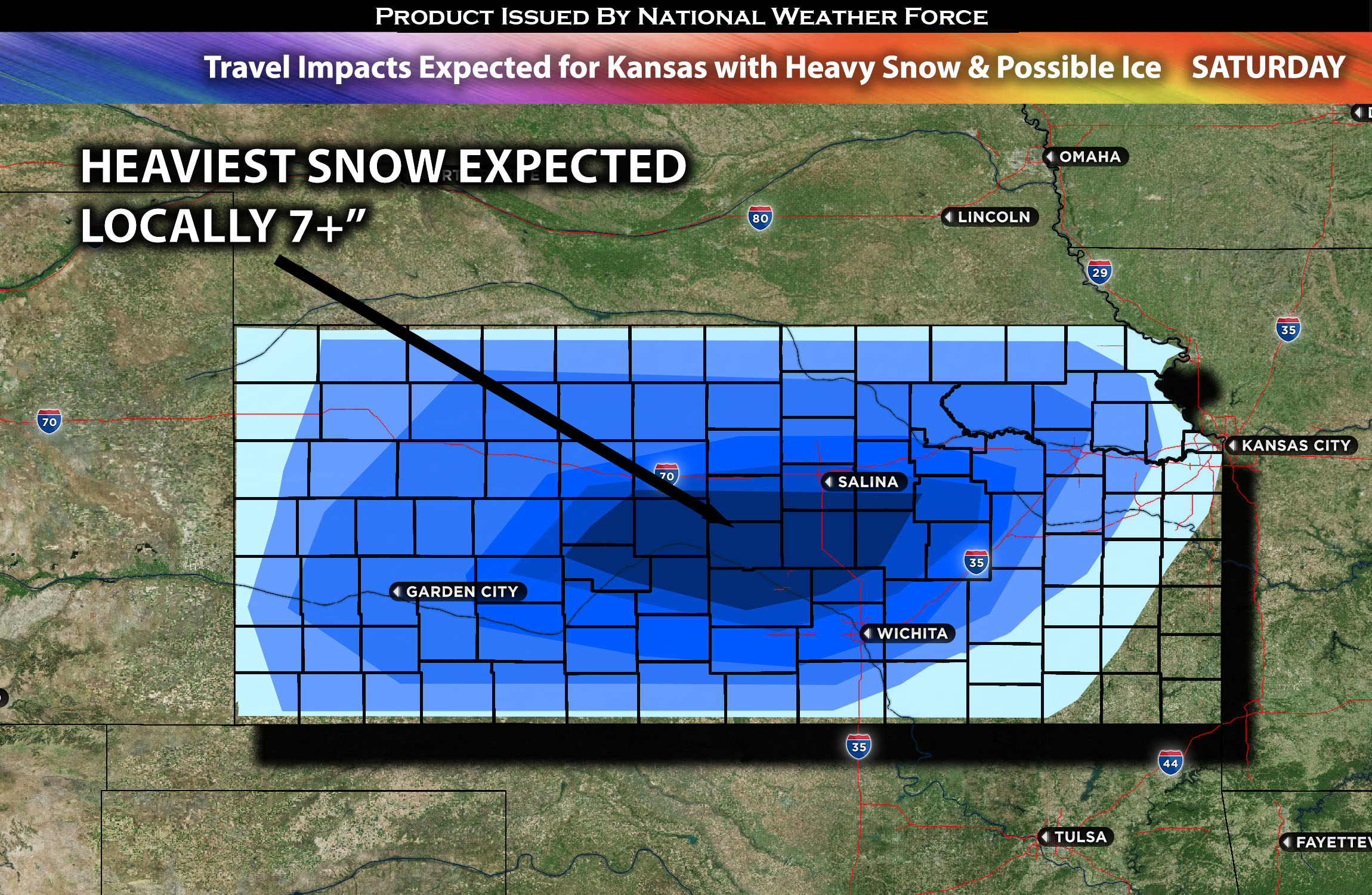
Regions Impacted: Kansas (mostly), surrounding states lighter impact.
Main impact: mixed precipitation, snow (heavy at times), and freezing rain (very light) possible.
Forecast Details:
In the upper levels of the atmosphere, an upper-level trough is expected to move eastward and reach the Rockies by early Saturday. Concurrently, upper-level divergence associated with a surface low, combined with mid-level moisture, is anticipated to produce rain showers some heavy at times from Saturday morning across Kansas. As the day progresses, mid-level temperatures are expected to drop, leading to a transition of all the rain into snow, which could be heavy at times, particularly in and around the Wichita, KS area (southward and nearby). Additionally, there is a minor risk of ice formation due to fluctuating temperatures near the borderline in the morning hours before the changeover to snow. This weather pattern is likely to affect travel, creating potentially hazardous conditions through Saturday evening and into the night. Total snowfall is generally expected to be in the range of 3 to 6 inches, with some localized areas possibly receiving over 7 inches.
Stay tuned for more updates.
Sina⚡⚡
With over a decade of experience in forecasting severe thunderstorms, this individual is a seasoned forecaster and developer. Their expertise in severe weather forecasting and computer science is entirely self-taught, complemented by a foundation in Atmospheric Science from UNCO and an IT background from WGU. They have dedicated their efforts to developing innovative tools that enhance the accuracy of analyzing large hail and tornadoes. As a significant contributor to the National Weather Force, they have played a crucial role in providing accurate and timely information, as well as developing tools to keep those affected well-informed.