
Outlook for Southeastern U.S.
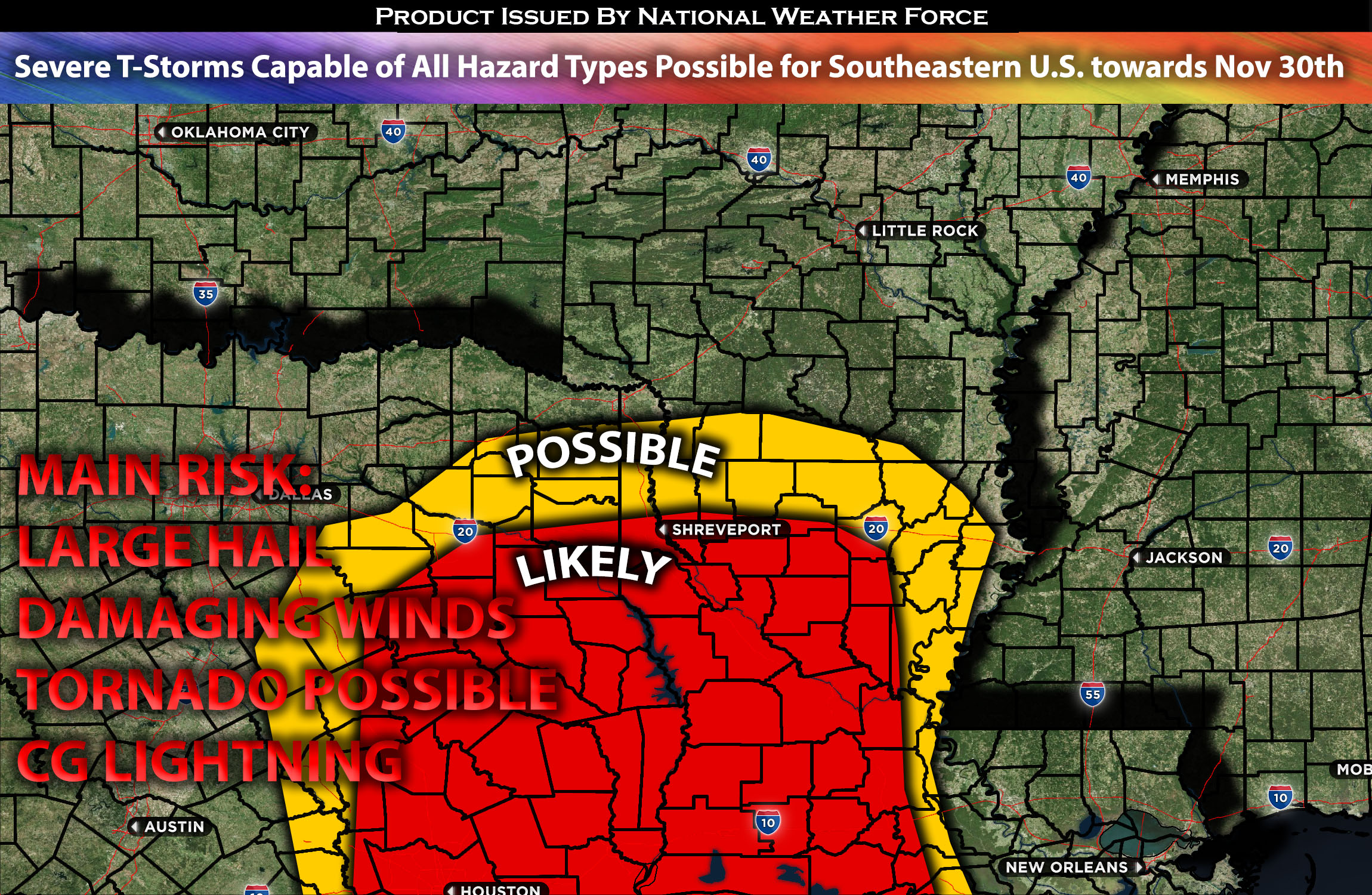
Towards the end of this week, around November 30th, the possibility of severe weather re-emerges with all hazard types possible. Once again, the Ark/La/Tex region stands out as the focal point for these severe weather conditions. While timing is still too far out. agreements with overall trends towards severe weather is coming together.
Forecast Outlook (Most likely to change and be more In-depth with the next update):
The risk of severe weather returns towards the end of this week, around November 30th, encompassing all possible hazard types. The primary area of concern for severe weather appears to be the Ark/La/Tex region once again. Multiple shortwave troughs, is anticipated to move southeastward over the area, bringing with it a southwesterly flow. This, combined with any instability and effective shear, could lead to severe storms capable of producing large hail, damaging winds, and possibly a few tornadoes, especially if low-level shear converges with the jet stream. As the day approaches, more details will emerge regarding the specific locations affected, the primary risks, and the timing.
Stay tuned for the next update, which will provide timing details, more specific information on impacted locations, and threats for specific micro-zones in the coming days.
Sina⚡⚡
With over a decade of experience in forecasting severe thunderstorms, this individual is a seasoned forecaster and developer. Their expertise in severe weather forecasting and computer science is entirely self-taught, complemented by a foundation in Atmospheric Science from UNCO and an IT background from WGU. They have dedicated their efforts to developing innovative tools that enhance the accuracy of analyzing large hail and tornadoes. As a significant contributor to the National Weather Force, they have played a crucial role in providing accurate and timely information, as well as developing tools to keep those affected well-informed.