
 Across Mississippi Valley and Southeast regions:
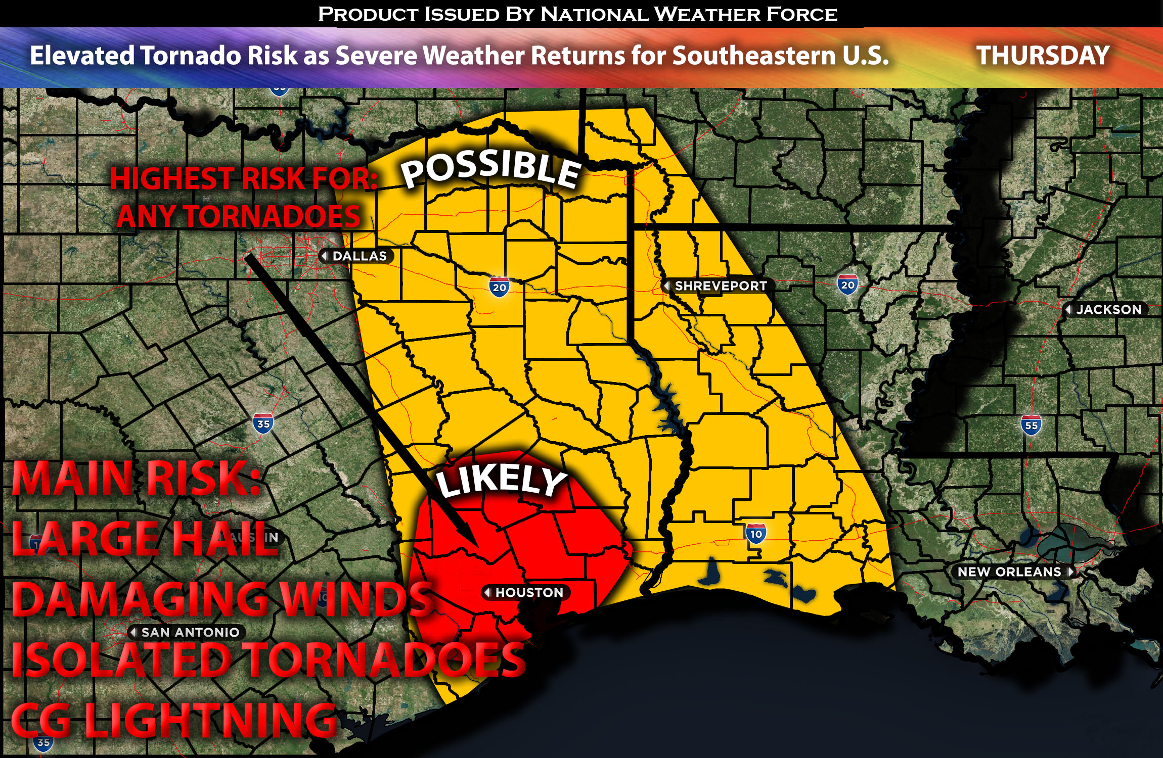
Strong to severe thunderstorms are anticipated to impact the region, with the primary risks being local large hail and possibly a few tornadoes due to elevated low-level shear caused by the jet stream within a brief timeframe. These storms, expected to be scattered, are likely to develop from west to east over the southeast Texas area during the afternoon. They will continue moving eastward across the impacted regions into the evening hours before diminishing, with limited environmental dynamics, see forecast details for more information.
Regions At Risk: southeast TX (including Houston, TX), portions of LA and southwestern AR.
Forecast Details:
As a mid-level trough moves into northern Mexico, an associated 85-knot mid-level jet stream will be over West Texas by Friday afternoon. At the same time, moisture advection will be right over the Texas Coastal Plains. Meanwhile, at the surface, dew points are anticipated to increase into the mid 60s range from the middle Texas Coast northward to west of Houston. This, combined with some elevated instability, will allow for storms to be marginally severe, mainly with the risk of a few isolated tornadoes due to strong low-level shear caused by the jet stream. This will allow a line of cells to form in the afternoon with the potential to produce tornadoes across the Houston area. These storms will then continue to move into Louisiana’s southwestern area before diminishing.
Main risk: local large hail, local damaging winds, a few tornadoes possible.
Stay tuned for more updates.
Sina⚡⚡
With over a decade of experience in forecasting severe thunderstorms, this individual is a seasoned forecaster and developer. Their expertise in severe weather forecasting and computer science is entirely self-taught, complemented by a foundation in Atmospheric Science from UNCO and an IT background from WGU. They have dedicated their efforts to developing innovative tools that enhance the accuracy of analyzing large hail and tornadoes. As a significant contributor to the National Weather Force, they have played a crucial role in providing accurate and timely information, as well as developing tools to keep those affected well-informed.