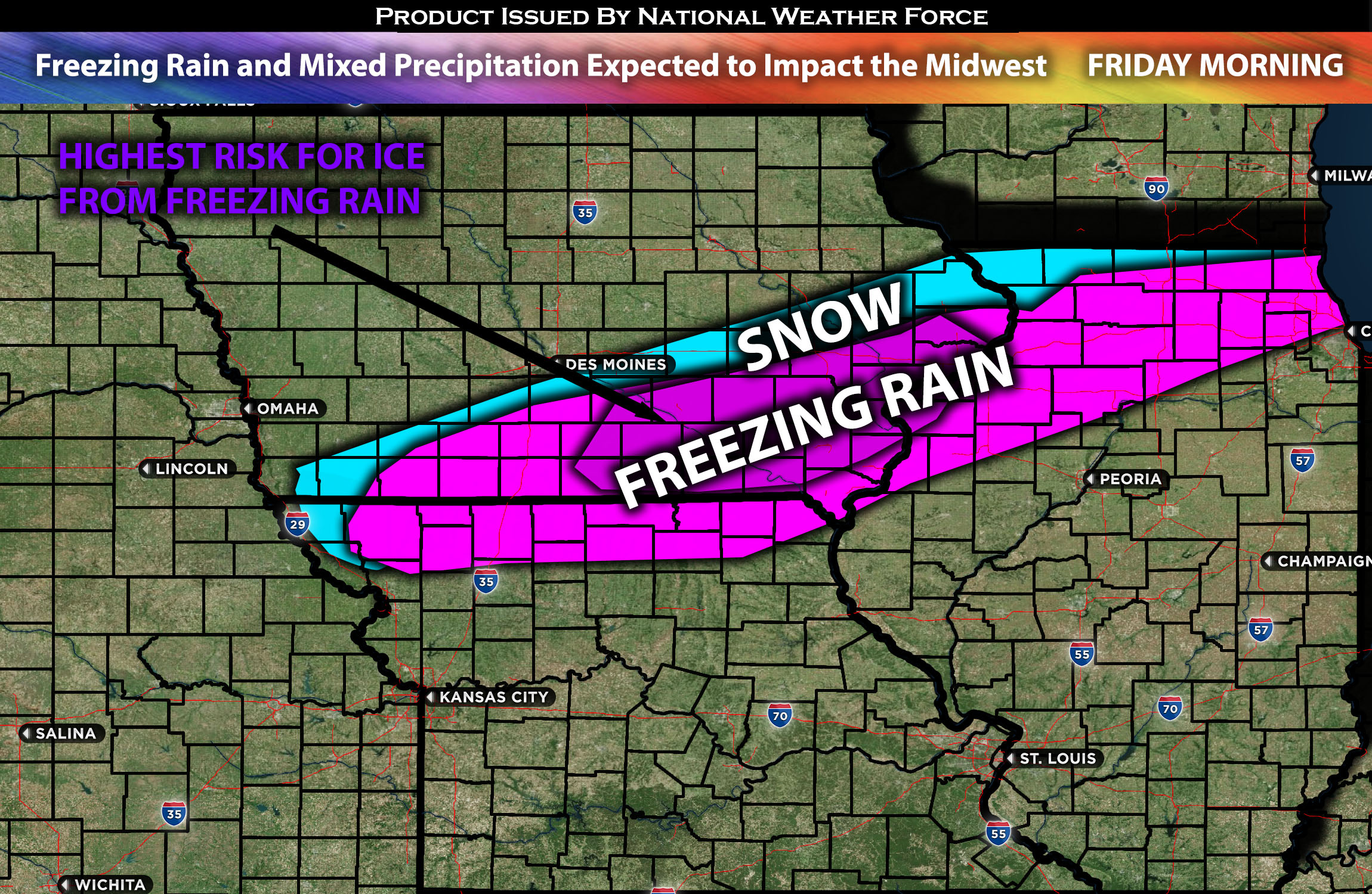
Across the Midwest including portions of IA, IL and MO:
A mixture of precipitation is anticipated across the area, with freezing rain also being part of the risk. What will start off as rain will drastically change over to freezing rain and mixed precipitation across the area from midnight Thursday through midday Friday. Freezing rain amounts look to be around a trace to locally as high as 0.45 of an inch. The worst-affected area looks to be around southeast IA.
Regions Impacted: IA southeast and east, IL northwest and portions of north, MO northwest and north.
Main impact: mixed precipitation, freezing rain, and some snow (nothing too heavy)
Forecast Details:
As a cold front moves southeastward through Iowa (IA), Illinois (IL), and Missouri (MO), it’s expected to bring varied types of precipitation. Initially, it’s likely to start as rain on Thursday night. This will occur as sub-freezing temperatures spread from northwest to southeast into Iowa during the early evening. As the front advances, the rain is expected to transition to a mix of precipitation types, including freezing rain, particularly affecting areas from Keosauqua to Sterling/Rock Falls, where an ice glaze could form. To the north and west, snow is more probable, with current expectations being about an inch of snowfall from midnight Thursday until midday Friday.
Stay tuned for more updates.
—————————
Sina⚡⚡
With over a decade of experience in forecasting severe thunderstorms, this individual is a seasoned forecaster and developer. Their expertise in severe weather forecasting and computer science is entirely self-taught, complemented by a foundation in Atmospheric Science from UNCO and an IT background from WGU. They have dedicated their efforts to developing innovative tools that enhance the accuracy of analyzing large hail and tornadoes. As a significant contributor to the National Weather Force, they have played a crucial role in providing accurate and timely information, as well as developing tools to keep those affected well-informed.
