
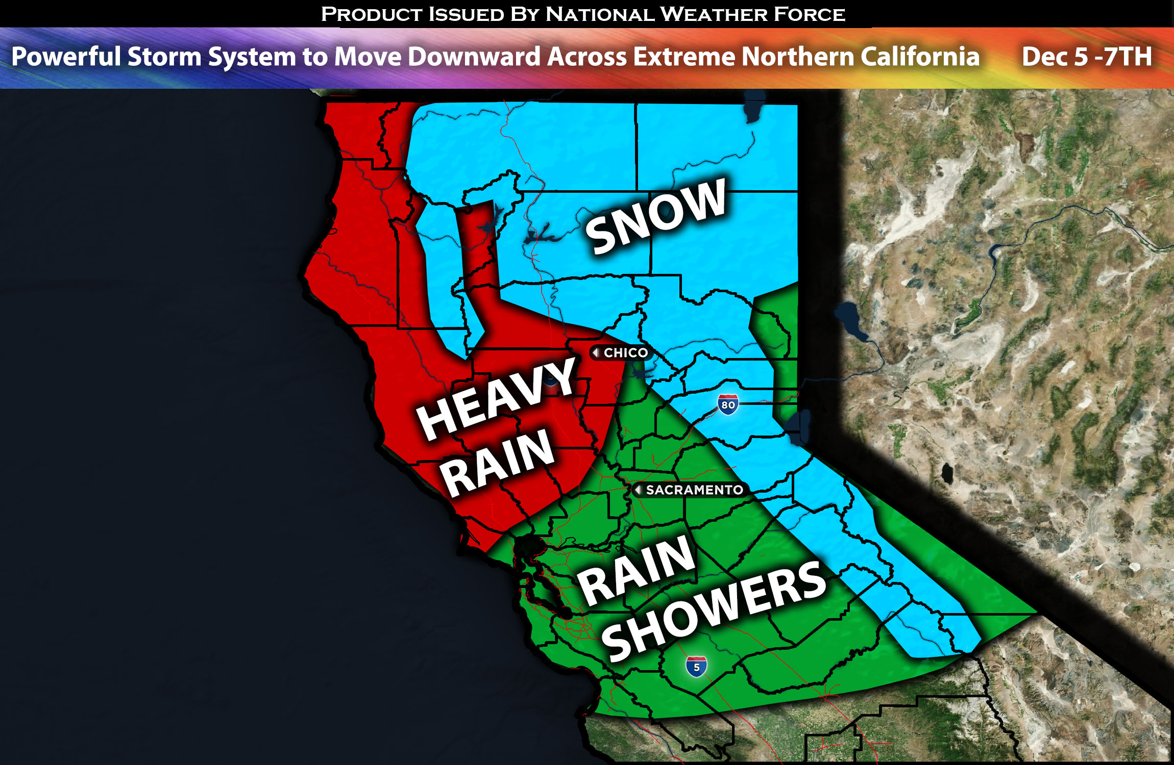
Across Northern California:
Scattered showers will transition to moderate and heavy rain as a powerful storm system moves through late Tuesday night, lingering through Thursday, with potential flooding in some areas. There will also be a risk for thunderstorms capable of producing small hail and additional heavy rainfall from Wednesday morning through Thursday. Snow is anticipated in the mountains (more details below). The heaviest rain will be more to the north across extreme northern CA such as Eureka, CA with much lower rainfall amounts as you move to the south. Rain totals anticipated to be significantly less across the bay area given the moisture flux being more north.
Approximate Rainfall Totals:
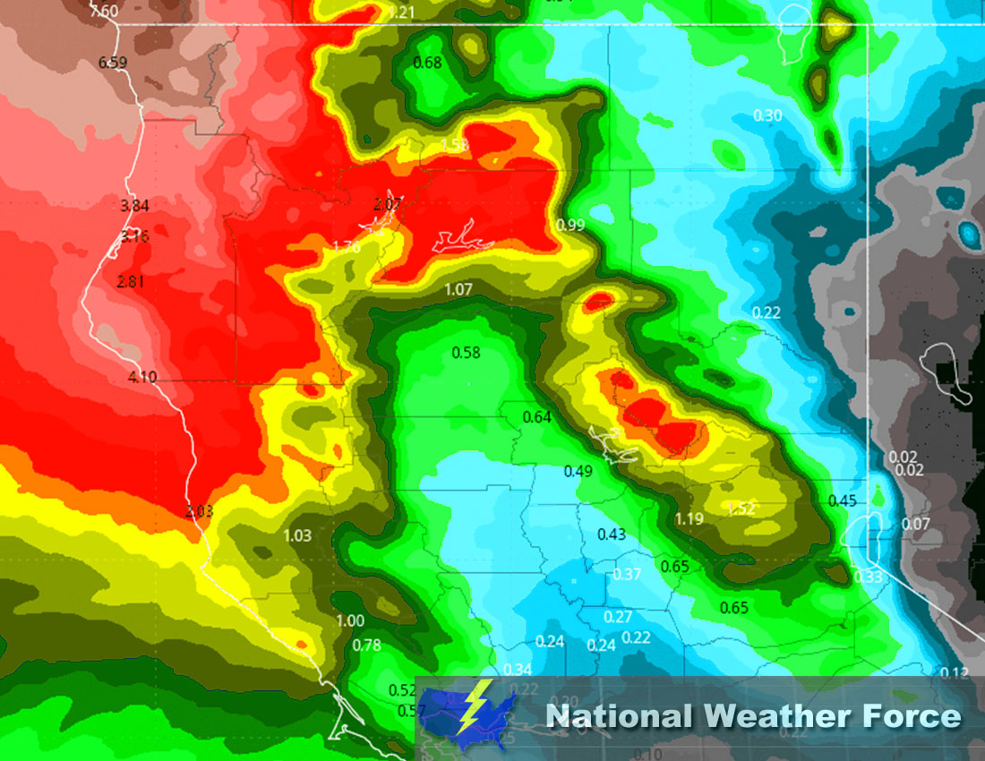
Regions At Risk: Extreme Northern CA and Northern CA (less significant).
Forecast Details:
Lingering showers will continue on and off before a much stronger frontal system slowly edges towards the coast overnight on Tuesday/Wednesday morning. With it, a strong flux of moisture with convective instability will bring moderate to heavy rainfall across the northwest portion of California. An additional 2 to 3 inches of rain, locally higher, is anticipated late Tuesday through Thursday night, with higher amounts over the higher terrain or where training storms are possible. There will also be a thunderstorm risk capable of producing small hail, given the cold temperatures in the mid-level atmosphere, which may also accompany more brief, heavier rain. Snow is expected to fall at around 3500 feet on Thursday but not the main threat. An additional shortwave trough is anticipated to move through on Thursday with another resurgence of stronger southerly winds, rainfall, and thunderstorms capable of small hail and additional brief heavy rain scattered. As you move southward towards the bay area, the rainfall rates significantly decrease given the bulk of moisture and ingredients being towards extreme northwestern CA.
Main risk: heavy rain leading to flooding, snow (in the mountains), and small hail.
Stay tuned for more updates.
Sina⚡⚡
With over a decade of experience in forecasting severe thunderstorms, this individual is a seasoned forecaster and developer. Their expertise in severe weather forecasting and computer science is entirely self-taught, complemented by a foundation in Atmospheric Science from UNCO and an IT background from WGU. They have dedicated their efforts to developing innovative tools that enhance the accuracy of analyzing large hail and tornadoes. As a significant contributor to the National Weather Force, they have played a crucial role in providing accurate and timely information, as well as developing tools to keep those affected well-informed.