
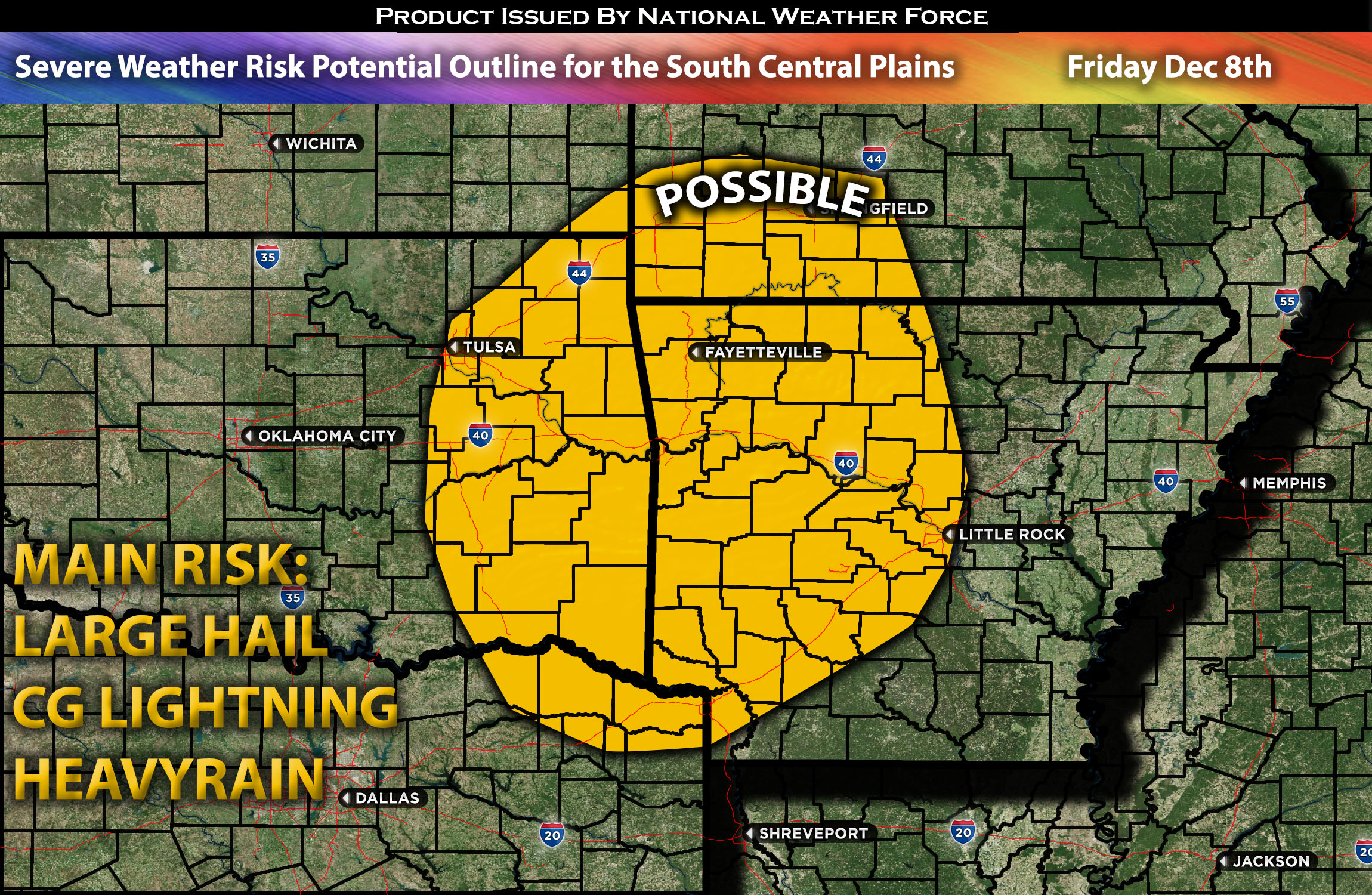
Outlook for Central Plains/Deep South (OK, AR, MO) Friday (Very Limited):
On Friday night, there is a limited risk of severe weather in this region. Due to limited ingredients, significant capping, and a lack of instability, the main risk from any storms that may form would be isolated large hail on Friday evening and night for portions of Ok, AR and MO southeast area (if any).
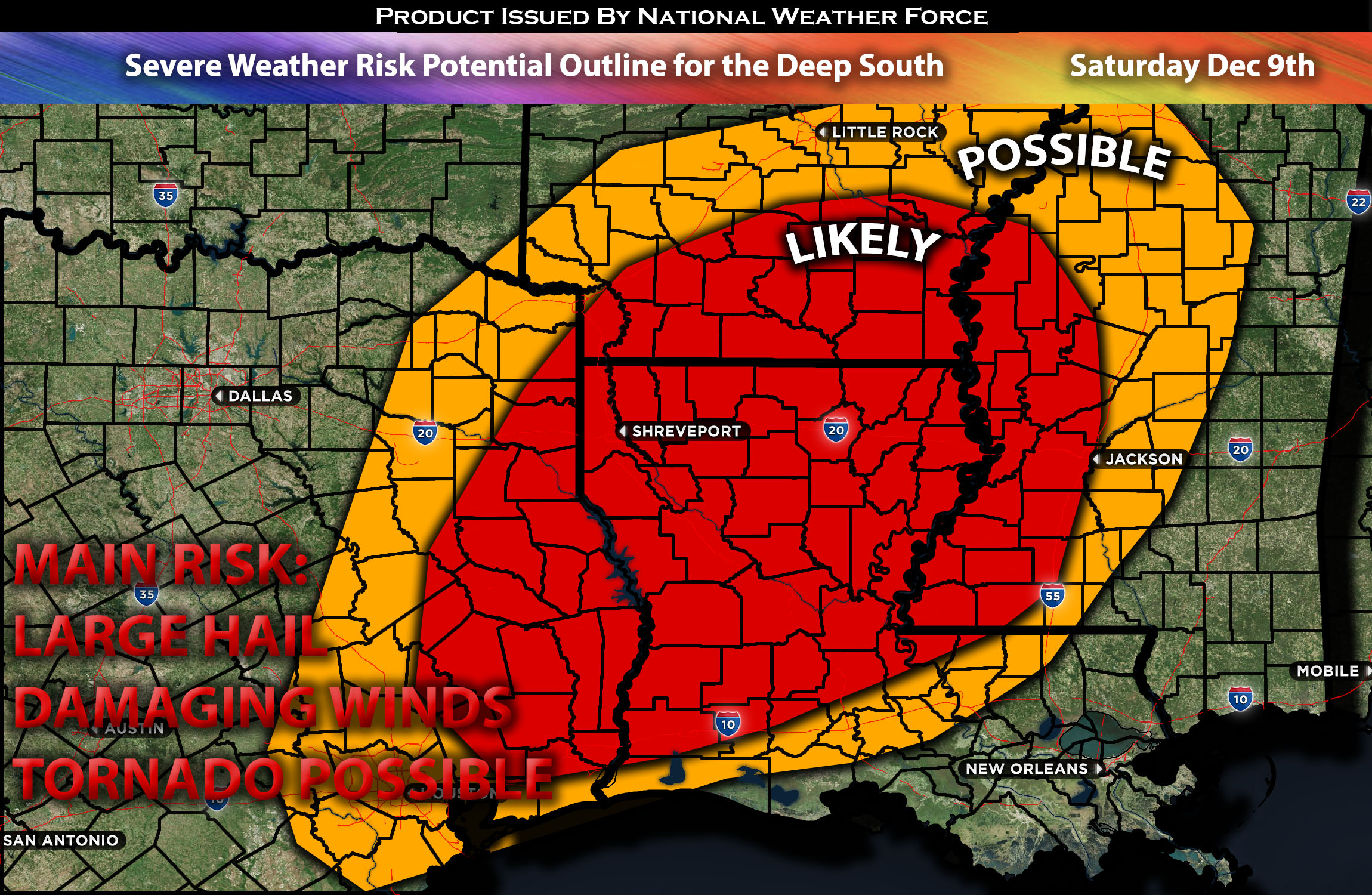
Outlook for the Deep South (TX, LA, AR, MS) Saturday (Main Risk):
A more unstable airmass is expected to affect the regions from southeast Texas, across the Ark-La-Tex region, to portions of Mississippi overnight. This condition could result in all types of hazards being present in any given storm, with the main risks being damaging winds and large hail. The storm complex is looking to be on the linear side as a squall line with discrete cells. More details will be provided as we approach the setup.
Forecast Outlook (Most likely to change and be more In-depth with the next update):
The risk of severe weather is set to return at the end of this week, beginning Friday night as a positively tilted upper trough moves into the Plains. Friday’s severe weather potential appears significantly limited due to capping and lack of instability. Nevertheless, if any storms do form, the main risk will be large, isolated hail. Simultaneously, a strong cold front at the surface is expected to bring very strong low-level flow bringing effective shear over the region combined with mid-level moisture and moderate instability. Given this, storms are anticipated to mostly merge, making the damaging wind threat the primary concern, although a few discrete cells may also produce various types of hazards. More information and details will be provided in the next update. The trough is also anticipated to continue through Sunday and becoming negative tilted which also will be addressed in the coming days.
Potential risk: large hail, damaging winds and tornado possible.
Stay tuned for the next update, which will provide timing details, more specific information on impacted locations, and threats for specific micro-zones in the coming days.
Sina⚡⚡
With over a decade of experience in forecasting severe thunderstorms, this individual is a seasoned forecaster and developer. Their expertise in severe weather forecasting and computer science is entirely self-taught, complemented by a foundation in Atmospheric Science from UNCO and an IT background from WGU. They have dedicated their efforts to developing innovative tools that enhance the accuracy of analyzing large hail and tornadoes. As a significant contributor to National Weather Force & Southern California Weather Force, they have played a crucial role in providing accurate and timely information, as well as developing tools to keep those affected well-informed.