
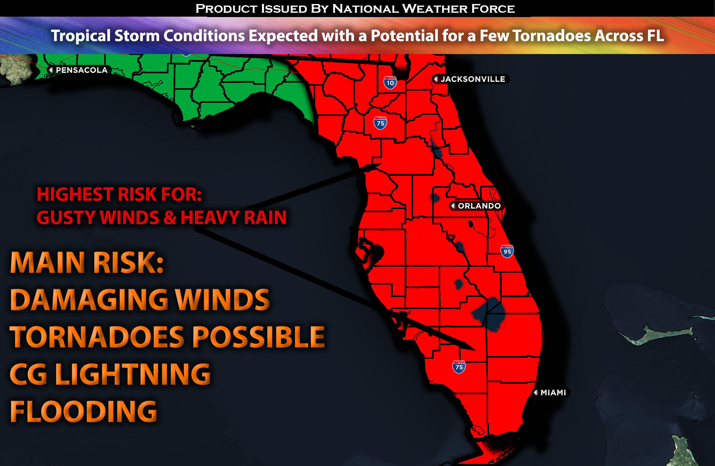
Across the State of FL:
A combination of weather patterns will bring very unsettled weather with torrential heavy rain, which may lead to flooding across Florida, especially in the south, from Friday through Monday, with the worst expected on Saturday. Strong damaging winds will also be a factor throughout Florida. Another risk will be a few tornadoes which will be something to be monitored. Already, multiple days of heavy rain have fallen in Florida due to an unsettled pattern, causing the ground to become very saturated. This, combined with the potential for more severe storms with much more heavy rain, increases the risk of flooding and wind damage across the area. (Check below for further details).
Forecast Details:
An unsettling weather pattern is expected throughout the weekend in Florida, as a stalled frontal boundary remains over the southern part of the state, bringing significant moisture advection which will cause heavy rain across the area. The flooding will be worse the further south you are in Florida, especially towards the Miami area, where the most moisture advection will be. As this frontal boundary begins to move slightly while continuing to bring moisture, a surface low is expected to form over the southern Gulf of Mexico, ahead of a strengthening shortwave trough. This system will move over the area around Saturday night. Additionally, a strong high-pressure system over the mid-Atlantic is expected to continue generating easterly winds, with speeds often exceeding 30-40 mph, and even higher in some local areas. Severe weather also poses a threat, as the ingredients for such conditions will be marginally present, given the strengthening low-level shear but limited instability. This combination will create a risk of tornadoes across Florida and strong, damaging winds in more intense storms. The system is expected to move out of the area by Sunday, as a cold front pushes through, introducing cooler, drier air.
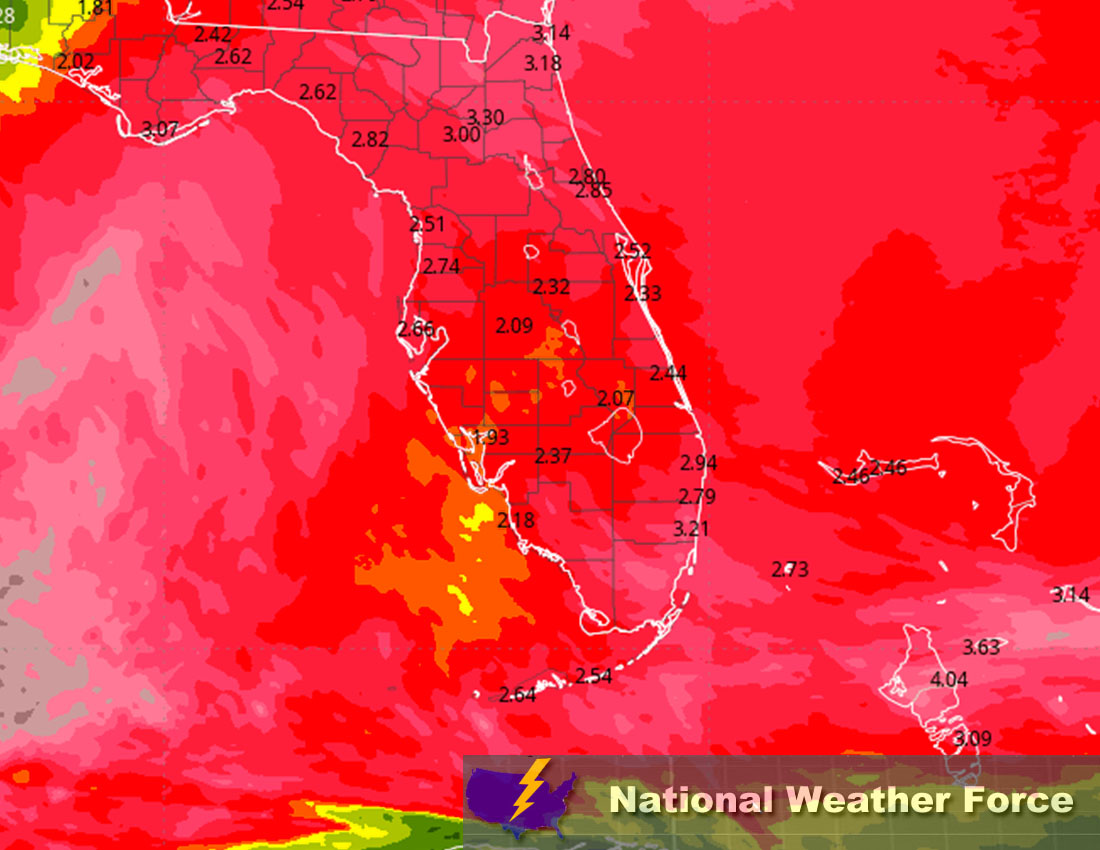
Approximate Rainfall Totals:
Main impact: heavy rain leading to flooding, a few tornadoes possible, and gusty winds leading to potential damage.
Stay tuned for more updates.
Sina⚡⚡
With over a decade of experience in forecasting severe thunderstorms, this individual is a seasoned forecaster and developer. Their expertise in severe weather forecasting and computer science is entirely self-taught, complemented by a foundation in Atmospheric Science from UNCO and an IT background from WGU. They have dedicated their efforts to developing innovative tools that enhance the accuracy of analyzing large hail and tornadoes. As a significant contributor to National Weather Force & Southern California Weather Force, they have played a crucial role in providing accurate and timely information, as well as developing tools to keep those affected well-informed.