
 Across the Southeast Area:
A strong system that is currently impacting Florida will track northward across northern Florida and into the Atlantic late tonight and into Sunday, bringing heavy rain leading to flooding, strong gusty winds, coastal flooding, and the potential for isolated severe storms across the area. (For the forecast for Florida, please check our previous update on that, as Florida will not be included in this one). Check below for further details.
Forecast Details:
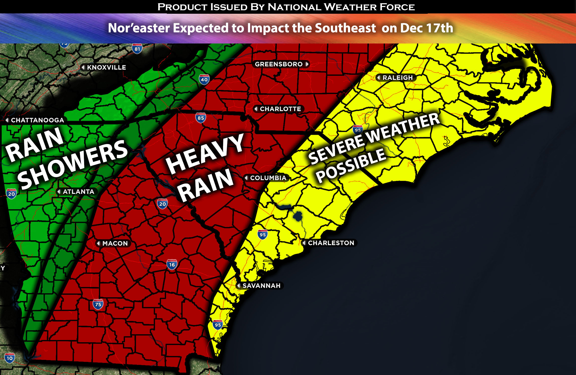
As a strengthening low-pressure system moves across northern Florida and into the Atlantic waters, it will be positioned right along the coasts of Georgia and South Carolina through Sunday night, slowly moving upward along the coast. In the upper atmosphere, a jet stream will also be on top, allowing for further lifting and enabling the low to continue to strengthen into a nor’easter. At the same time, multiple shortwave troughs will be embedded in the broader trough over the entire eastern half of the U.S., allowing for multiple rounds of forcing to ascend and lift. This, combined with deep moisture being drawn into the entire region, will allow for very heavy rainfall across the area, especially towards the coastal regions. There will also be a sporadic severe weather threat, given a low instability environment along the coast but with very high effective shear over 65 knots. This will allow for a few storms to potentially cause damaging winds and perhaps a brief tornado, given the limited spin in the atmosphere. The surface low, however, is expected to accelerate northward towards the Northeast by Monday, leaving tapering showers over the region due to the excessive moisture.
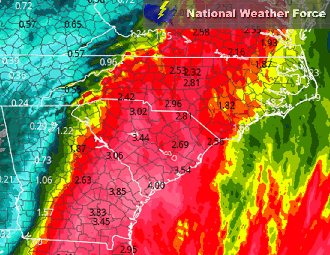
Approximate Rainfall Totals (in inches):
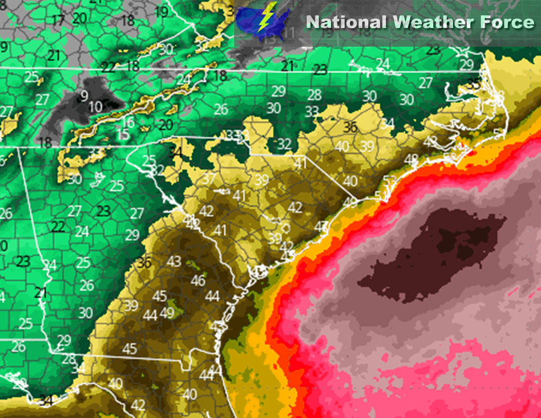
Approximate Maximum Wind Gusts (MPH):
Main impact: very heavy rain leading to flooding, coastal flooding, damaging winds, and a brief tornado or two possible.
Stay tuned for more updates.
Sina⚡⚡
With over a decade of experience in forecasting severe thunderstorms, this individual is a seasoned forecaster and developer. Their expertise in severe weather forecasting and computer science is entirely self-taught, complemented by a foundation in Atmospheric Science from UNCO and an IT background from WGU. They have dedicated their efforts to developing innovative tools that enhance the accuracy of analyzing large hail and tornadoes. As a significant contributor to National Weather Force & Southern California Weather Force, they have played a crucial role in providing accurate and timely information, as well as developing tools to keep those affected well-informed.