
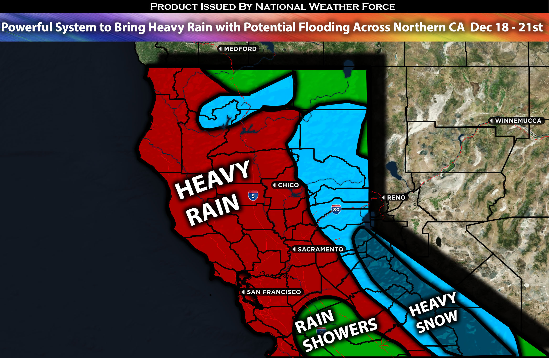
Across Northern CA:
As a pattern change comes to Northern California, it will bring unsettling weather to impact the area, bringing heavy rainfall for multiple days which may lead to flooding as well. The first system is expected to impact early Monday morning, bringing rain showers that will be heavy at times and increase in coverage across the area. Then, more heavy rainfall is expected across the area from Tuesday through Thursday before tapering off again towards the end of the week. Of course, the further north and closer to the coast you are, the higher the rainfall amounts. (Check below for further details).
Forecast Details:
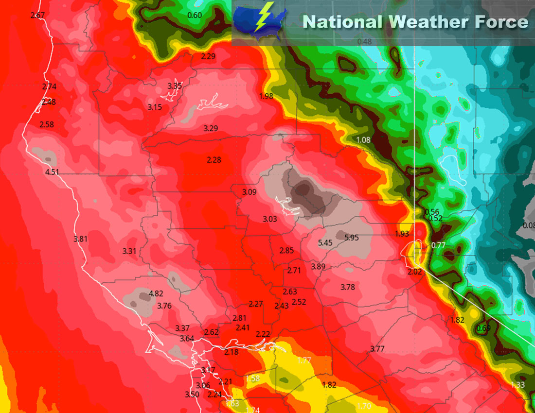
As a trough approaches the area from the west, moving slowly eastward, it will bring moisture across the area. Given this, it will start with rain showers, with the heaviest rainfall expected around Monday night through Tuesday, followed by more rain showers on Wednesday (intermittently heavy) before slowly decreasing in coverage. This introduces the risk for flooding as well, which will need to be monitored. Due to this being more of a warm tropical system, the snow level will be very high, around 7500 to 8000 ft, allowing only for very high elevation snowfall during the first part of the system. The further north you go, the greater the rainfall risk, especially towards the coast and west of the mountains. There will also be gusty winds, especially across the extreme northwestern portions of California, such as in areas like Eureka. Rainfall amounts are expected to be around 2-3 inches for most areas, with some areas receiving 3-4 inches and locally higher.
Approximate Rainfall Totals (in inches):
Approximate Maximum Wind Gusts (MPH):
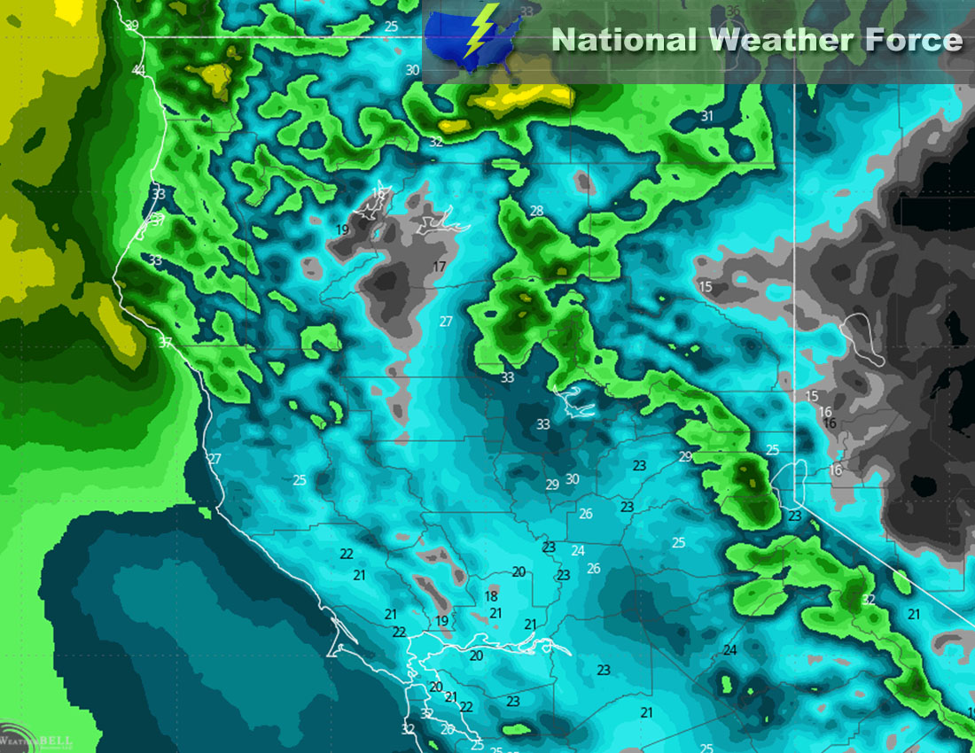
Main impact: heavy rain leading to potential flooding, and gusty winds.
Stay tuned for more updates.
Sina⚡⚡
With over a decade of experience in forecasting severe thunderstorms, this individual is a seasoned forecaster and developer. Their expertise in severe weather forecasting and computer science is entirely self-taught, complemented by a foundation in Atmospheric Science from UNCO and an IT background from WGU. They have dedicated their efforts to developing innovative tools that enhance the accuracy of analyzing large hail and tornadoes. As a significant contributor to National Weather Force & Southern California Weather Force, they have played a crucial role in providing accurate and timely information, as well as developing tools to keep those affected well-informed.