
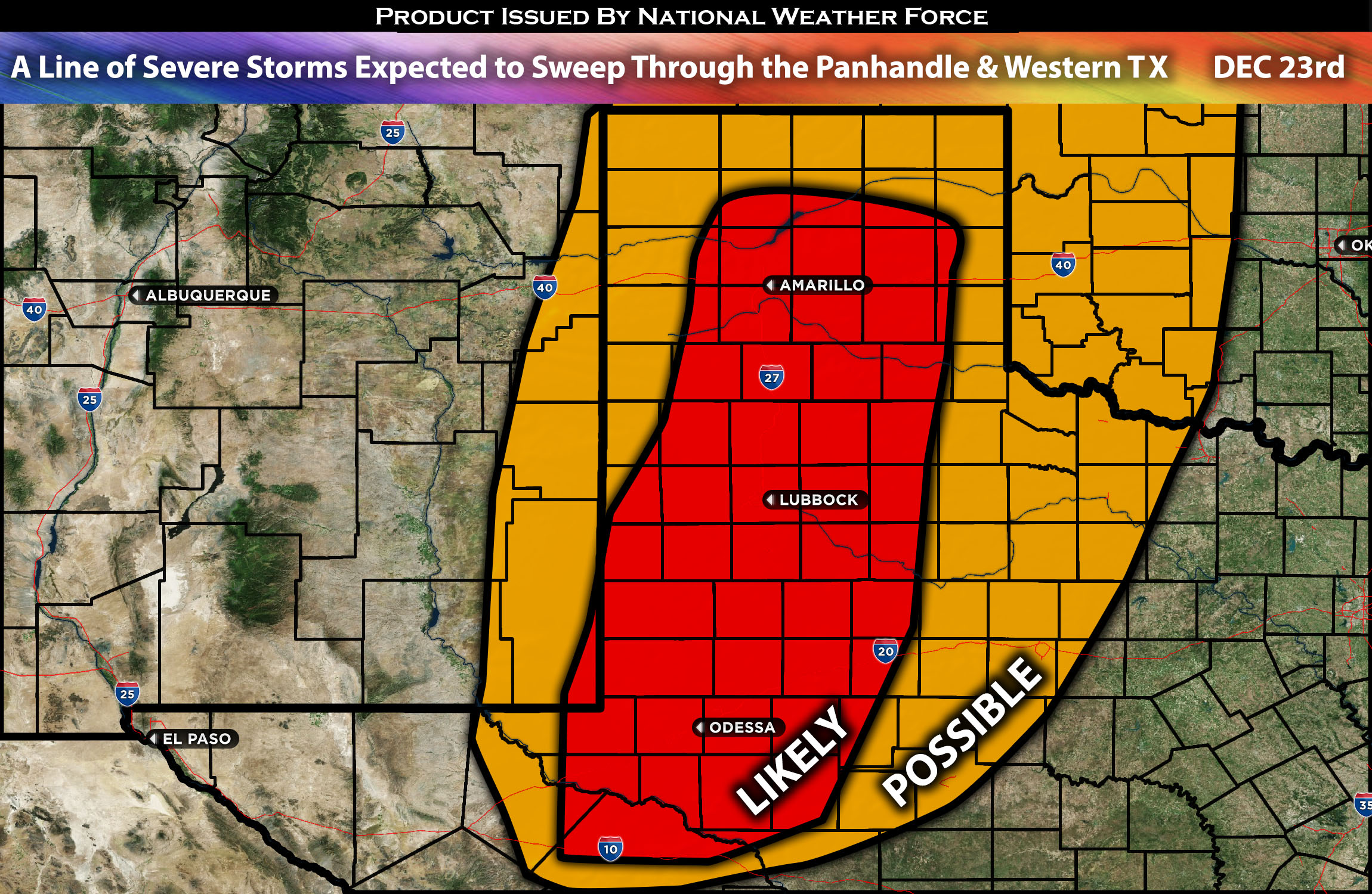
Across Eastern NM Stretching to Western TX (Including the Panhandle):
As a strong system that brought flooding to some portions of California moves east across Arizona, it will bring the ingredients for severe storms capable of producing mainly damaging winds, a tornado possibility, and large hail in discrete cells, especially across eastern New Mexico and into southwestern and western Texas (further forecast details below).
Forecast Details:
In the upper levels of the atmosphere, a low-pressure system is expected to continue eastward across the south-central states. At the same time, a mid-level jet ahead of it is pushing southerly winds across the southwest Texas area, bringing in more moisture aloft. Instability will also build a little, but it is limited due to cloud cover across the area and limited heating. Across southwestern and western Texas, bordering New Mexico and extending to extreme southeastern New Mexico, scattered thunderstorms are expected to form by mid-afternoon into the evening. These storms will initially be discrete, allowing for a risk of large hail, damaging winds, and perhaps a tornado, given the somewhat elevated low-level shear in the area. As the evening progresses into the night, a line of severe storms is expected to move across the area through early Christmas Eve morning. The main risk with these storms will be damaging winds, cloud-to-ground lightning, and heavy rainfall.
Main risk: Damaging straight-line winds, tornado possible, and isolated large hail (especially in discreet cells).
Stay tuned for more updates.
————————————————-
Sina⚡⚡
With over a decade of experience in forecasting severe thunderstorms, this individual is a seasoned forecaster and developer. Their expertise in severe weather forecasting and computer science is entirely self-taught, complemented by a foundation in Atmospheric Science from UNCO and an IT background from WGU. They have dedicated their efforts to developing innovative tools that enhance the accuracy of analyzing large hail and tornadoes. As a significant contributor to National Weather Force & Southern California Weather Force, they have played a crucial role in providing accurate and timely information, as well as developing tools to keep those affected well-informed.