
Across Northern & Central CA:
Multiple systems are expected to impact northern California, bringing torrential heavy rain for many. This is especially true the further north and closer to the coast you are, where rainfall amounts will be quite high. Along with the heavy rain, gusty winds and heavy snowfall at times in the mountains are also expected. The first system will be moving through as soon as Wednesday morning, bringing rain showers across the area. A more potent system is anticipated towards the weekend, starting as soon as Friday afternoon or evening, and continuing with more heavy rain through the weekend (More details below for the forecast).
Forecast Details:
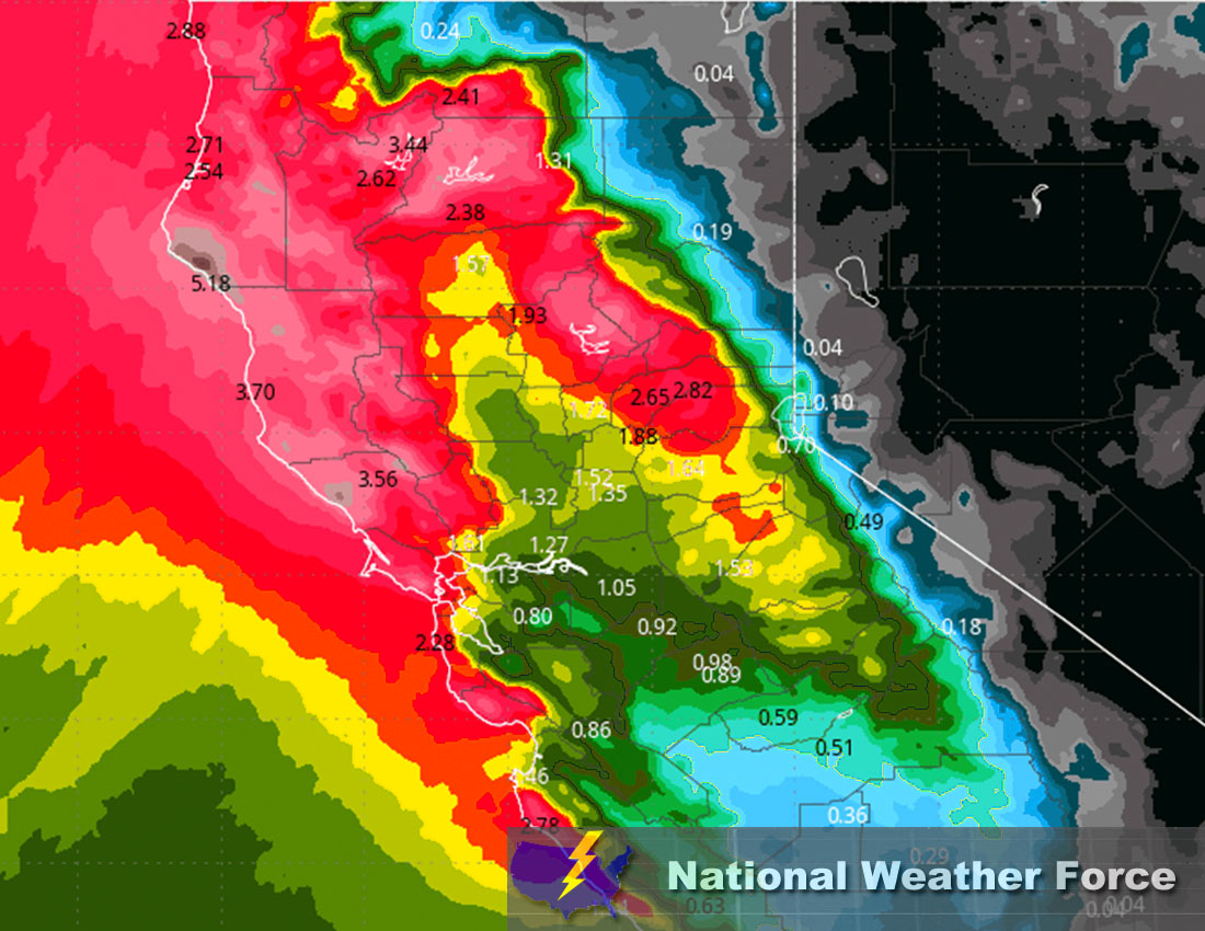
A front is expected to sweep through the area, bringing rain showers for the entire region, heavy at times, especially towards the coastal northern portions and west of the mountains. The snow levels will be 6500-7000 ft for the most part and are expected to slightly rise to above 7500 ft by Thursday afternoon. Then, as cold air sinks, the snow levels are expected to drop again (check below for snowfall totals). Rain showers will prevail from the west and move inland across the rest of the area eastward. A small break looks more likely around Thursday, with slight lingering pop-up showers possible. Then around Friday morning, especially in the afternoon, more widespread showers and heavy rain will move in, further sweeping through the area in an on-and-off sequence. This will continue throughout most of the weekend. The rainfall amounts look to be anywhere between 2-4 inches, locally higher, especially in extreme northwestern portions and west of the mountains. (See approximate rainfall map below).
Approximate Rainfall Totals (in inches):
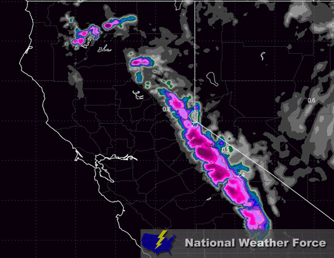
Approximate Snowfall Totals (in inches):
Main impact: rain heavy at times leading to potential flooding, snow heavy at times in the mountains, and gusty winds.
Stay tuned for more updates.
—————————————————-
Sina⚡⚡
With over a decade of experience in forecasting severe thunderstorms, this individual is a seasoned forecaster and developer. Their expertise in severe weather forecasting and computer science is entirely self-taught, complemented by a foundation in Atmospheric Science from UNCO and an IT background from WGU. They have dedicated their efforts to developing innovative tools that enhance the accuracy of analyzing large hail and tornadoes. As a significant contributor to National Weather Force & Southern California Weather Force, they have played a crucial role in providing accurate and timely information, as well as developing tools to keep those affected well-informed.