
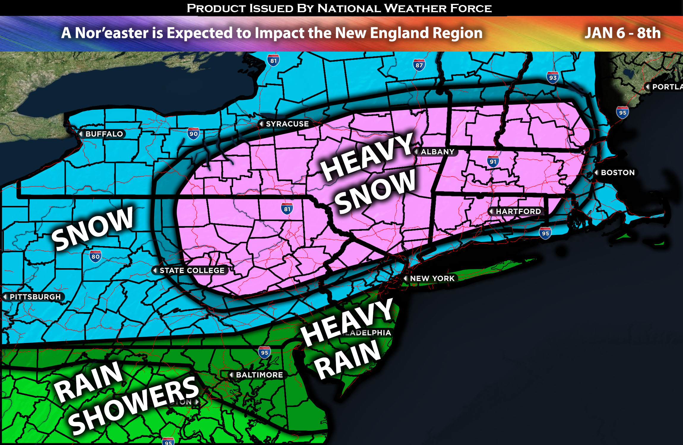
Across New England:
A powerful system, also known as a Nor’easter, is expected to pass off the south coast of the southern New England region around Saturday night through Sunday, bringing very heavy snow and strong winds to many across the Northeast. This will also introduce the risk for power outages due to the strong winds and very low visibility, which will be near blizzard conditions. For more details, check below.
Main impact: Rain showers heavy at times, heavy snow with blowout conditions in some areas and strong gusty winds.
Forecast Details:
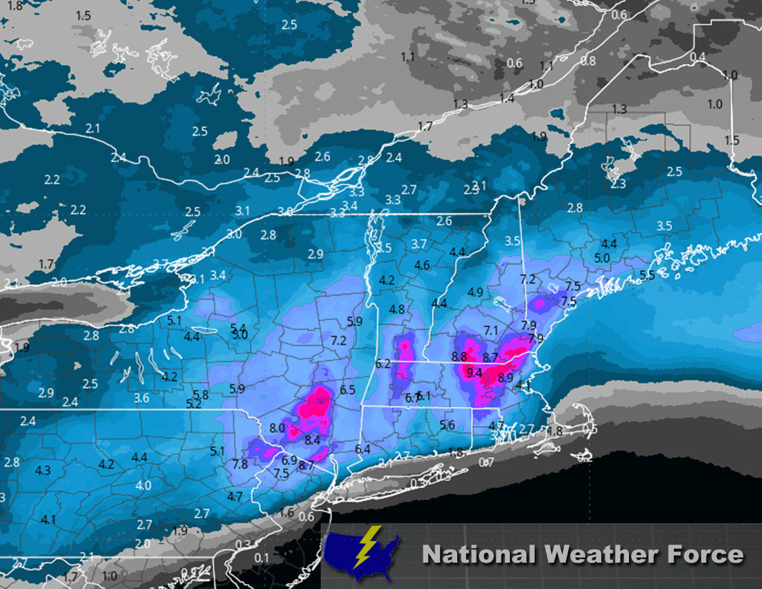
In the upper levels of the atmosphere, a low-pressure system is expected to strengthen and move up the coast across southern New England. As it moves upward, it will be accompanied by a strengthening and enhancing low-level jet. At the same time, intense cyclogenesis, ample moisture, and strong upward forcing will enhance the snowfall rate, especially at higher elevations and inland. The closer to the coast, the more likely the precipitation will be heavy rain due to warmer air. There will be a distinct line separating the areas of heavy rain from those experiencing heavy snow, just north of it. In areas such as New York City, heavy rain is more likely, with perhaps a few traces of snow or a couple of inches as you go northward (especially north of the city). The further north and inland you go, the higher the snowfall rates. The snowfall rate will be quite impressive in areas like Worcester, Springfield, Hartford, Providence, and Manchester, where around a foot of snow is expected, with local amounts as higher than 12-18 inches, especially in higher elevations. The best chance for heavy snow currently appears to be mostly west and north of the I-95, where temperatures will remain suitable for heavy snow. Check below for approximate snowfall totals to better understand what to expect in your area. Another risk to watch will be strong winds, which will range between 30-40 mph with local gusts in the 50s.
Approximate Snow Totals:
Stay tuned for more updates.
Sina⚡⚡
With over a decade of experience in forecasting severe thunderstorms, this individual is a seasoned forecaster and developer. Their expertise in severe weather forecasting and computer science is entirely self-taught, complemented by a foundation in Atmospheric Science from UNCO and an IT background from WGU. They have dedicated their efforts to developing innovative tools that enhance the accuracy of analyzing large hail and tornadoes. As a significant contributor to National Weather Force & Southern California Weather Force, they have played a crucial role in providing accurate and timely information, as well as developing tools to keep those affected well-informed.