
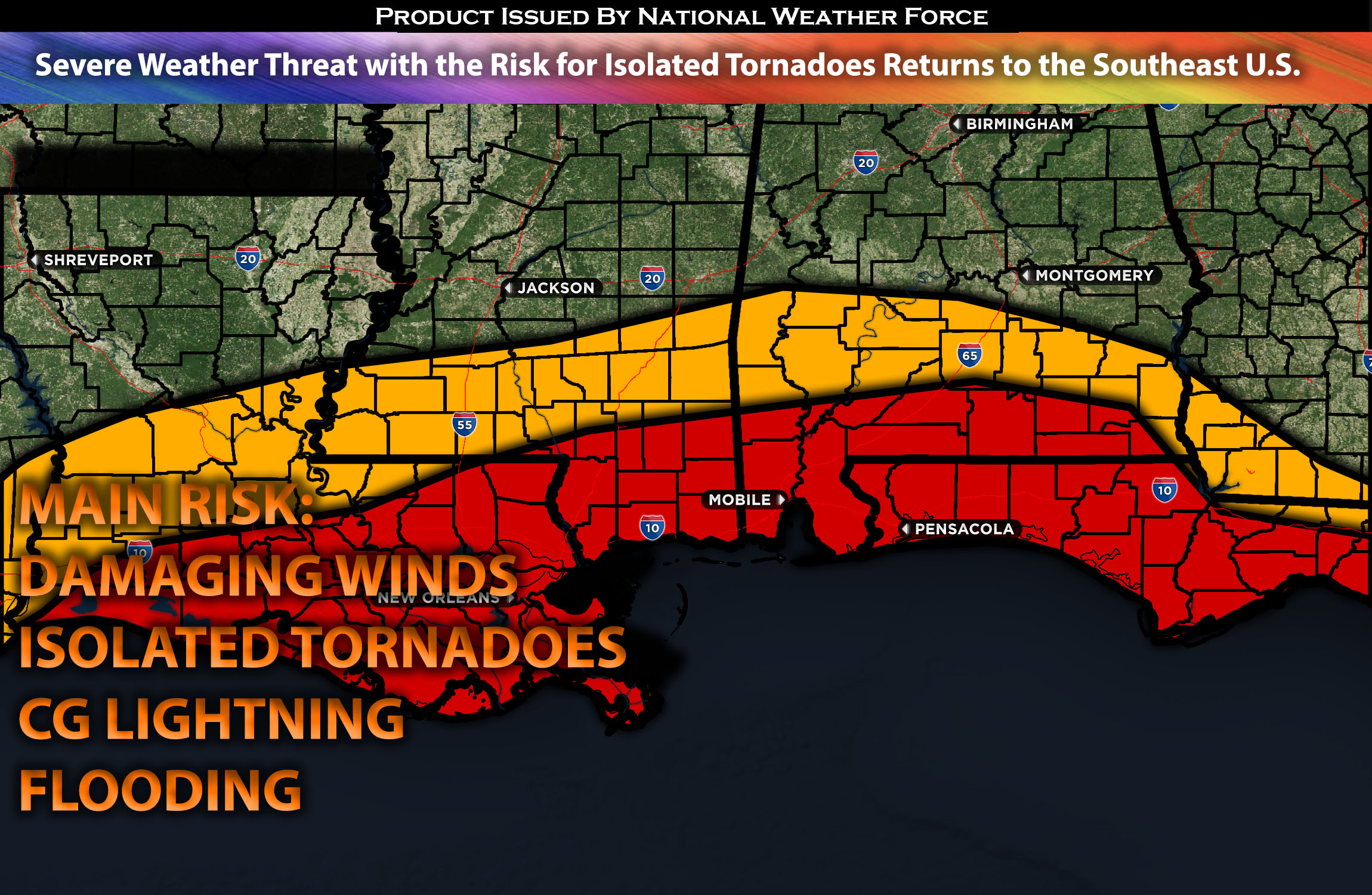
Across the Southeast (especially the Coastal Areas):
As a system in the upper levels of the atmosphere is expected to move eastward across the Plains and then continue eastward across the southeastern portions, it will bring in moisture from the Gulf of Mexico. Despite limited ingredients, there is just enough potential for a couple of cells to develop, mainly across the coastal areas of the Southeast. The main risk with these cells, due to the limiting ingredients, will be locally damaging winds and perhaps a few isolated tornadoes. (further forecast details below).
Approximate Timing: Late Afternoon-Overnight
Forecast Details:
In the upper levels of the atmosphere, a weakening trough is expected to continue sweeping across the Plains and move eastward. At the same time, a surface low is expected to push eastward across the Gulf Coast regions, with warm air advection ahead of multiple boundaries. The coastal areas in the Southeast are anticipated to destabilize mainly in the late afternoon and into the overnight hours. In the regions where the surface warm front is located, and just north of this boundary, there will be limited instability, but enough veering winds with height to allow for a slight tornado risk, and local damaging winds, especially for southeastern Louisiana through the eastern Florida Panhandle. The further north away from the coast will be accompanied with heavy rain as it moves through the impacted regions.
Main risk: Damaging local winds, isolated tornadoes possible, and isolated large hail (especially in discreet cells).
Stay tuned for more updates.
Sina⚡⚡
With over a decade of experience in forecasting severe thunderstorms, this individual is a seasoned forecaster and developer. Their expertise in severe weather forecasting and computer science is entirely self-taught, complemented by a foundation in Atmospheric Science from UNCO and an IT background from WGU. They have dedicated their efforts to developing innovative tools that enhance the accuracy of analyzing large hail and tornadoes. As a significant contributor to National Weather Force & Southern California Weather Force, they have played a crucial role in providing accurate and timely information, as well as developing tools to keep those affected well-informed.