Outlook for the Midwest:
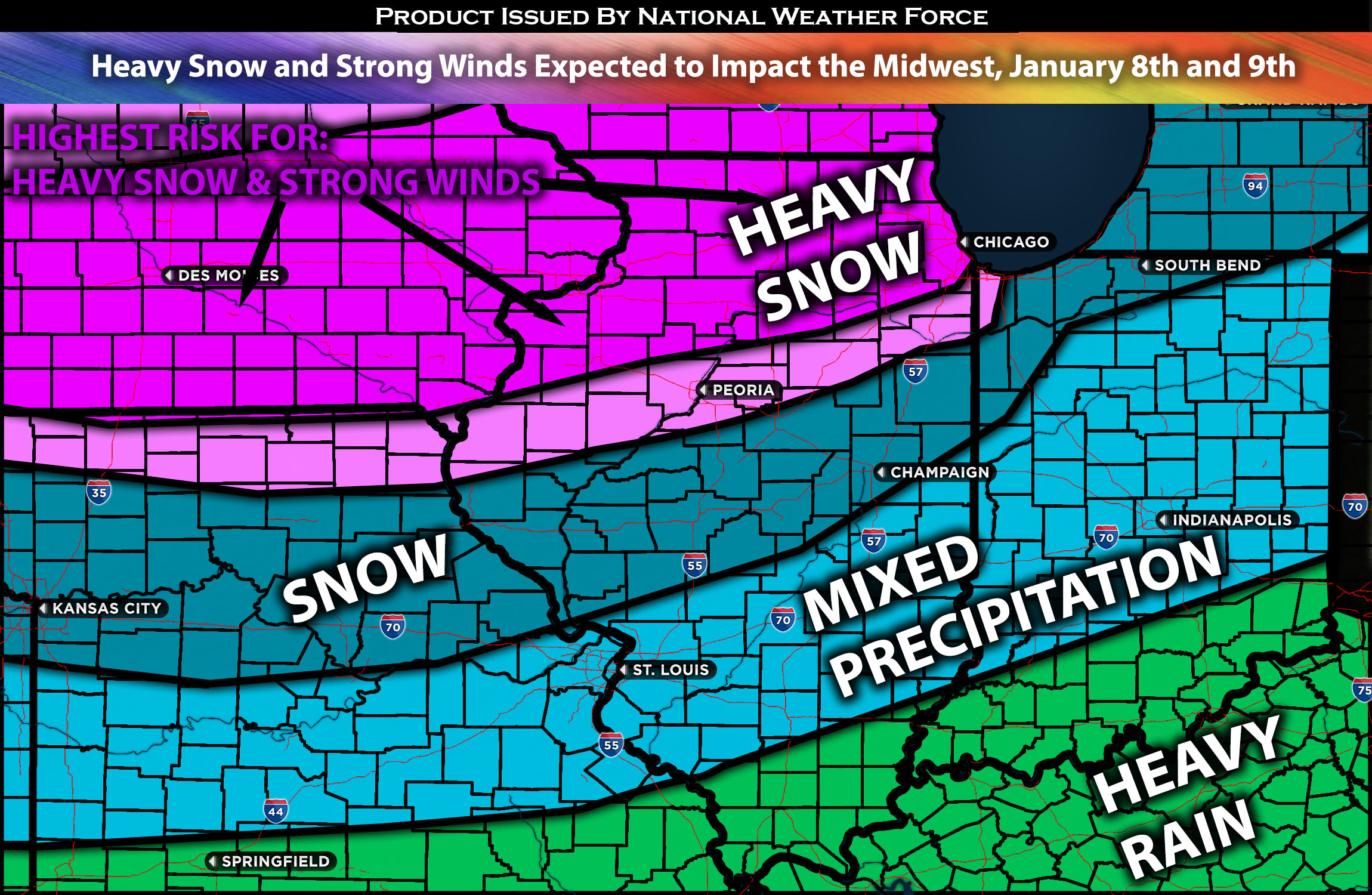
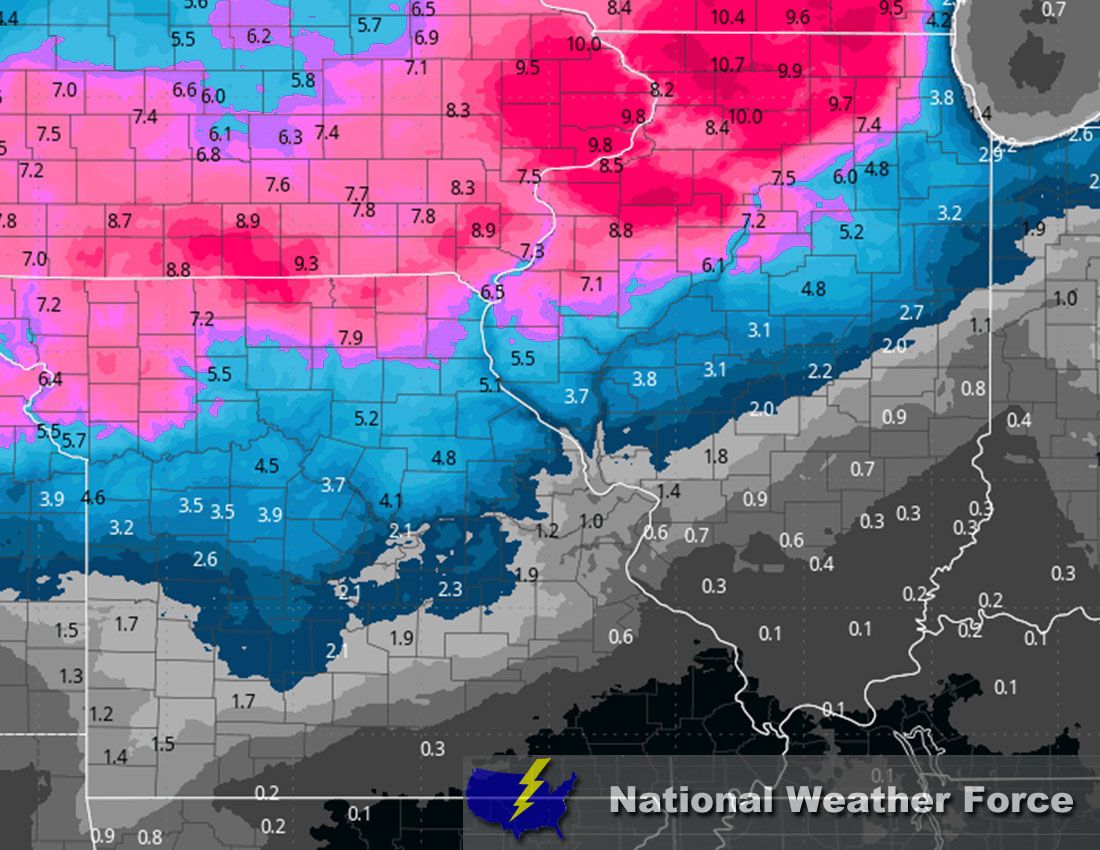
A powerful storm system is expected to impact the area, bringing very wet accumulating snow from Monday night into Tuesday night in different rounds, with the second round being much stronger. The first round is expected to bring around 2-4 inches of snow, with the northern Illinois area, including Chicago, being the most highly impacted (see below for snowfall accumulation estimate maps). The second round will bring widespread heavy snow with strong gusty winds to the region, especially in northern Illinois. For more details on the forecast, please check below.
Main impact: Heavy snow, rain showers, mixed precipitation and strong winds.
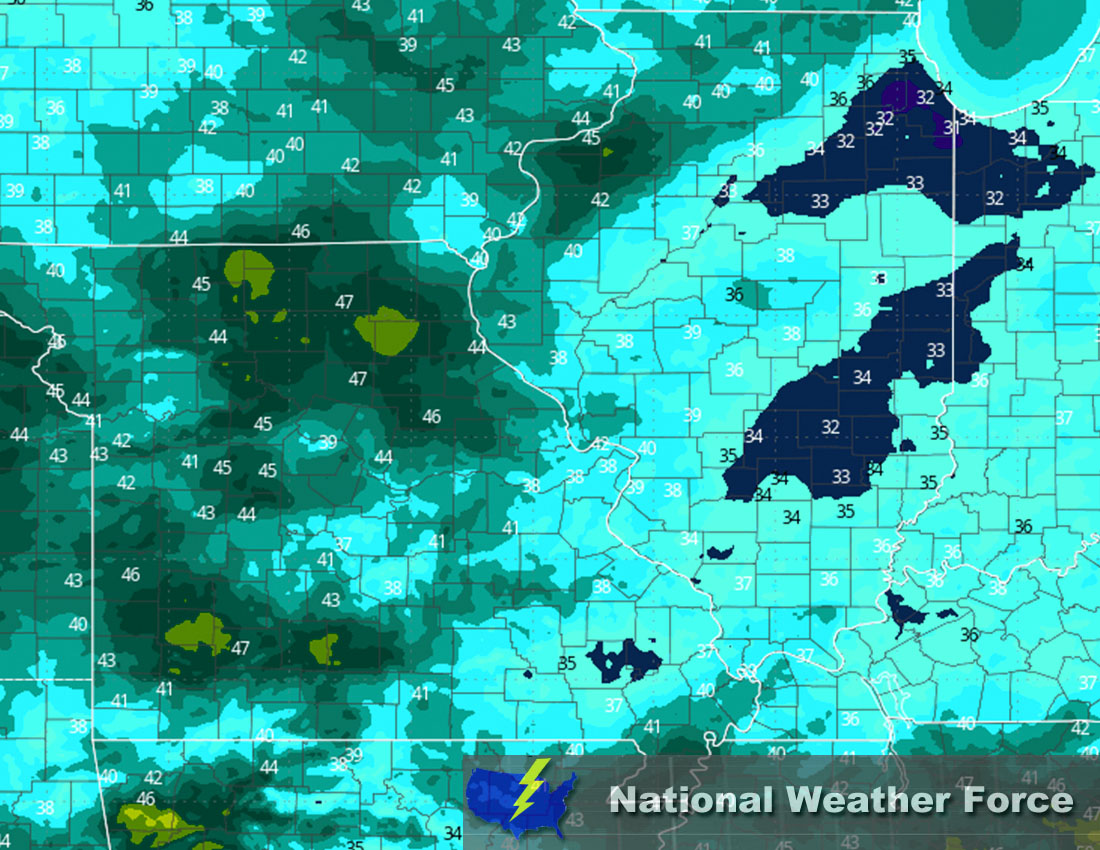
Overall Forecast: A deepening and strengthening mid/upper-level cyclone is expected to track across the central plains on Monday night and into Tuesday. At the surface a cold front is also expected to move through the region. The cyclone will bring strong mid-level flow, with the low-level jet aligned with the upper-level jet streak at maximum strength, and further ingredients aimed for the region to bring very heavy snow. At the same time, very cold Arctic air will come down, allowing for temperatures that ensure continuous snow accumulation. The heaviest snow is expected during the day on Tuesday as a second round, given the track of the system. Strong winds also look to accompany this setup, causing very low visibility and dangerous travel conditions.
From IA Stretching to IN: Anywhere in portions of southern Illinois and into Missouri eastward, more of a rain transition is expected due to the warmer air in those regions. The snow will diminish late Tuesday from west to east, giving way to the cold air behind. However, a few more snow showers and rain showers will also be possible due to the turning of the other side of the low-pressure system.
From MO Into Southern Portions of IL: Across Missouri, the micro weather determining the difference between snow and heavy rain will be somewhere along the line where temperatures can stay in the range for snow. This is expected in the northern portions of Missouri, with a few snow showers and rain showers, especially towards central Missouri. More rain and mixed precipitation are expected the further south and east you are during this system. The same pattern is expected across Indiana southward, with most of the snow occurring the further north you are.
Approximate Snow Totals:

Approximate Maximum Wind Gusts (MPH):

Stay tuned for more updates.
Sina⚡⚡
With over a decade of experience in forecasting severe thunderstorms, this individual is a seasoned forecaster and developer. Their expertise in severe weather forecasting and computer science is entirely self-taught, complemented by a foundation in Atmospheric Science from UNCO and an IT background from WGU. They have dedicated their efforts to developing innovative tools that enhance the accuracy of analyzing large hail and tornadoes. As a significant contributor to National Weather Force & Southern California Weather Force, they have played a crucial role in providing accurate and timely information, as well as developing tools to keep those affected well-informed.
