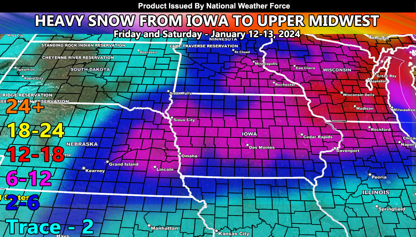
Heavy snowfall developing south and west of Iowa will eventually overspread the state for your Friday. This will continue spreading northeastward into Northern Illinois, Southern Minnesota, and all of Wisconsin through the period specified in the graph.
Snowfall amounts within the National Weather Force snowfall model clearly shows this is a heavy snow event. On top of this, wind will accompany the heavy snow falling and already on the ground from said system. This will bring whiteout (blizzard) conditions.
As Sunday through Tuesday of this next week hits, expecting the arctic air blast to move through, bringing low temperatures in the minus teens and even lower wind chills. This is a cold one, folks so prepare accordingly.
Master General Meteorologist – Raiden Storm
Get these alerts over the new Android and Iphone app and/or e-mail service by becoming a full premium member subscriber today and never miss an update from this office. Remember, you cannot just make an account on the app and get notifications. You must select your zones and then go through the payment process.
ALSO IMPORTANT: Once you set your zones you will see notifications being BLANK UNTIL YOU GET AN ALERT. You are new on the member app, it doesn’t know you from past notifications. So just because it is blank in the beginning of service does not mean it does not work.
Click here to learn more.

