
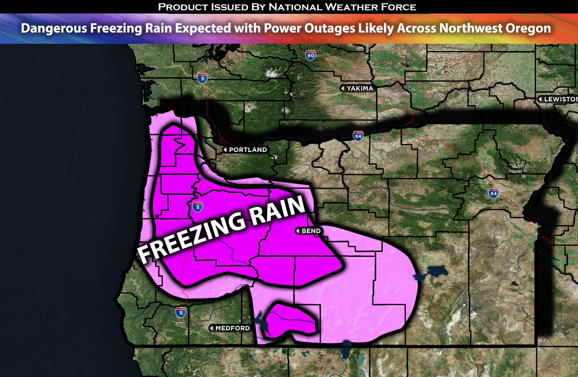
Outlook for OR northwest:
Dangerous freezing rain is expected across the region from Saturday morning through Saturday night. Due to the accumulation, trees will be likely to fall on power lines, causing potential power outages.
Main impact: freezing rain, blowing winds and very cold temperatures.
Overall Forecast: An Arctic airmass is expected to continue moving in, bringing very cold, freezing temperatures across the area, accompanied by dangerous wind chills. This, combined with a surface low expected to arrive Friday night and continue into Saturday across Oregon, will result in mixed precipitation impacts depending on the location. One of the major impacts will be freezing rain and sleet across the region throughout Saturday and Saturday night. The freezing rain is expected to bring ice accumulation on roads, trees, and power lines, potentially causing disruptions such as power outages and obstructed roadways. Caution and preparedness are advised during this period when traveling.
Across OR Eugene, Central Coast Range and the Coast:
The Arctic airmass, which is expected to persist over the coming days, will maintain low temperatures in the low 30s, across the northwest Oregon area, including the coastal regions. This significant drop in temperature, combined with an incoming weather system, sets the stage for impact as freezing rain. Starting as early as Saturday early morning, precipitation in the form of freezing rain is anticipated to begin and will likely continue throughout the duration of Saturday, extending into the night.
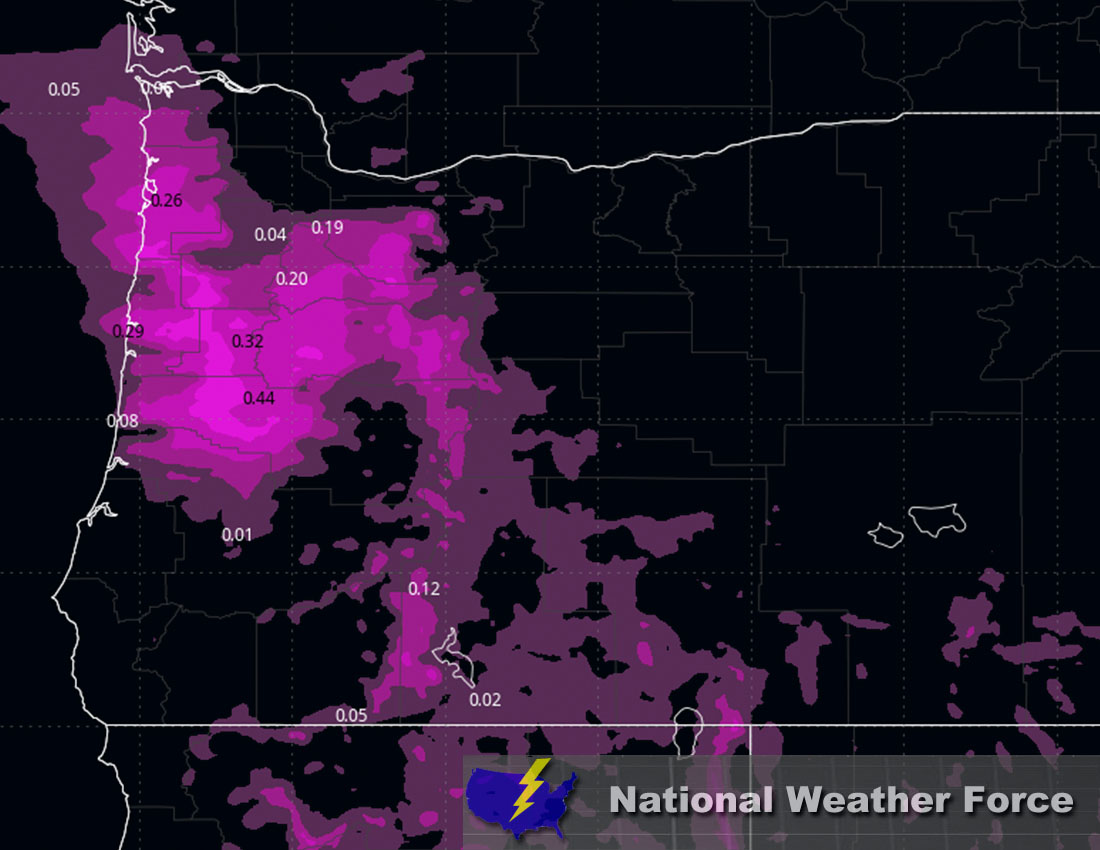
Approximate Freezing Rain Accumulation:
Stay tuned for more updates.
Sina⚡⚡
With over a decade of experience in forecasting severe thunderstorms, this individual is a seasoned forecaster and developer. Their expertise in severe weather forecasting and computer science is entirely self-taught, complemented by a foundation in Atmospheric Science from UNCO and an IT background from WGU. They have dedicated their efforts to developing innovative tools that enhance the accuracy of analyzing large hail and tornadoes. As a significant contributor to National Weather Force & Southern California Weather Force, they have played a crucial role in providing accurate and timely information, as well as developing tools to keep those affected well-informed.