
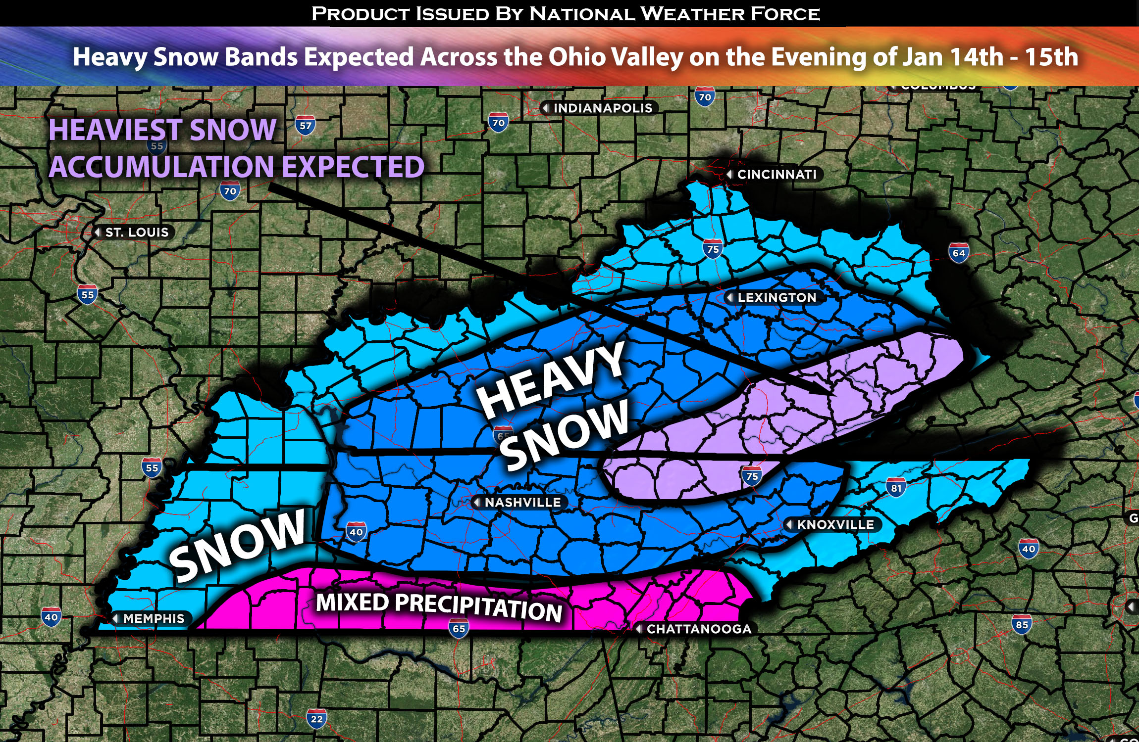
Outlook for the Ohio Valley Region:
An upper-level disturbance, forecasted to impact the area, is expected to usher in a wave of very cold temperatures, accompanied by strong winds and heavy snow, starting from Sunday evening and continuing through Monday. This weather system is likely to cause a notable drop in temperature across various parts of the region, potentially reaching well below the seasonal average. Heavy snow with notable accumulation is anticipated, which could have implications for transportation and daily plans.
Main impact: moderate to heavy snow and strong winds.
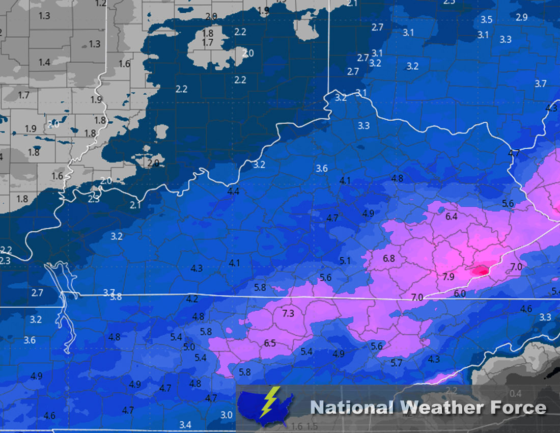
Overall Forecast: A sharp cold front is expected to sweep over KY & TN bringing very cold air into the area. This will cause temperatures to struggle to rise above 24 degrees. Simultaneously, an upper-level disturbance is expected to cross the region, bringing moderate to heavy snow. Additionally, a 120-knot upper-level jet stream will be present over the area. This, combined with plenty of moisture and mid-level convergence zones, is where heavy snow bands are expected. Some local areas could easily see around 6 inches in spots of accumulation, with a widespread 3 to 5 inches expected. Please refer to the information below for approximate totals of snowfall accumulation. Furthermore, the combination of very cold air and snow will create dangerous conditions, especially for vulnerable individuals.
Across TN & KY Region:
Snow bands are expected to start moving in from west to east around 5-6 pm on Sunday evening, followed by heavier snow bands in subsequent rounds. Multiple waves of snow will come through the area. Combined with the low temperatures, this will ensure that precipitation remains as snow across most of TN and KY area. However, in areas bordering the south towards AL, sleet and ice will be additional concerns. Another, much stronger wave is expected to impact the region on Monday morning and will persist throughout the day. The snow and mixed precipitation are expected to diminish by late Monday evening.
Approximate Snow Totals:
Sina⚡⚡
With over a decade of experience in forecasting severe thunderstorms, this individual is a seasoned forecaster and developer. Their expertise in severe weather forecasting and computer science is entirely self-taught, complemented by a foundation in Atmospheric Science from UNCO and an IT background from WGU. They have dedicated their efforts to developing innovative tools that enhance the accuracy of analyzing large hail and tornadoes. As a significant contributor to National Weather Force & Southern California Weather Force, they have played a crucial role in providing accurate and timely information, as well as developing tools to keep those affected well-informed.