
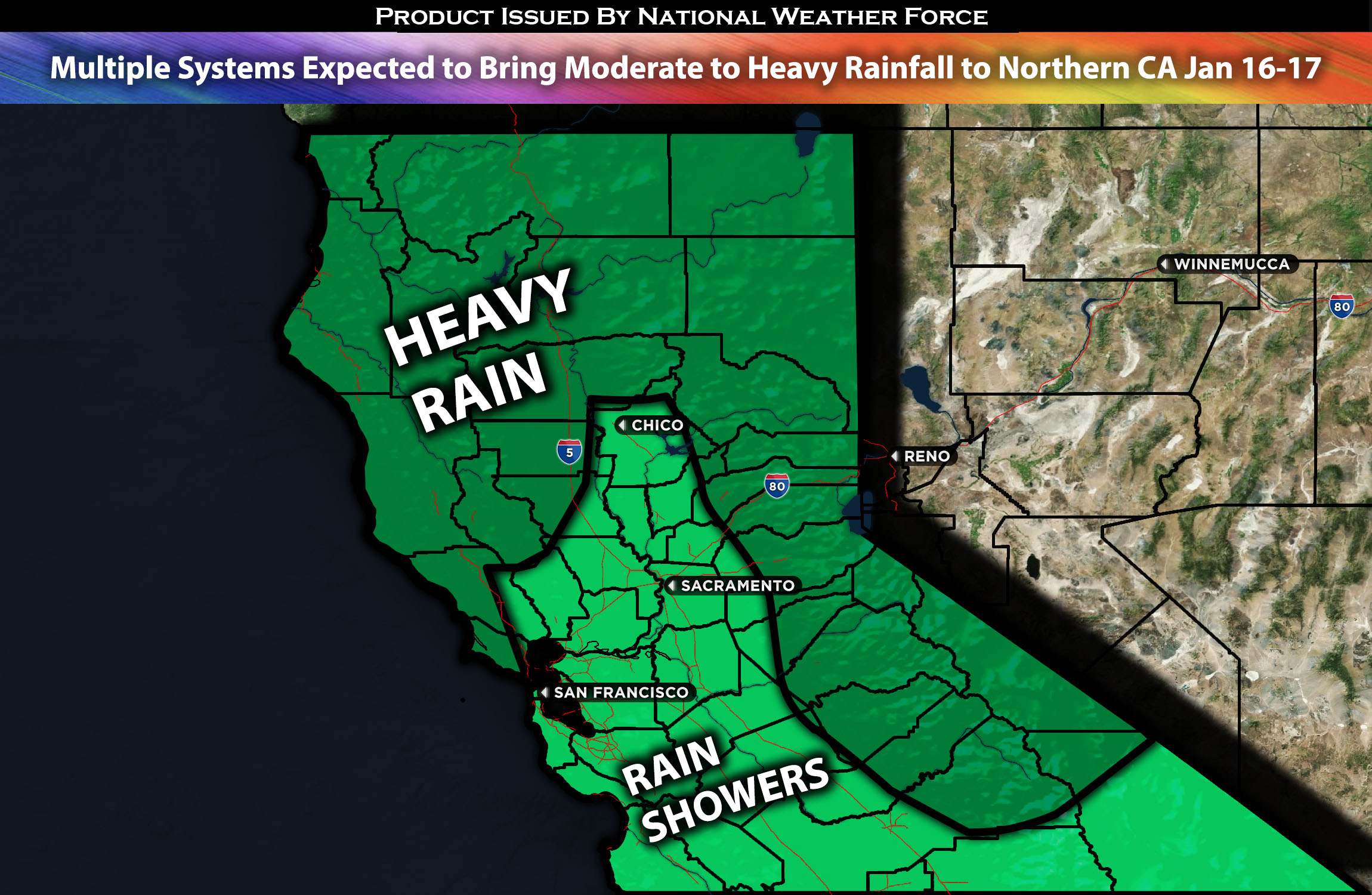
Across Northern CA:
A very active week is approaching for most of the Pacific Northwest and West Coast, as multiple systems impact the region throughout the week. This is especially true for areas further north and closer to the coast, where rainfall amounts are expected to be quite high. Along with the multiple rounds of rain, gusty winds will also accompany these systems, especially in the canyons and passes. Additionally, more significant systems that could potentially impact the region with very heavy rainfall over the weekend are being monitored for updates. Updates will be provided around mid-week. (More details below for the forecast).
Overall Forecast:
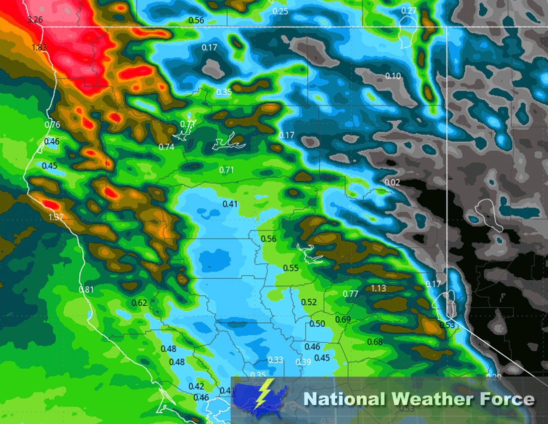
In the mid/upper levels of the atmosphere, a shortwave trough is anticipated to move just north of California (CA). Simultaneously, at the surface, a low-pressure system is expected to bring SSW (south-southwest) winds into the area of northern California. This, combined with significant moisture being pushed into the region, will result in widespread precipitation. Additionally, due to the SSW flow, the initial freezing levels will be over 8500 feet, causing the precipitation to fall as rain. On Tuesday, a surface jet with winds around 30-40 knots is also expected, although wind speeds will be much lower near the northern coasts due to the SSW flow from the low-pressure system. The strongest winds are expected by Tuesday afternoon, before a front moves in, diminishing them later on Tuesday night. Additionally, another shortwave trough is expected to move through the area in the midweek period. (See approximate rainfall map below).
Across Northern CA Timing & Impact: Rain showers are expected to impact the region during the early morning commute, moving from west to east along the coast. These rain showers will become widespread and heavy at times, all across northern CA (including the bay area). This pattern will continue through the afternoon and into the evening, before diminishing overnight on Tuesday. A few lingering showers are expected across the region in a hit-or-miss manner through Wednesday morning.
Approximate Rainfall Totals (in inches):
Stay tuned for more updates.
Sina⚡⚡
With over a decade of experience in forecasting severe thunderstorms, this individual is a seasoned forecaster and developer. Their expertise in severe weather forecasting and computer science is entirely self-taught, complemented by a foundation in Atmospheric Science from UNCO and an IT background from WGU. They have dedicated their efforts to developing innovative tools that enhance the accuracy of analyzing large hail and tornadoes. As a significant contributor to National Weather Force & Southern California Weather Force, they have played a crucial role in providing accurate and timely information, as well as developing tools to keep those affected well-informed.