
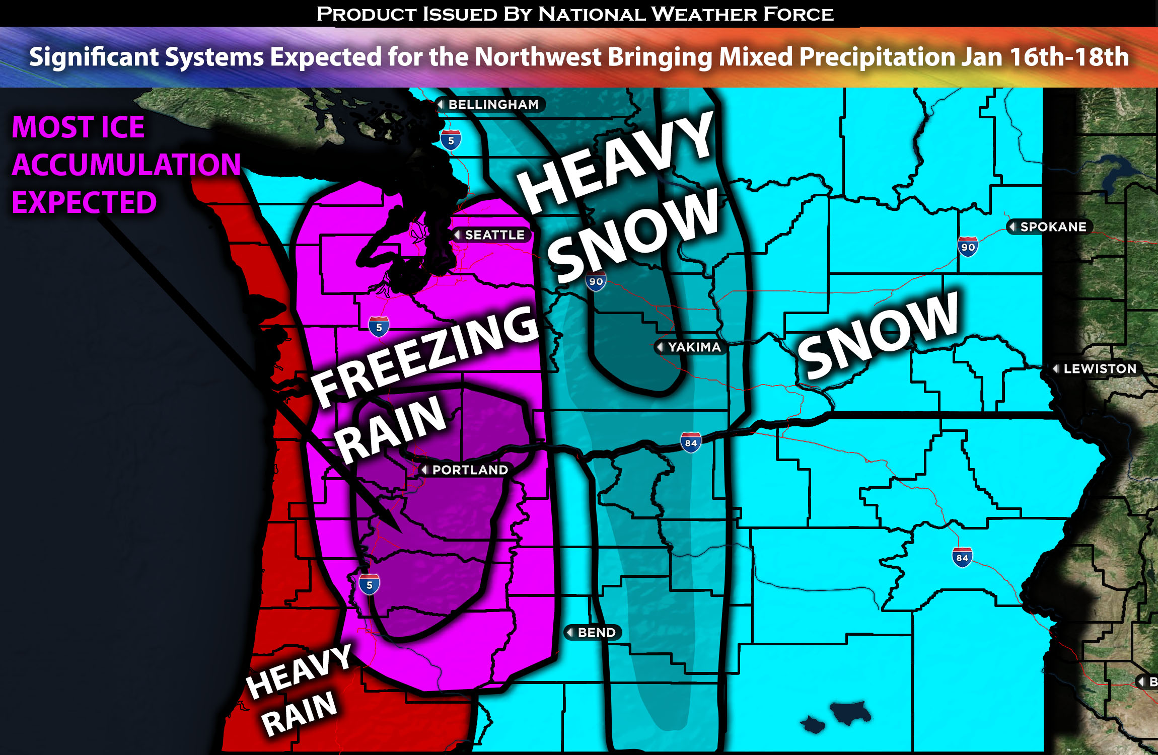
 Across WA & OR:
Multiple storm systems are expected to impact the region, offering little respite across the northwest. These systems will bring torrential rainfall, heavy snow, and mixed precipitation, including freezing rain for some areas, along with strong winds, one after the other. Additionally, more powerful systems, potentially stronger than the earlier ones, are also being monitored for the weekend. Further details on these systems will be provided mid-week. (More details below for the forecast).
Overall Forecast:
A frontal system is expected to impact the region from Tuesday afternoon through Wednesday with embedded mid/upper-level shortwave troughs that will further allow convection across the area. This, combined with significant moisture being pushed into the region, will result in widespread precipitation. Much cooler and cold temperatures are expected, with most areas in the range of the 30s and some in the 20s. Due to these temperatures depending on location most of the precipitation will come as mixed. The precipitation will be in the form of snow, sleet, or ice, especially with very heavy accumulation for some (especially in the mountains). Moderate to heavy mountain snow is expected to begin as soon as Tuesday night and continue through mid-Thursday. The Cascades are expected to be one of the hardest-hit areas. See the approximate precipitation totals map below.
Across WA/OR Timing & Impact: Precipitation is expected to start moving in from the southwest across western Oregon by late Tuesday afternoon. Many areas, including Portland, the Columbia River Gorge, Hood River, the North/Central Range, southwestern Washington, and surrounding areas, will likely see freezing rain due to low temperatures and the right conditions. (Check the map below for ice accumulation.) Heavy rain showers at times are expected around the coast of Washington through Tuesday night before diminishing. Heavy snow is anticipated across central and eastern Washington through at least Thursday. Each wave will have strong bands of snow all across Washington. In Oregon, most of the precipitation will start as heavy rain along the coast and transition to ice and snow towards the mountains and the eastern parts of the state as you move eastward. Due to the complexity of the forecast, please check the accumulation approximates for each type of precipitation for your area.
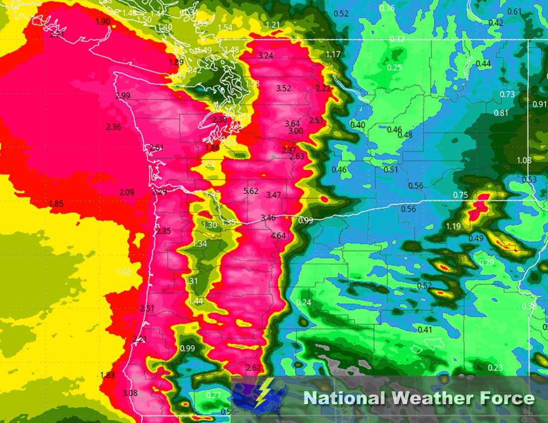
Approximate Rainfall Totals (in inches):
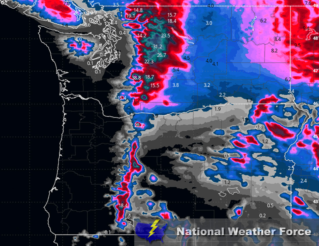
Approximate Snowfall Totals (in inches):
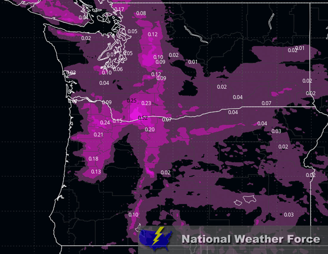
Approximate Ice Accumulation (in inches):
Stay tuned for more updates.
Sina⚡⚡
With over a decade of experience in forecasting severe thunderstorms, this individual is a seasoned forecaster and developer. Their expertise in severe weather forecasting and computer science is entirely self-taught, complemented by a foundation in Atmospheric Science from UNCO and an IT background from WGU. They have dedicated their efforts to developing innovative tools that enhance the accuracy of analyzing large hail and tornadoes. As a significant contributor to National Weather Force & Southern California Weather Force, they have played a crucial role in providing accurate and timely information, as well as developing tools to keep those affected well-informed.