Across Northern & Central CA:
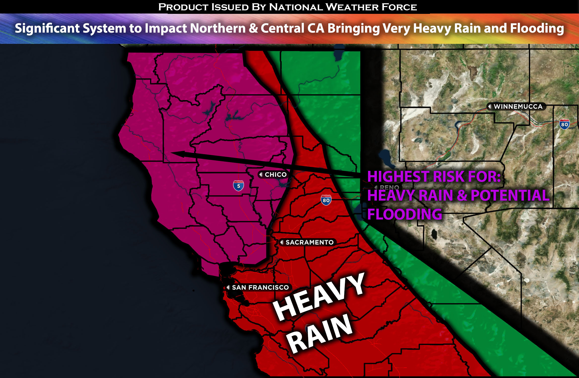
A multi-day active weather pattern is unfolding, with significant precipitation expected from the weekend through Monday in northern and central California. This will bring in the risk for flooding and travel issues across the region, especially west of the mountains and in the northern coastal areas. This also will include the bay area due to heavy rain in a short period of time expected for most regions. More details below for the forecast with regional details.
Overall Forecast:
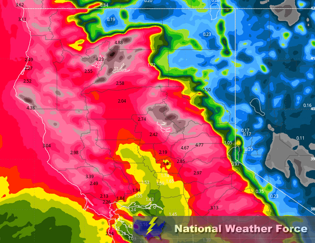
An interesting pattern is unfolding across the area as an upper-level trough, negatively tilted, with a cold front to the south, moves into the area. This, combined with multiple atmospheric rivers and a defined low-pressure system spinning offshore, will push further moisture aloft. This will result in very heavy precipitation across northern and central California, extending as far as southern California, this weekend. There will be multiple waves of moisture surges impacting the region, with some being more concentrated than others, creating heavier rain and mountain snow. As the surface low moves onshore around Saturday afternoon, it will continue to push more moisture into the region. This combination of factors, along with heavy rainfall in a short period of time, will likely cause urban and local flooding, especially in areas that continuously experience training storms. Due to the upper-level dynamics, there will also be a risk for thunderstorms, which can cause more localized flooding and lightning, particularly on Saturday evening. Then on Sunday, another heavy band of storms will come through, sweeping across the area with widespread precipitation. See the approximate precipitation totals map below.
Across Northern/Central CA Timing & Impact: Rain showers are expected to start far ahead of the front, with another round of precipitation expected across northern and central California, especially in the further north regions. Initially, the rain will not seem too heavy. However, the first wave of heavy rain is expected to come through Saturday morning into the afternoon, particularly in the northern areas. Further south, including the Bay Area, precipitation will be more scattered. Then, by Saturday evening, this pattern will change as a heavier band of precipitation moves in, resulting in widespread moderate to heavy rain across the entire region. Embedded thunderstorms are also expected, due to the lift dynamics from the cold front with convection, especially west of the mountains including the bay area mainly on Friday late at night through Saturday morning/afternoon. On Sunday, the rain will clear out, with more on-and-off showers that are very scattered in nature. There will be a few hours of break before the next wave comes in overnight, leading into Monday morning, bringing further widespread precipitation. Finally, precipitation will become more scattered throughout Monday. More back-to-back systems are expected to continue, with further updates on this coming on Sunday. Heavy snow will also be expected way up in the mountains as well especially on Sunday and Monday where the cold core of the storm is expected bringing snow levels down a bit.
Approximate Rainfall Totals (in inches):

Main impact: rain heavy at times leading to potential flooding, snow heavy at times in the mountains, and gusty winds.
Stay tuned for more updates.
Sina⚡⚡
With over a decade of experience in forecasting severe thunderstorms, this individual is a seasoned forecaster and developer. Their expertise in severe weather forecasting and computer science is entirely self-taught, complemented by a foundation in Atmospheric Science from UNCO and an IT background from WGU. They have dedicated their efforts to developing innovative tools that enhance the accuracy of analyzing large hail and tornadoes. As a significant contributor to National Weather Force & Southern California Weather Force, they have played a crucial role in providing accurate and timely information, as well as developing tools to keep those affected well-informed.
