
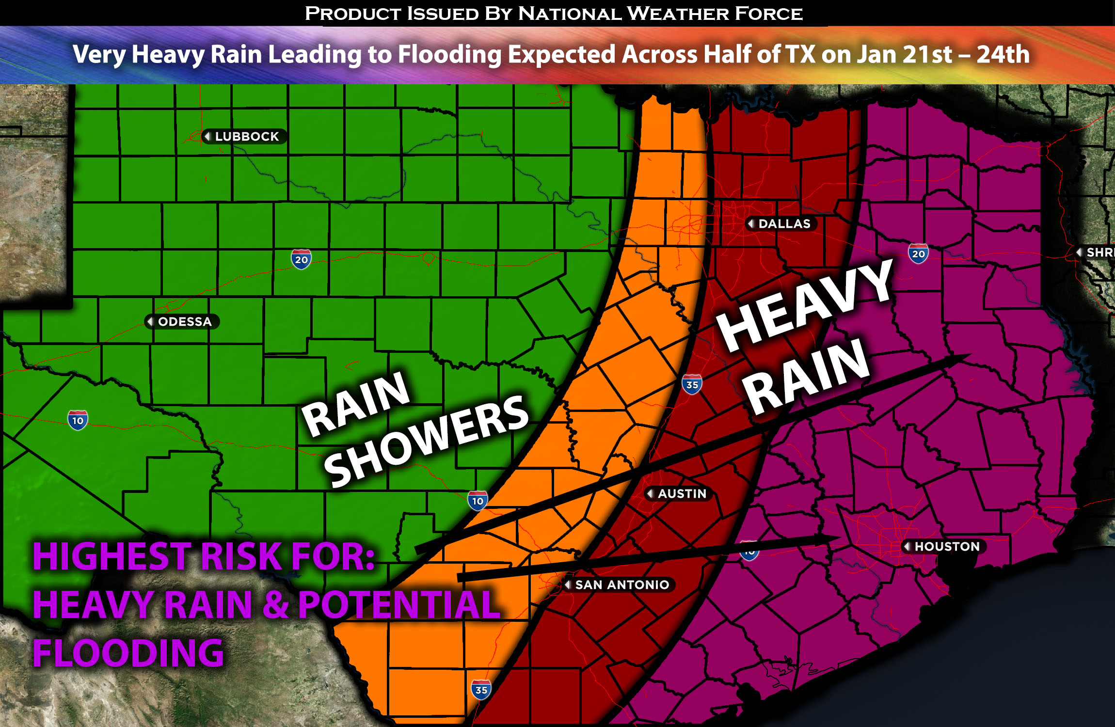
 Across South Central, Central, Eastern & Northeastern TX:
An interesting pattern will unfold bringing very heavy precipitation and impact across south central, eastern and northeastern TX. This will bring in the risk for flooding and travel issues across the region, especially the further south you are closer to the deeper moisture aloft. At the same time there will also be convective activity with embedded thunderstorms across the region. More details below for the forecast with regional details.
Overall Forecast:
In the mid/upper levels of the atmosphere, a negatively tilted trough is expected to move eastward across the south-central U.S., bringing in very deep Gulf moisture across south-central, eastern, and portions of northeastern Texas. Dew points will start to rise significantly by Sunday morning, and by Monday evening, they are expected to reach the mid to potentially upper 60s, which is more than sufficient. Overcast conditions across the region, resulting from the lift, will be prevalent on Sunday before the arrival of heavy precipitation. This, combined with a low-level jet guiding this setup and allowing for a deepening southwest flow aloft, will create conditions conducive to very heavy rainfall. This poses a risk of flooding across the region, especially in south-central Texas.
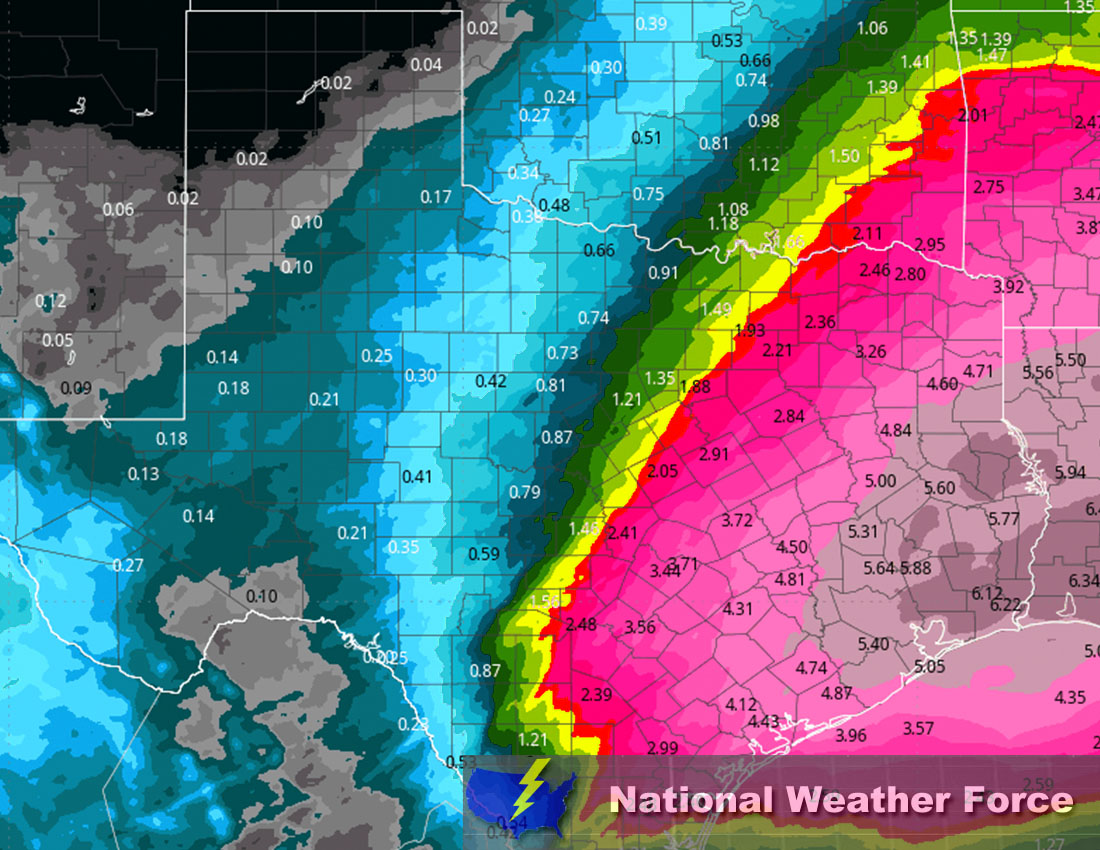
Across TX Timing & Impact: Across central, southern, south-central, eastern, and northeastern Texas, rain showers will begin around Sunday afternoon. They will increase in coverage from the west, moving northeastward across the region. Then, as more moisture continues to be pushed into the region, heavy rain embedded with thunderstorms will first affect southern Texas, starting Sunday night into Monday morning, and increase in coverage as it spreads across the rest of the region. The most concentrated region for heavy rain appears to be around Houston and the southern and central areas of Texas. The heavy rain will continue, becoming more scattered by Monday night. Then, another strong pulse will push through on Tuesday, bringing further moderate to heavy rain across the region, this time concentrated in eastern Texas. More scattered showers will continue with any remaining moisture through Wednesday, before the moisture and impulses move eastward into the southeastern U.S.
Approximate Rainfall Totals (in inches):
Stay tuned for more updates.
Sina⚡⚡
With over a decade of experience in forecasting severe thunderstorms, this individual is a seasoned forecaster and developer. Their expertise in severe weather forecasting and computer science is entirely self-taught, complemented by a foundation in Atmospheric Science from UNCO and an IT background from WGU. They have dedicated their efforts to developing innovative tools that enhance the accuracy of analyzing large hail and tornadoes. As a significant contributor to National Weather Force & Southern California Weather Force, they have played a crucial role in providing accurate and timely information, as well as developing tools to keep those affected well-informed.