
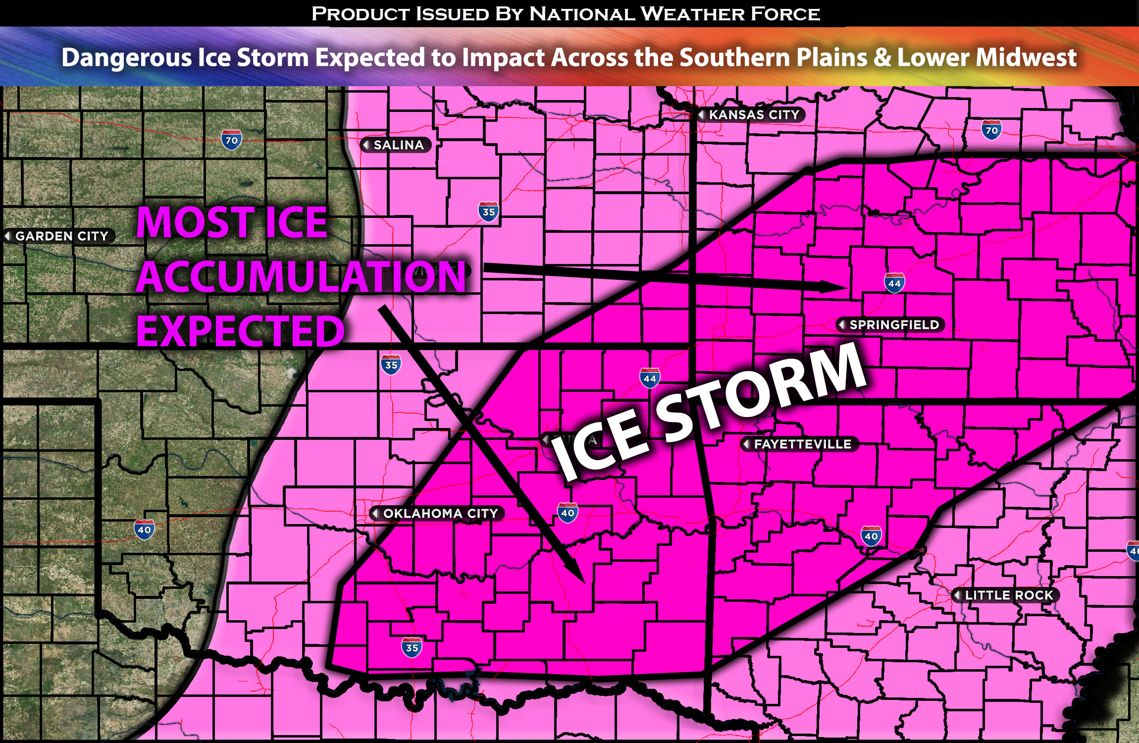
Across the Southern Plains Through the Lower Midwest:
The same mid/upper trough with a negative titled axes is expected to bring more issues across a majority of states as it combines with conditions to create a dangerous setup for ice, leading to icy roads and hazardous conditions, is expected to unfold tonight through Monday morning across the southern plains and through the lower Midwest. More details below for the forecast with regional details.
Overall Forecast:
In the mid/upper levels of the atmosphere, a negatively tilted trough is expected to move eastward across the south-central U.S., bringing in very deep Gulf moisture into the central U.S. Dew points are already starting to rise with the incoming moisture in the region. However, due to the difference temperatures in the atmosphere with a significant warm-up around 850mb will cause the frozen precipitation to melt before falling as rain, and then re-freezing at the surface level, creating perfect conditions for ice.
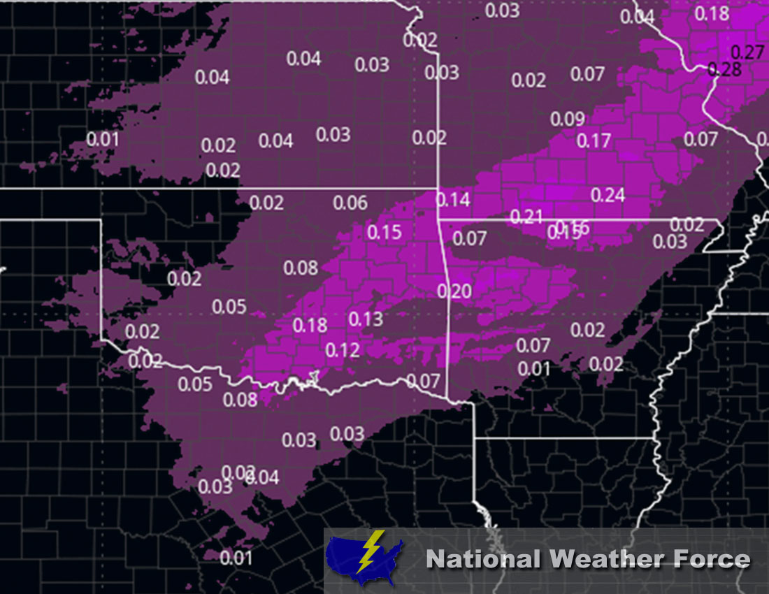
Timing & Impact: Freezing rain is expected from portions of northern Texas through Oklahoma and into parts of Kansas, Missouri, and Arkansas. It is set to start this evening in northern Texas and central Oklahoma, then push north-northeast, following the moisture and impulses, across the rest of the region by Monday morning. The rain is expected to freeze immediately upon contact with the ground, causing icy conditions across the affected area. The heaviest ice accumulation is anticipated in Missouri, Arkansas, and Oklahoma, where locally over a quarter of an inch of ice may accumulate, creating very hazardous conditions. As warmer conditions also move upward, the freezing rain will transition to heavy rain throughout the day on Monday.
Main impact: freezing rain giving away to icy conditions and heavy rain afterwards.
Approximate Ice Accumulation (in inches):
Stay tuned for more updates.
Sina⚡⚡
With over a decade of experience in forecasting severe thunderstorms, this individual is a seasoned forecaster and developer. Their expertise in severe weather forecasting and computer science is entirely self-taught, complemented by a foundation in Atmospheric Science from UNCO and an IT background from WGU. They have dedicated their efforts to developing innovative tools that enhance the accuracy of analyzing large hail and tornadoes. As a significant contributor to National Weather Force & Southern California Weather Force, they have played a crucial role in providing accurate and timely information, as well as developing tools to keep those affected well-informed.