
 Across the Upper Midwest:
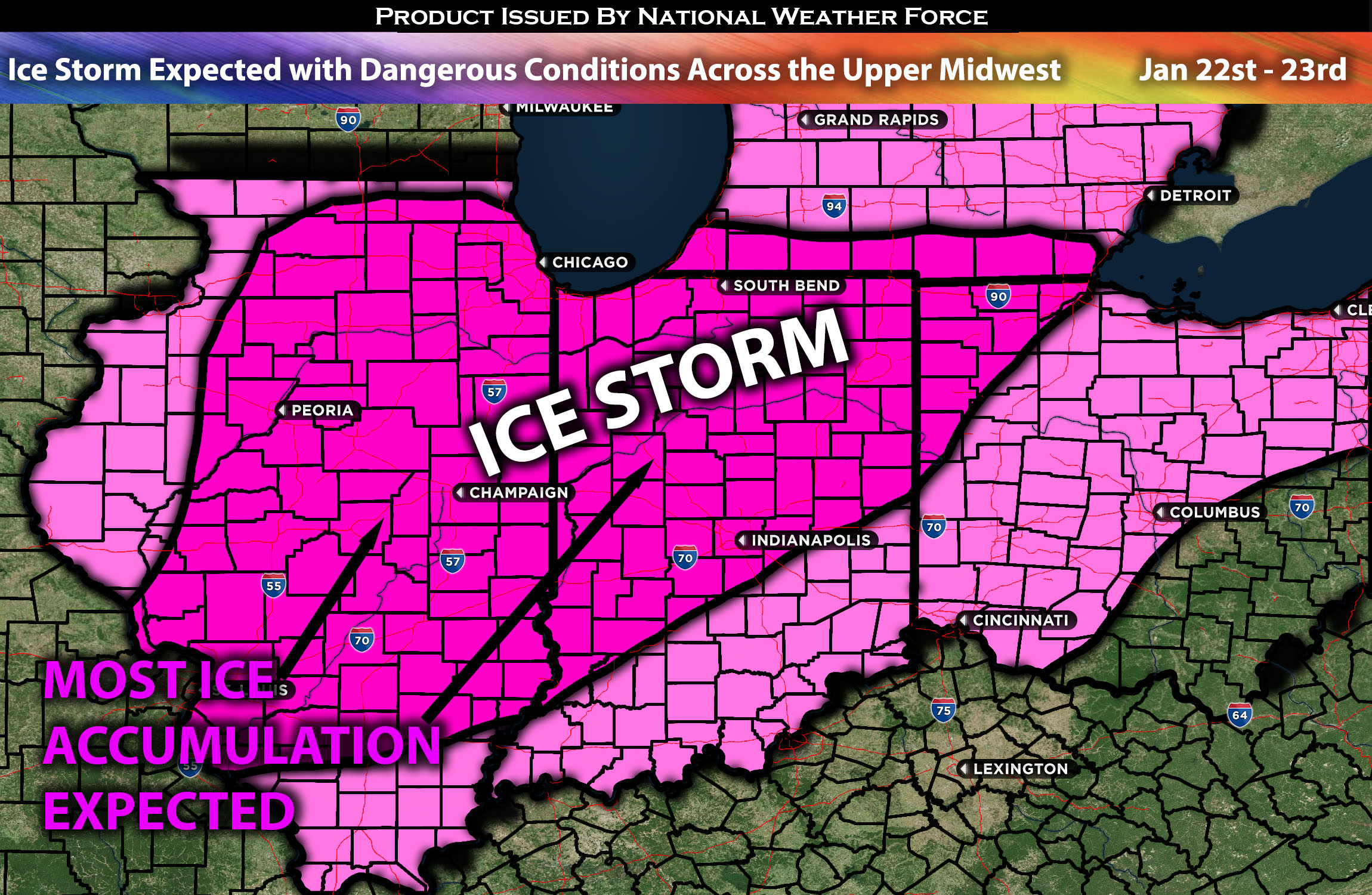
Hazardous conditions are expected as a mid/upper-level trough, featuring a negatively tilted axis, is anticipated to cause additional problems across the upper Midwest for the starting work week. This system, merging with existing conditions, is likely to lead to a treacherous situation marked by ice formation, resulting in icy roads and hazardous conditions. This development is anticipated from midnight tonight through Tuesday morning with the bulk of it being Monday night. Further information and regional specifics of the forecast can be found below.
Overall Forecast:
In the mid to upper levels of the atmosphere, an eastward-moving, negatively tilted trough is anticipated to cross the south-central U.S. slowly moving up with advection ahead of it, drawing in substantial Gulf moisture into the Midwest United States. This influx of moisture, combined with atmospheric impulses/shortwaves, will enable the formation of precipitation across the region. However, atmospheric temperature variations, notably a considerable warm-up at approximately 850mb, are expected to melt any frozen precipitation aloft. This will result in it falling as rain and subsequently re-freezing upon reaching the ground, leading to ideal conditions for ice formation.
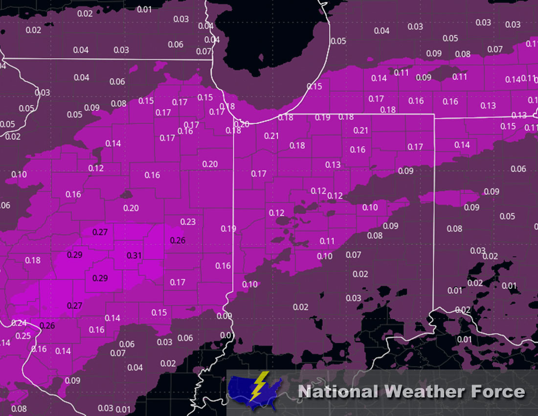
Timing & Impact: A few rounds of freezing rain are expected to reach mainly central Illinois by early Monday morning. Following this, the main wave of freezing rain will sweep through around Monday evening, transitioning to heavy rain with embedded freezing rain into Tuesday morning. Areas north of Illinois will experience heavy snow due to freezing temperatures, while warmer air aloft will affect regions further south. Across Indiana and Ohio, freezing rain is expected before it transitions to heavy rain by Tuesday morning. There will be intermittent periods of freezing rain amidst the rain. For Indiana, the demarcation line between freezing rain and heavy rain will be in northern Indiana, where more freezing rain is expected. As you move further south, the precipitation increasingly transitions to heavy rain. See the ice accumulation approximation below.
Approximate Ice Accumulation (in inches):
Main impact: freezing rain giving away to icy conditions and heavy rain afterwards.
Stay tuned for more updates.
Sina⚡⚡
With over a decade of experience in forecasting severe thunderstorms, this individual is a seasoned forecaster and developer. Their expertise in severe weather forecasting and computer science is entirely self-taught, complemented by a foundation in Atmospheric Science from UNCO and an IT background from WGU. They have dedicated their efforts to developing innovative tools that enhance the accuracy of analyzing large hail and tornadoes. As a significant contributor to National Weather Force & Southern California Weather Force, they have played a crucial role in providing accurate and timely information, as well as developing tools to keep those affected well-informed.