
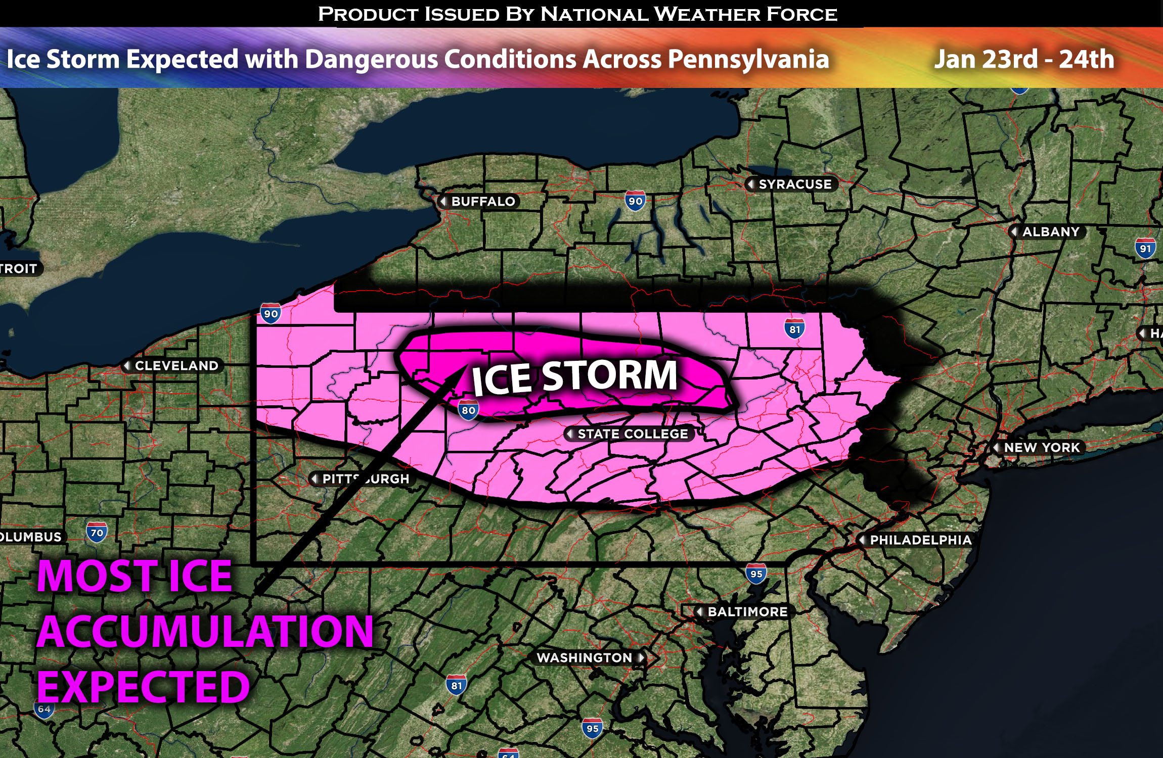
Across Pennsylvania:
Dangerous conditions are expected as the right conditions for freezing rain develop, which will cause problems across Pennsylvania. This is likely to lead to a treacherous situation marked by ice formation, resulting in icy roads and hazardous conditions. This development is anticipated to begin early Tuesday morning and continue throughout the day. Further information and regional specifics of the forecast can be found below.
Overall Forecast:
In the mid to upper levels of the atmosphere, a shortwave trough, accompanied by an influx of moisture, is expected to move through the area and enable the formation of precipitation across the region. A surface boundary, expected to become a warm front, will border Pennsylvania (PA) and New York (NY). Areas south of this boundary will have a risk of freezing rain due to the present conditions, while areas to the north, especially in NY, are expected to receive snow. This boundary will be influenced by atmospheric temperature variations, with a notable warm-up at approximately 850mb expected to melt any frozen precipitation aloft. This will result in it falling as rain and subsequently re-freezing upon reaching the ground, leading to ideal conditions for ice formation across the area.
Timing & Impact: Freezing rain, coming from the west, is expected across northern Pennsylvania, pushing eastward and becoming more widespread through Tuesday morning and noon. Then, colder air will sink down along with a boundary, allowing for a mix of precipitation. This includes light snow, sleet, and freezing rain, particularly right at the northern border of Pennsylvania. Subsequently, as more warm air moves aloft, central Pennsylvania will experience more freezing rain and some mixed rain around Tuesday evening into the night. This will transition to rain as increasing amounts of warm air push through by Wednesday morning. There will be more pockets of cool air that may allow for some additional freezing rain on Wednesday morning before completely transitioning over to rain Wednesday afternoon. See the ice accumulation approximation below.
Approximate Ice Accumulation (in inches):
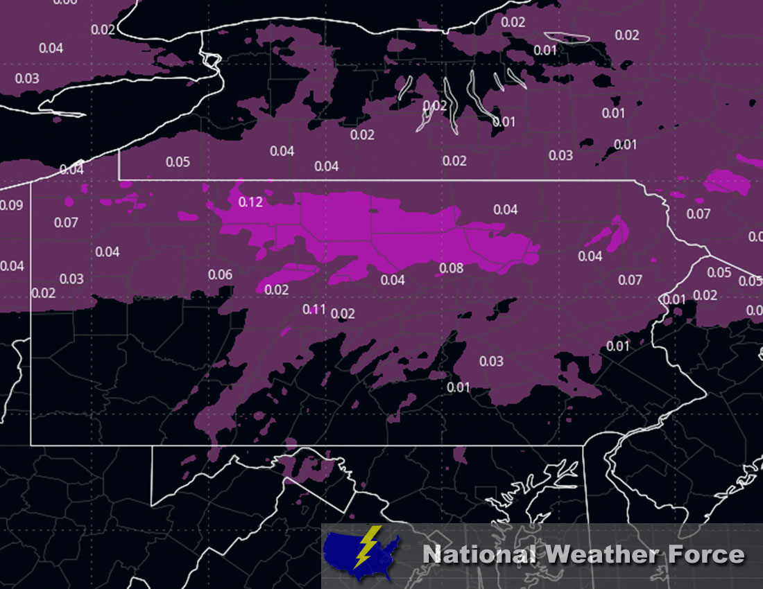
Main impact: freezing rain giving away to icy conditions and rain afterwards.
Stay tuned for more updates.
Sina⚡⚡
With over a decade of experience in forecasting severe thunderstorms, this individual is a seasoned forecaster and developer. Their expertise in severe weather forecasting and computer science is entirely self-taught, complemented by a foundation in Atmospheric Science from UNCO and an IT background from WGU. They have dedicated their efforts to developing innovative tools that enhance the accuracy of analyzing large hail and tornadoes. As a significant contributor to National Weather Force & Southern California Weather Force, they have played a crucial role in providing accurate and timely information, as well as developing tools to keep those affected well-informed.