
Across the Mid-Atlantic Region:
A powerful system is expected to push northeastward into the Mid-Atlantic region, bringing heavy snow and strong winds, with near-blizzard conditions expected across the region starting on Tuesday early morning through Tuesday afternoon before pushing out. For more details on the forecast please check below.
Overall Forecast:
In the mid/upper levels of the atmosphere, a closed low is expected to continue pushing northeastward across the Upper Southeast into the Mid-Atlantic. At the same time, a surface low will also be moving northeastward, positioning itself perfectly in a very cold air mass as a nor’easter off the coast of the Mid-Atlantic. A very moist air mass will cover the region, combined with very powerful winds that will stay mainly below the freezing levels throughout the atmospheric layers. This setup, with a low-level jet right over the area, will create the perfect conditions for very heavy snow and strong winds in this part of the region, leading to near blizzard conditions for a couple of hours. Winds will be gusting between 25-35mph locally higher.
Timing & Impact: At first around Monday night a few showers are expected to move through before everything transitions to snow by around 4am EST with heavy snow bands constantly pushing through areas such as NYC and its neighboring cities and states. The heavy snow and strong winds will continue before the system pushes out by Tuesday afternoon/evening hours with possibly a few scattered snow showers possible given the remainder moisture left over before pushing completely through leaving with very cool airmass over the area on Wednesday. Check the maps for potential maximum wind gusts, and snowfall below.
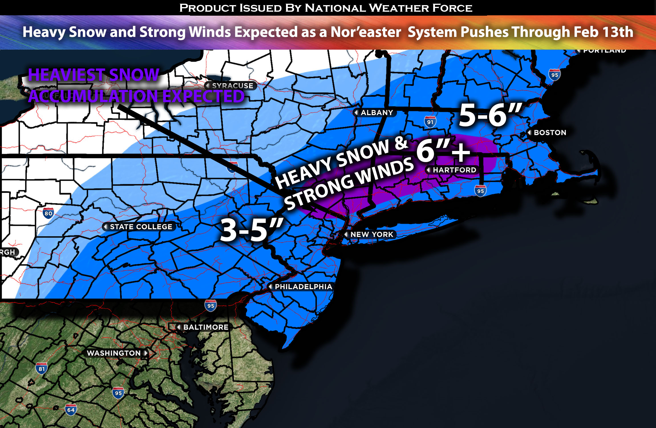
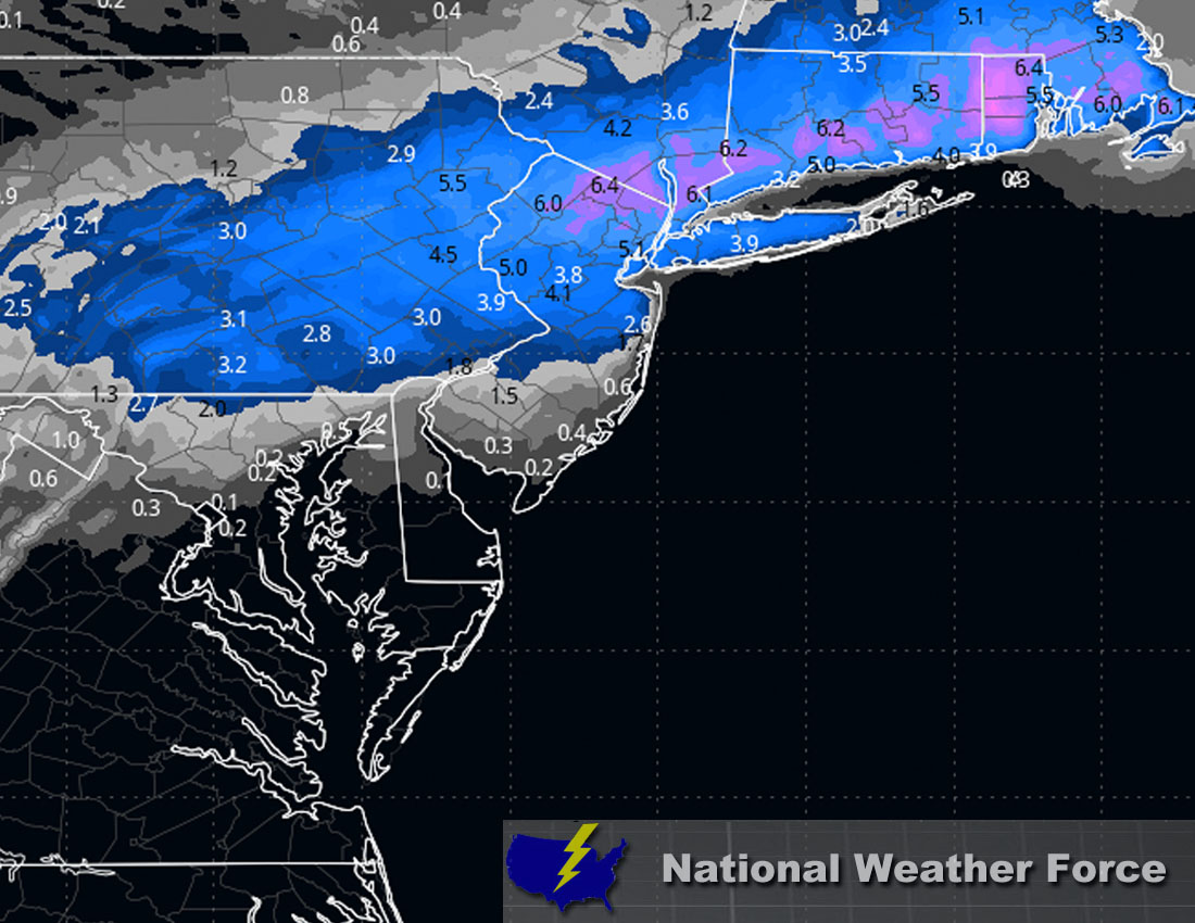
Approximate Snowfall Totals (in inches):
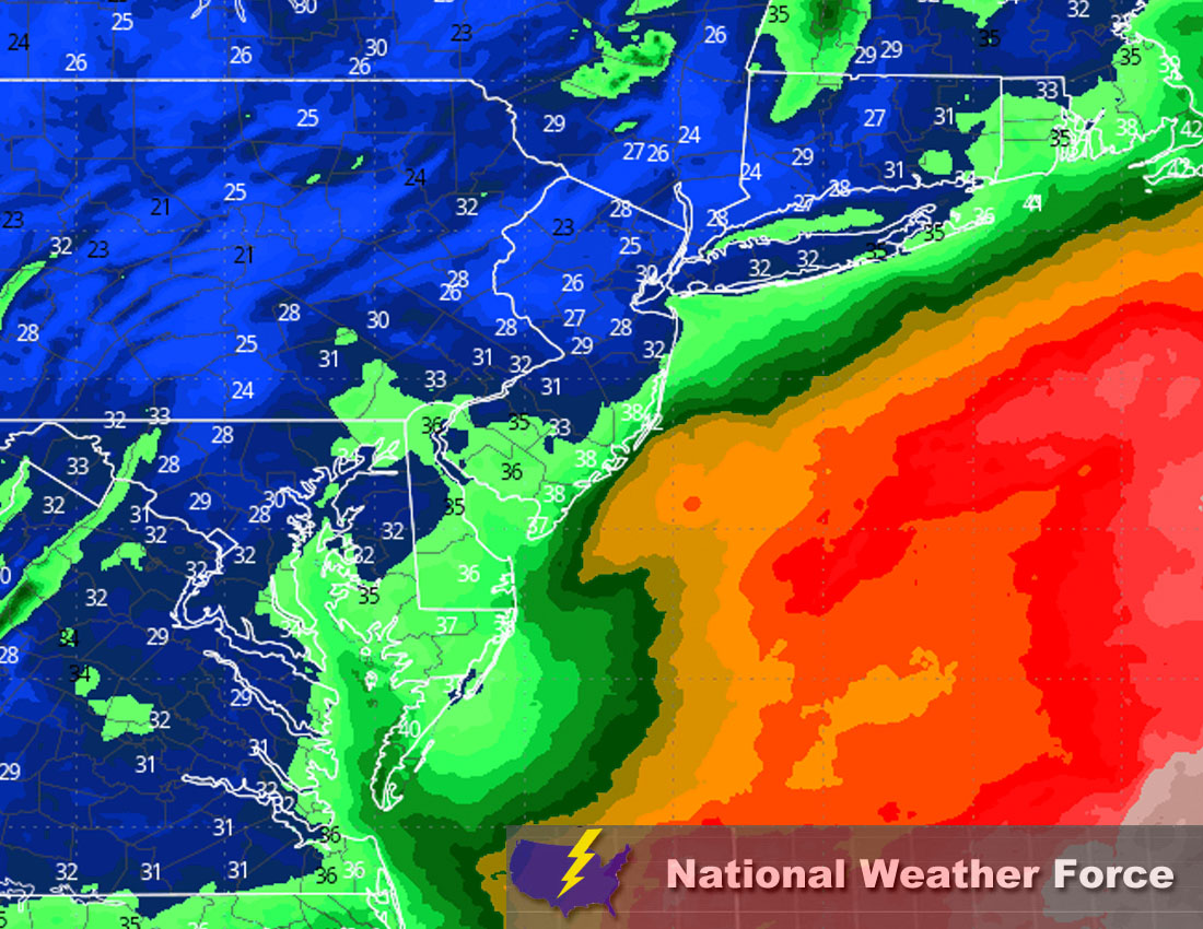
Approximate Maximum Wind Gusts (MPH):
Main impact: heavy snow, strong winds and very cold conditions.
Stay tuned for more updates.
Sina⚡⚡
With over a decade of experience in forecasting severe thunderstorms, this individual is a seasoned forecaster and developer. Their expertise in severe weather forecasting and computer science is entirely self-taught, complemented by a foundation in Atmospheric Science from UNCO and an IT background from WGU. They have dedicated their efforts to developing innovative tools that enhance the accuracy of analyzing large hail and tornadoes. As a significant contributor to National Weather Force & Southern California Weather Force, they have played a crucial role in providing accurate and timely information, as well as developing tools to keep those affected well-informed.