Across the Washington Area:
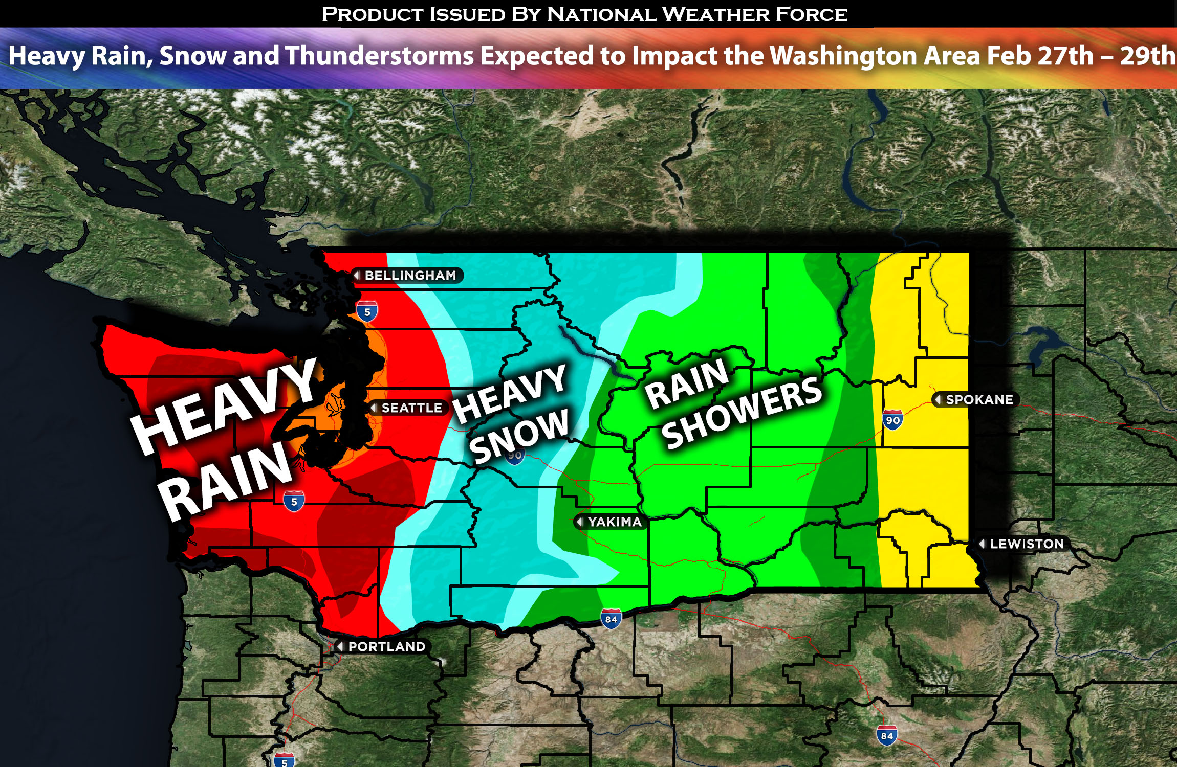
A powerful atmospheric setup is anticipated to impact Washington State, especially from Tuesday night through Thursday, bringing significant heavy rain, heavy mountain snow, strong winds that could be damaging, and more impacts. Check overall forecast’s for further specific details on the forecast.
Overall Forecast:
An atmospheric river pattern is starting to form over the Pacific Northwest and will persist throughout the day as a low-pressure system over the Gulf of Alaska moves deeper southward. This afternoon, a surface front will move northeastward across the region, bringing precipitation inland. A strong southerly flow at the surface will cause temperatures to rise, raising snow levels to above 2000-3000 feet by Tuesday evening in most places. Initially, a strong westerly flow higher up might lead to rain shadow effects in the Puget Sound lowlands, but by the evening, moderate rainfall is expected to cover these lowlands.
Snow Forecast:
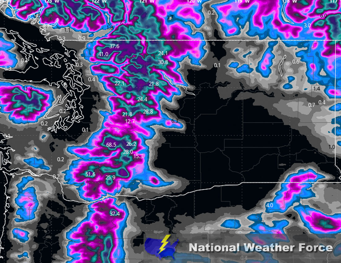
In terms of snow more will also come in at the same to the mountain regions from Tuesday afternoon to Thursday morning/afternoon. Snow accumulations of 1 to 4 feet in the Olympics and 2 to 5- feet in the Cascades, with the potential for even greater amounts in some areas locally. On Wednesday, the storm system will anchor itself near the Washington Coast and spread southward, ushering in several fronts across the Pacific Northwest. This scenario will cause a significant uptick in precipitation across the region, drawing in copious moisture from the Pacific and resulting in heavy rainfall in lower elevations and hefty snow accumulations in the mountains. Snow levels will climb to between 4300 and 4500 feet on Wednesday, which could affect rivers in the Southwest Interior.
Other Impact Details:
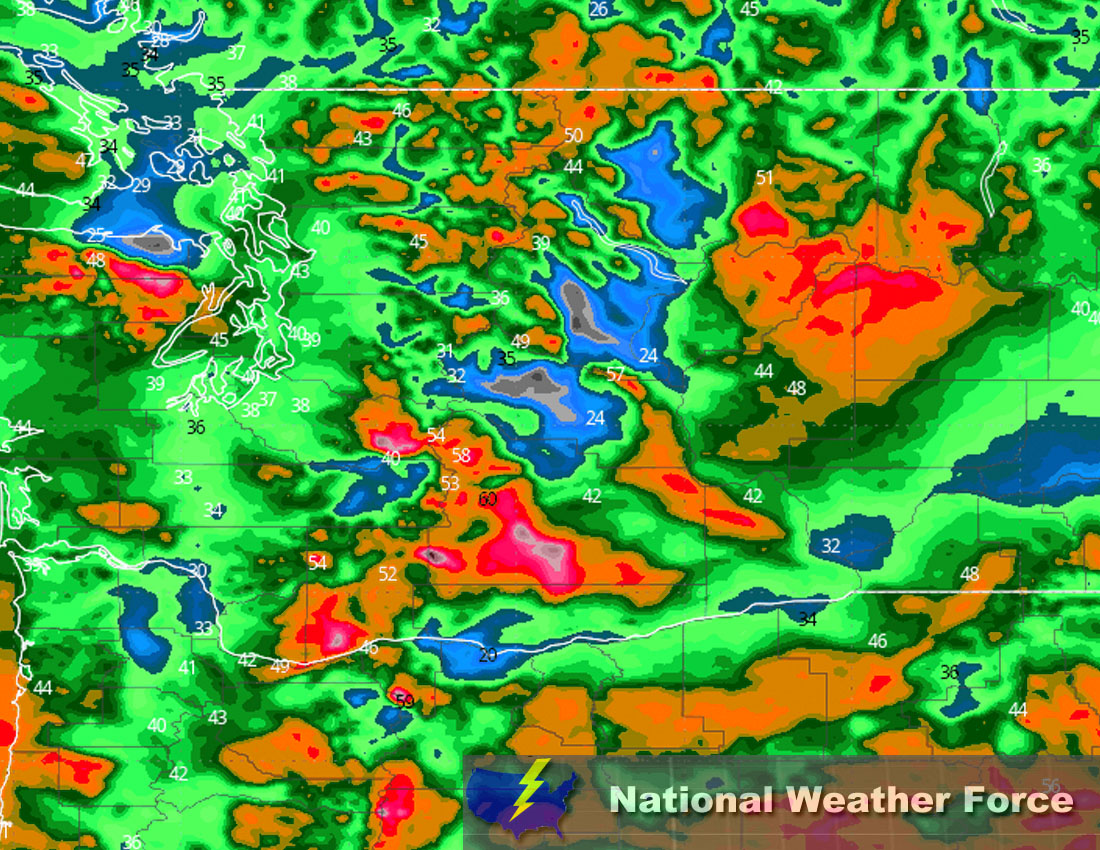
Winds from the south to southwest will also intensify across western Washington, potentially gusting up to 40 mph in lower areas and 50 mph through the mountain passes by Wednesday afternoon and evening. These conditions may lead to challenging travel and decreased visibility over the passes yet might not reach the severity of blizzard conditions. Moving into Thursday morning, as the storm progresses southward along the Pacific Coast, it will drag a cold front over western Washington, pushing the bulk of precipitation further south. The low-pressure system, situated west of Vancouver Island, will continue to douse the Pacific Northwest, though precipitation and wind intensity are anticipated to diminish. The weather is expected to shift towards more unstable, convection-driven patterns. There is some expectation of instability over the coast on Thursday, hinting at the possibility of thunderstorms, particularly over coastal waters and near the shoreline. For more updates on the hourly forecast and further details on the timing, check below.
Timing & Impact:
Consistent moderate to heavy rainfall will continue as the system pushes through, bringing heavy rainfall with it through Thursday. At the same time, mountain snow is also expected to continue, becoming heavier later tonight. Strong winds are expected to accompany the system, with wind gusts in the 30-50 mph range, and locally higher, especially in the passes and canyons. These winds are expected to pick up Wednesday morning and continue to increase into the afternoon, peaking around that time before diminishing into Thursday.
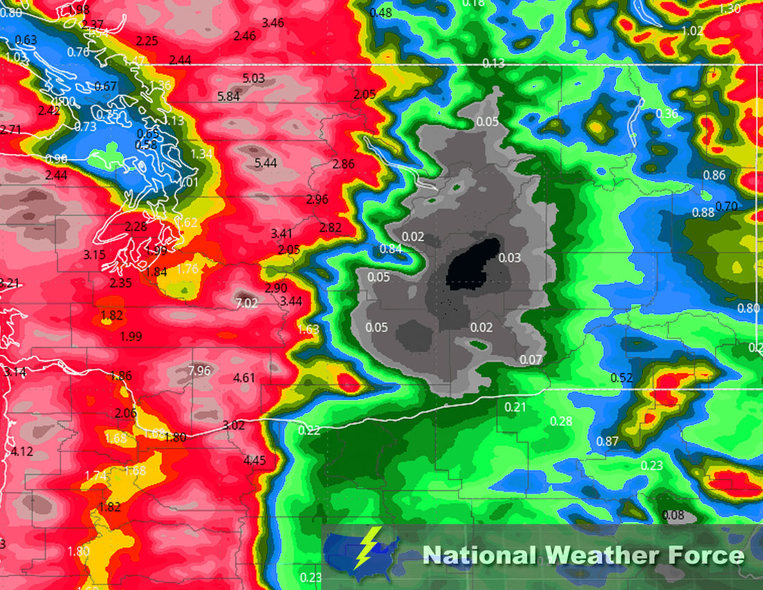
Approximate Rainfall Totals (in inches):

Approximate Snowfall Totals (in inches):

Approximate Maximum Wind Gusts (MPH):

Main impact: moderate to heavy rainfall, heavy mountain snow, small hail/grapple and strong winds.
Stay tuned for more updates.
Sina⚡⚡
With over a decade of experience in forecasting severe thunderstorms, this individual is a seasoned forecaster and developer. Their expertise in severe weather forecasting and computer science is entirely self-taught, complemented by a foundation in Atmospheric Science from UNCO and an IT background from WGU. They have dedicated their efforts to developing innovative tools that enhance the accuracy of analyzing large hail and tornadoes. As a significant contributor to National Weather Force & Southern California Weather Force, they have played a crucial role in providing accurate and timely information, as well as developing tools to keep those affected well-informed.
