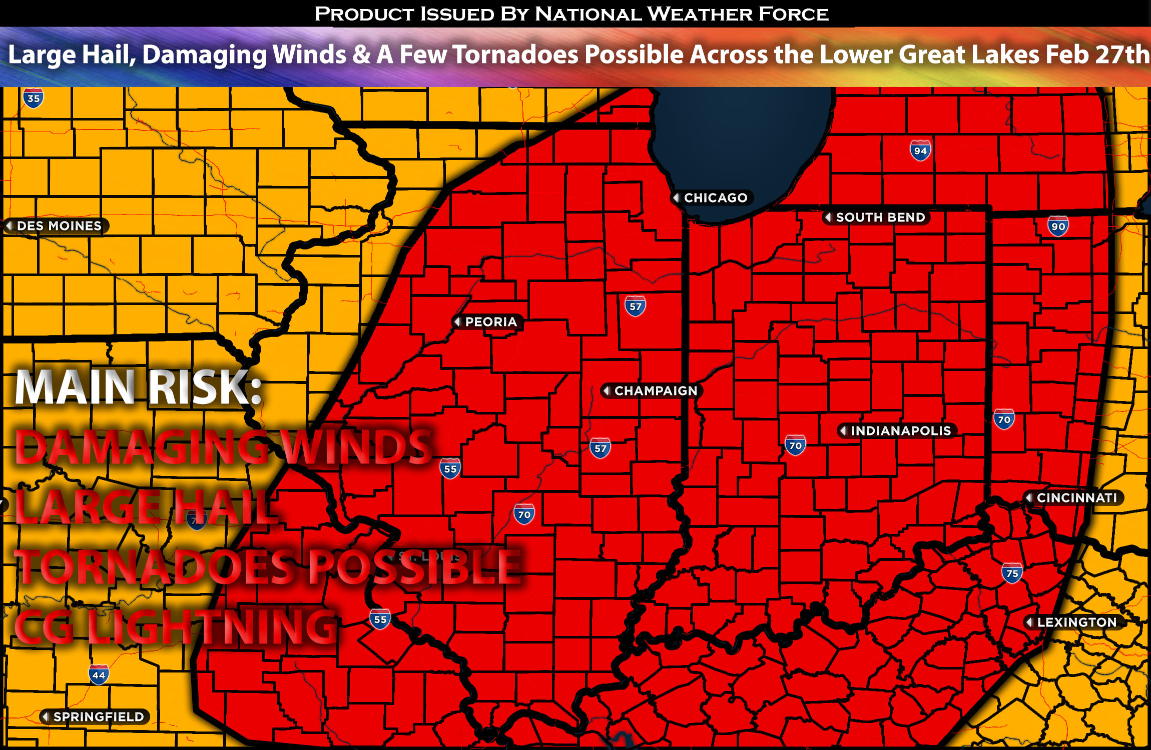
 Outlook for the Lower Great Lakes into the Lower Ohio Valley:
A powerful system is expected to sweep through the lower Great Lakes into the lower Ohio Valley region on Tuesday. As it does, it will create an unstable atmosphere ahead of it, capable of producing all types of hazards. Check the forecast details below for more information. For more details on the forecast, please check below.
Main impact: large hail, damaging winds, a few tornadoes possible.
Approximate Timing: Storms are expected to form and become strong or potentially severe around the evening/late evening into the overnight hours before moving eastward across the area.
Overall Forecast: The weather in central and western US will gradually shift, moving from a weak, divided airflow to a stronger, unified system as northern and southern flows merge. Minor disturbances in the strong southern flow will contribute to forming a large storm system along a cold front in the northern Plains. This storm will draw limited moisture northward into the lower Ohio Valley and Great Lakes, potentially causing strong or severe thunderstorms along the front through early Wednesday. Warm air will raise humidity, with dewpoints reaching the upper 50s to low 60s Fahrenheit in southern and central Illinois, Indiana, and western Ohio by mid-afternoon. A vague moisture boundary along a surface trough or weak dryline will form from western/central Illinois to eastern Missouri, potentially triggering isolated thunderstorms in central/northern Illinois late afternoon. Similarly, warm air flow could cause scattered thunderstorms in northern Indiana, southern Michigan, and northwestern Ohio. The expectation for moderate instability and elevated wind shear favoring severe thunderstorm development. An unusual elevated mixed layer for February will enhance storm updrafts, increasing the hail risk. By late evening, as a mid-level trough deepens and air pressure drops over northern Illinois, an increased atmospheric response in the warm sector could lead to possibly a few tornadoes and strong wind gusts as well as very large hail as storms form in northern IL.
Timing & Impact:
Storms are anticipated to form in the evening ahead of the cold front, near the warm front area, where conditions are most favorable for very powerful storms capable of producing all types of hazards. Further storm development is expected along and ahead of the front as it pushes eastward, with multiple waves anticipated. Additional storm development is expected into the Indiana area as the front pushes eastward, with any of these storms capable of producing damaging winds, large hail, and perhaps isolated tornadoes if there is enough spin in the cells through early Wednesday morning.
Stay tuned for more updates.
Sina⚡⚡
With over a decade of experience in forecasting severe thunderstorms, this individual is a seasoned forecaster and developer. Their expertise in severe weather forecasting and computer science is entirely self-taught, complemented by a foundation in Atmospheric Science from UNCO and an IT background from WGU. They have dedicated their efforts to developing innovative tools that enhance the accuracy of analyzing large hail and tornadoes. As a significant contributor to National Weather Force & Southern California Weather Force, they have played a crucial role in providing accurate and timely information, as well as developing tools to keep those affected well-informed.
