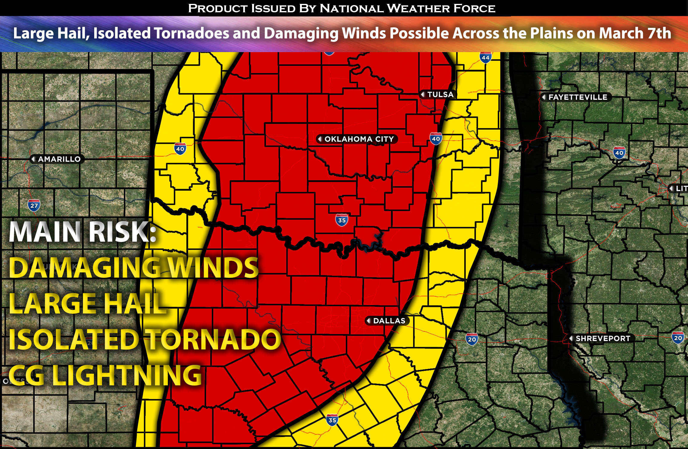
 Outlook for the Central/Southern Plains:
Multiple impulses, along with a main disturbance, are expected to create an elevated, unstable atmosphere across Texas, extending into portions of Oklahoma and the southern Kansas area. Due to the limited ingredients, these storms will primarily bring large hail, damaging winds, and perhaps an isolated tornado. There will be multiple rounds depending on the location. Check the forecast below for further details.
Main impact: large hail, damaging winds, an isolated tornado possible.
Approximate Timing: On going storms expected in TX throughout the morning with multiple waves with another round being in the afternoon/evening across OK/KS area.
Overall Forecast: Multiple shortwave troughs will move through the lower part of a large upper trough across the Southwest, bringing fast mid-level winds primarily across northern Mexico but extending into southern Texas by early Friday due to a leading wave. This will be coupled with warm, moist air moving in at lower levels due to a southerly jet. Despite generally low instability, there’s a chance for small to marginally severe hail with the strongest storm cores. This weather pattern is expected to persist throughout most of the day across northern Texas, with new storms forming on the western edge of the initial wave of storms, near the area where the atmosphere cools rapidly with height. The moisture and warmth in the boundary layer to the west/northwest may lessen by the afternoon. Forecasts show significant uncertainty for Thursday’s conditions, especially regarding how far northwest the moisture will return and how buoyant the air will be. Nevertheless, with strong heating west of the dryline, the area near the triple point of the surface cyclone, from the eastern Texas Panhandle into northwest Oklahoma, is likely to see storms with large hail in the evening. Further, at least some elevated storm activity is expected near or north of the stationary front into south-central Kansas, where there’s a risk of severe hail due to very steep cooling rates at mid-levels moving in from the west. From western to northern Texas into the Edwards Plateau, storm development late Thursday into the night will be driven by mid-level cooling and increased low-level merging of air flows as the Pacific front meets the dryline. This setup may lead to the formation of several storm clusters with temporary, rotating storms capable of producing occasional severe hail and strong to severe wind gusts.
Timing & Impact:
Due to the very unorganized ingredients, storms are expected to form after destabilization, with ongoing storms anticipated from Wednesday night into Thursday morning. Storms are expected to be ongoing, with more severe storms forming throughout the afternoon in Texas. Later in the afternoon/evening, more storms are expected to form further north as well, moving eastward with the system through Thursday night.
Stay tuned for more updates.
Sina⚡⚡
With over a decade of experience in forecasting severe thunderstorms, this individual is a seasoned forecaster and developer. Their expertise in severe weather forecasting and computer science is entirely self-taught, complemented by a foundation in Atmospheric Science from UNCO and an IT background from WGU. They have dedicated their efforts to developing innovative tools that enhance the accuracy of analyzing large hail and tornadoes. As a significant contributor to National Weather Force & Southern California Weather Force, they have played a crucial role in providing accurate and timely information, as well as developing tools to keep those affected well-informed.
