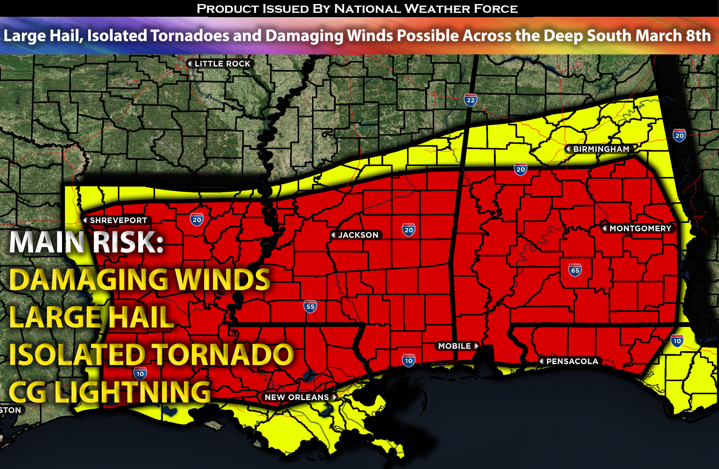
 Outlook for the Deep South from LA Extending Towards AL:
As the system continues to push eastward, combined with favorable conditions, it will enable severe storms to develop across the Deep South. There will be two different setup locations, with one being stronger than the other due to more organized factors. Please see below for further details.
Main impact: large hail, damaging winds, an isolated tornado possible.
Approximate Timing: On going storms expected with the main of the band and more strong/severe storms forming within the hours in the afternoon/evening into the overnight hours moving eastward.
Overall Forecast: An upper trough with a positive tilt will move eastward from the Southwest to the South-Central States, carrying two embedded shortwave impulses. Fast mid-level winds from the southwest, exceeding 75 knots at the mid/upper levels of the atmosphere, will shift from southern Texas to the Arkansas-Louisiana-Mississippi region by Friday night. Additionally, a modest surface cyclone is expected to move from northern Texas towards the Tennessee Valley. This setup, with more favorable conditions for supercells compared to the other, could lead to all types of hazards, including very large hail in discrete cells. Moving towards the central Gulf Coast/South, stronger low-level shear will be present in the warm conveyor belt, although weak mid-level cooling rates will limit the atmosphere’s ability to destabilize or strengthen. Given the adequate low-level shear for supporting rotating updrafts, any supercell that forms could potentially spawn a tornado. However, the convective pattern is expected to become disorganized quickly due to thunderstorm mergers, leading to multiple storm clusters that could produce damaging winds. The uncertainty in the timing of surface-based storms in the warm sector further complicates the ability to identify a specific area with a heightened tornado risk. Despite this, there remains a low-probability threat for tornadoes and damaging winds into Friday night across parts of Mississippi and Alabama, possibly extending as far east as Georgia later on.
Timing & Impact:
Ongoing storms are expected in the morning hours, with more organized storms anticipated to form in the coming hours from west to east, starting in the LA/MS area and then becoming a cluster of storms, eventually forming a squall line that will sweep eastward through the evening and overnight. Discrete cells will also be present, carrying the highest risk for large hail and isolated tornadoes. The main risk with the main line of storms will be damaging winds as they cluster together very quickly.
Stay tuned for more updates.
Sina⚡⚡
With over a decade of experience in forecasting severe thunderstorms, this individual is a seasoned forecaster and developer. Their expertise in severe weather forecasting and computer science is entirely self-taught, complemented by a foundation in Atmospheric Science from UNCO and an IT background from WGU. They have dedicated their efforts to developing innovative tools that enhance the accuracy of analyzing large hail and tornadoes. As a significant contributor to National Weather Force & Southern California Weather Force, they have played a crucial role in providing accurate and timely information, as well as developing tools to keep those affected well-informed.
