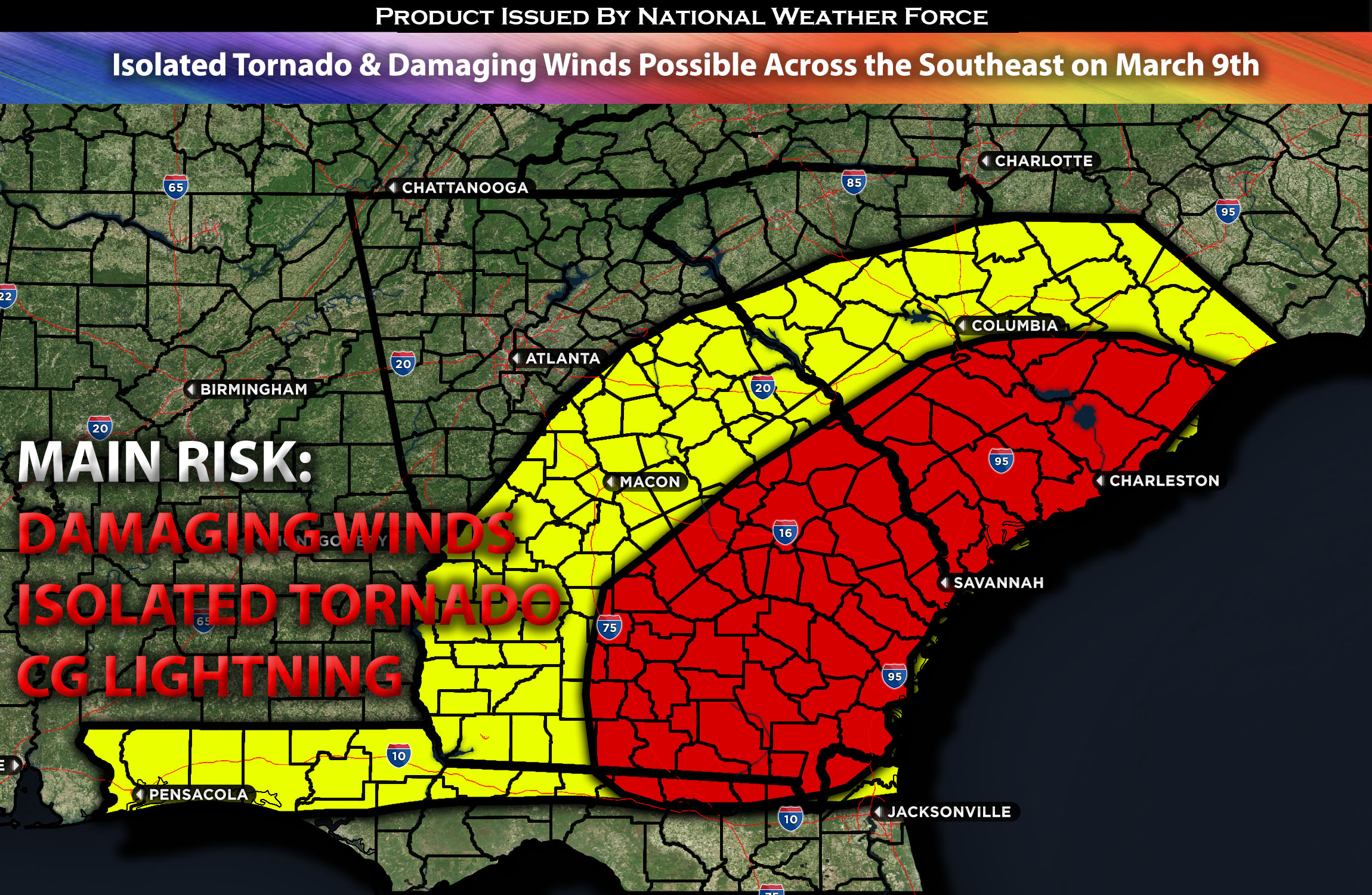
 Outlook for the Deep South from GA Extending Towards SC:
Some storm activity will persist through the overnight hours and into the morning. As the system continues to move eastward, it will bring another risk for severe storms across areas of Georgia and South Carolina on Saturday afternoon and evening. Check below for more details.
Main impact: damaging winds, an isolated tornado possible.
Approximate Timing: On going storms expected with the main of the band and more strong/severe storms forming within the hours in the afternoon/evening into the overnight hours moving eastward.
Overall Forecast: Steady rain is currently affecting parts of Georgia and South Carolina, lying northeast of more intense storms stretching toward the central Gulf Coast (where all the current unstable airmass is). This existing weather pattern is crucial for determining the severity and timing of the forecasted storm threat. Recent forecasts have increasingly suggested that intense storms are likely to develop and move east from the central Gulf Coast into northern Florida and southern Georgia during the morning and afternoon, fueled by increased daytime heating ahead of the storm front over the Florida Peninsula. Early in the day, the potential for tornadoes and strong winds is heightened, but this threat is expected to decrease into the afternoon as the wind direction shifts and weakens.
In the Carolinas, the severe weather risk depends on whether the atmosphere can become unstable following the passage of the widespread rain moving east-northeast this morning. Forecasts agree that some level of ground-level instability will form by the afternoon. However, due to the expected continuation of intense storms in southern Georgia and northern Florida, and based on current weather observations, the available energy for storms is expected to be limited. Nonetheless, due to significant mid-level atmospheric pressure drops and strong wind shear across different layers, there’s a chance for a few low-topped supercells in the afternoon, which could bring a risk of tornadoes and localized strong winds.
Timing & Impact:
Ongoing storms are expected in the morning hours, with more organized storms anticipated to form in the coming hours from west to east, starting in the Georgia area and then becoming a cluster of storms. This cluster carries a small risk for damaging winds and an isolated tornado. The main risk with the primary line of storms will be damaging winds, as they are expected to cluster together very quickly. There will be a few rounds, first being the ongoing storms, followed by another main one in the afternoon/evening. Limited convection will be something to watch, depending on the level of instability across the area. Nevertheless, low-top cells are still possible.
Stay tuned for more updates.
Sina⚡⚡
With over a decade of experience in forecasting severe thunderstorms, this individual is a seasoned forecaster and developer. Their expertise in severe weather forecasting and computer science is entirely self-taught, complemented by a foundation in Atmospheric Science from UNCO and an IT background from WGU. They have dedicated their efforts to developing innovative tools that enhance the accuracy of analyzing large hail and tornadoes. As a significant contributor to National Weather Force & Southern California Weather Force, they have played a crucial role in providing accurate and timely information, as well as developing tools to keep those affected well-informed.
